Country:

 City:
City:



In Raon-l’Étape, follow Rue du Bambois, which continues as Route d’Étival, and carry on to the end of the road. Park shortly after the Châtelles Forest House, at the junction of several forest tracks.
(S/E) Take the well-signposted path running alongside a small stream, heading towards the Pierre d’Appel, mainly following the Yellow Disc markings.
(1) Turn left towards the Pierre d’Appel for a pleasant, steady and easy climb.
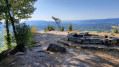
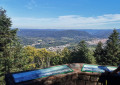
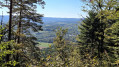
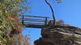
(2) On reaching the archaeological site, at the signpost, take a sharp left-hand bend following the sign for “Pierre d’Appel 10 mins”: Yellow Disc markings. At the Pierre d’Appel promontory, head straight on to enjoy a bench and a magnificent panoramic view: small suspension footbridge.
(3) Turn back, then head right towards La Roche du Bouc. Pass under the suspension footbridge you saw earlier and continue to follow the Yellow Disc markings to reach the mobile phone mast.
(4) Turn left towards “Route de Repy”: follow the Yellow Disc markings. Further on, join a wider forest track and follow it to the right for about a hundred metres, before taking the path descending to the left towards the Roche du Bouc: Yellow Disc. Lovely view and a bench at the Roche du Bouc.
(5) Head up the path on the right, which rejoins the forest track you left earlier. Follow it to the left, then keep to the right straight away and walk for about 200 metres.
(6) Turn right, leaving the Yellow Disc markings, to follow the Yellow Ring and Green Disc markings.
(7) 100 m further on, be sure to take the path leading down to the left. Follow it straight on, crossing three wider forest tracks, and continuing each time along the path opposite. Return to the junction of the circular route and head back to the car park (S/E).
 Visorando Member
 Moderate