Country:

 City:
City:


The start and finish are at the large car park located at the exit of the hamlet of La Trouche, 4 km north-east of Raon-l'Étape on the D392, heading towards the Col du Donon.
(S/E) To the north-east of the car park, take the forest path running alongside the D392: marked with Yellow Rings and Blue Rings. Please note: the route has been slightly altered compared to the IGN map. Follow the Yellow Ring markings towards the Rocher du Pilier. After two sharp 180° turns, after 800 m you will reach a fairly flat path heading south-west.
(1) Follow this path for a good kilometre until you reach a junction of four paths.
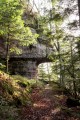
(2) Take the path on the far left towards Rocher du Pilier: Yellow Ring markings. Halfway along, cross a track and continue straight ahead to reach Rocher du Pilier: you can walk around it.
(3) Continue along the path for 1 km to reach a junction with numerous paths and signposts.
(4) Take the path on the left, continuing to follow the same markings. Pass the Roches Rondes (553 m) and cross a junction of paths to reach the unassuming Roche de Schache.
(5) Turn 180° to the right onto a small, gently descending path signposted Tête des Rondeaux (among others) and marked with a Green Ring. Follow this somewhat winding path for about 1 km, running alongside the impressive walls of tall pink sandstone rocks: the Rocher de Grande Basse and the Roche des Rondeaux. This section ends with a short climb featuring a hairpin bend, leading to a junction on the Tête des Rondeaux plateau.
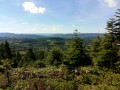
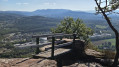
(6) Turn left, following the Blue Diamond markings towards the Col de Croix Collé and the Tête de Vénival. Just after a viewpoint over the Plaine valley and Raon-l'Étape (complete with a bench), head down to a five-way junction at the unassuming Col de Croix Collé.
(7) Take the path opposite and, very quickly, take a downhill path marked with a Yellow Ring on the right. Cross a forest track and rejoin the path opposite after turning 180°. Reach the junction of the four paths you passed on the way up.
(2) Take the path on the left. Descend to the bend in a wide forest track and take it to the right to make a gentle descent back to the car park where you started (S/E).
 Visorando Member
 Moderate