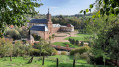
Vénival Circular Route

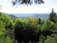
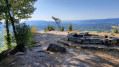
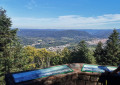
A walk that will allow you to discover the landscapes around the Ravine Stream valley and take in views overlooking the village of Raon-l’Étape.

Details

17061901
Creation:
Last update:
Last review:
  • Walking
    Activity: Walking
  • ↔
    Distance: 5.71 mi
  • ◔
    Average duration: 3h 50 
  • ▲
    Difficulty: Moderate

  • ⚐
    Back to start: Yes
  • ↗
    Ascent: + 1,391 ft
  • ↘
    Descent: - 1,398 ft

  • ▲
    Highest point: 1,916 ft
  • ▼
    Lowest point: 1,050 ft

Photos

Description of the walk

Take Rue Aristide Briand to reach the hamlet of Chavré, passing by the Trapp quarries where you can park.

(S/E) Head south and keep left at the junction.

(1) Follow the signposted ‘Green Ring’ trail, which heads off to the left towards the mountainside. Carry on straight ahead until you reach the junction with a wide forestry track.

(2) Turn right, then keep left towards the Club Vosgien chalet.

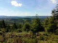
(3) Leave the main track and follow the path on the right which descends towards the Saint-Prayel valley. Admire the landscape of pine trees and heather and the view over the Rabodeau valley. Turn right at the fork and continue to a forest track.

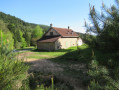
(4) Cross it and continue almost straight ahead along the path leading to the old Vénival forest keeper’s house.

(5) Turn left for about a hundred metres, then left again to follow the steep path which will take you to the Col de Croix Collé.

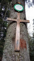
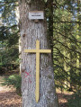
(6) Once you reach the pass, with your back to the cross, take the narrow path that climbs to the left of the main forest track and, following the ridge, leads to the Club Vosgien chalet.

(7) Take the path on your right (marked with a Yellow Disc). You’ll come out onto a forest track; continue to the right for about a hundred metres.

(8) Leave the track and follow a path to the left, continuing to follow the Yellow Disc markings.

(9) Turn left onto the forest track, then right at the three-way junction.

(10) Opposite the Trapp quarries, follow the road to the left back to your starting point (S/E).

Waypoints

  1. S/E : mi 0 - alt. 1,270 ft - Chavré Forest House
  2. 1 : mi 0.08 - alt. 1,266 ft - Path on the left
  3. 2 : mi 0.74 - alt. 1,667 ft - Forest track, on the right
  4. 3 : mi 0.89 - alt. 1,742 ft - Path on the right
  5. 4 : mi 1.58 - alt. 1,325 ft - Forest track
  6. 5 : mi 2.07 - alt. 1,050 ft - Vénival Forest House
  7. 6 : mi 2.96 - alt. 1,709 ft - Col de Croix Collé (521m)
  8. 7 : mi 4.28 - alt. 1,755 ft - Club Vosgien chalet
  9. 8 : mi 4.63 - alt. 1,739 ft - Turn left at the fork
  10. 9 : mi 4.92 - alt. 1,568 ft - Junction with a track
  11. 10 : mi 5.5 - alt. 1,257 ft - Trapp Quarries
  12. S/E : mi 5.71 - alt. 1,270 ft - Chavré Forest House

Reviews and comments

4 / 5
Based on 4 reviews

Reliability of the description
3.7 / 5
Ease of following the route
3.8 / 5
Route interest
4.5 / 5
User 19964898

Overall rating : 3.7 / 5

Date of your route : Jun 29, 2026
Reliability of the description : ★★★★☆ Good
Ease of following the route : ★★★☆☆ Average
Route interest : ★★★★☆ Good
Very busy route : No

PLEASE NOTE: it would appear that this circular loop is NO LONGER WALKABLE.
Between point 3 and point 4, about a third of the way along, just before a hairpin bend leading to another path where there is a bench facing the valley, the path disappears, completely obscured by rocks and vegetation, 48.396680°N 6.890057°E alt536.
These are the coordinates of a point I recorded on the spot, but I didn’t make use of the feature in the app – something I only realised afterwards – though the coordinates are for the stopping point.
We ran out of time to explore in the other direction; between 6 and 5 we made our way to the Club Vosgien chalet via forest tracks to rejoin the end of the route from 7 to 10.
Note that at point 9, you can either turn left onto the forest track
or you follow the Yellow Circle, which is a footpath (heading to the right) and leads to point 10.
That’s it – happy walking to you all!

Machine-translated

franchie
franchie

Overall rating : 4.3 / 5

Date of your route : Jun 23, 2025
Reliability of the description : ★★★★☆ Good
Ease of following the route : ★★★★☆ Good
Route interest : ★★★★★ Very good
Very busy route : No

A beautiful hike in the woods, very pleasant in hot weather. This route actually follows the yellow disc markings, the Jean-Marie Michel circuit. Point 5 is actually the Balthazard Forest House.

Machine-translated

ABPP
ABPP

Overall rating : 5 / 5

Date of your route : Dec 10, 2024
Reliability of the description : Not used / Not applicable
Ease of following the route : ★★★★★ Very good
Route interest : ★★★★★ Very good
Very busy route : No

To avoid getting cold at lunchtime, we set off on this walk from the Vénival forest lodge, hoping to reach the Club Vosgien chalet around midday – which is exactly what happened. We set off at 10.39 am and arrived at 12.25 pm without rushing. Please note that this part of the route consists mainly of a long climb. We followed the route using the GPS track without referring to a map. There were no difficulties. We crossed two logging sites, both signposted with information boards. In the southern part of the route, the path was blocked off with barrier tape, but we were able to get through as the felling had apparently finished and there was no one there. All in all, a lovely walk in the fresh Vosges air, mostly under the canopy except when looking down over Raon-l’Etape. In this terrain, the forest is a very pleasant place to walk through.

Machine-translated

Sof88
Sof88

Overall rating : 3.3 / 5

Date of your route : Aug 26, 2024
Reliability of the description : ★★★☆☆ Average
Ease of following the route : ★★★☆☆ Average
Route interest : ★★★★☆ Good
Very busy route : No

The Red Disc at point 5 n is not there. At point 9, there is a path marked with a Yellow Disc which leads to point 10

Machine-translated

lemarcheur65
lemarcheur65 ★

Hello, Aline Vernier
https://www.visorando.com/randonnee-bouc...
I’m reading:
(1) Follow the signposted Green Ring trail
(7) Take the path on the right-hand side (marked with a Yellow Disc).
(8) Leave the track and follow a path to the left, continuing to follow the Yellow Disc markings.

I don’t understand your message.

Machine-translated

VERNIER Aline
VERNIER Aline

The map we’d printed out is only a rough guide,
we never managed to find the ‘red circle’ markings

not great

Machine-translated

Other walks in the area

For more walks, use our search engine .

The GPS track and description are the property of this route's author. Please do not copy them without permission.