Walk through the Helpe Valley

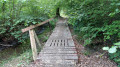
This walk offers an idyllic and very peaceful route through the countryside. Ideal for getting away from it all without encountering many people, it alternates between the understated charm of a peaceful village, sections through the woodland and country lanes. The route is mainly signposted with yellow squares, although the markings are sometimes less prominent on certain sections.

Details

106672343
Creation:
Last update:
Last review:
  • Walking
    Activity: Walking
  • ↔
    Distance: 7.88 mi
  • ◔
    Average duration: 4h 00 
  • ▲
    Difficulty: Moderate

  • ⚐
    Back to start: Yes
  • ↗
    Ascent: + 427 ft
  • ↘
    Descent: - 443 ft

  • ▲
    Highest point: 974 ft
  • ▼
    Lowest point: 686 ft
  • ⚐ Country: Belgium
  • ⚐ City: Momignies 
  • ⚑
    Start/End: N 50.052567° / E 4.209514°
  • ❏
    IGN map(s): Ref. 2807O, 2808E
  • Hour-by-hour weather

Description of the walk

Starting point: Mâcon town centre

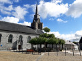
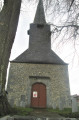
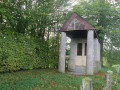
The route begins in the heart of the village. Here you can admire a pretty blue-stone church surrounded by beautiful old buildings. The area is very quiet, with no hustle and bustle or open cafés, making it the perfect starting point for a peaceful stroll before setting off.

The journey to the forest

The route out of town towards the woods follows tarmac roads. This section is entirely open, with no shelter from the sun, and offers little of interest, but it allows you to reach the shaded area quickly.

The forest section

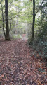
This is the highlight of the route. The path winds its way beneath the trees, offering a cool, very pleasant walk that’s well sheltered from the heat.

The return to Mâcon

The first part of the return journey follows magnificent paths through unspoilt countryside. The very end of the circular route rejoins tarmac roads to return to Mâcon, where you may encounter a few cars.

Waypoints

  1. S/E : mi 0 - alt. 705 ft - Trieu Magotte
  2. 1 : mi 0.36 - alt. 732 ft - Le Champiau
  3. 2 : mi 1.85 - alt. 846 ft - Monceau-Embrechies
  4. 3 : mi 3.17 - alt. 974 ft - Woods
  5. 4 : mi 5.53 - alt. 778 ft - Etang à Trois Queues
  6. 5 : mi 7.34 - alt. 725 ft - The Wicher
  7. S/E : mi 7.88 - alt. 705 ft - Trieu Magotte

Other walks in the area

For more walks, use our search engine .

The GPS track and description are the property of this route's author. Please do not copy them without permission.