The Coudray Route in Villiers-Charlemagne

The south-east route of Villiers-Charlemagne will take you on a tour of the countryside of southern Mayenne. The
highlights of this walk include two beautiful castles and a lovely view of the River Mayenne.

  • It is possible to combine this route with route no. 8.

Details

n°367526
Creation:
Last update:
Last review:
  • Walking
    Activity: Walking
  • ↔
    Distance: 8.37 mi
  • ◔
    Average duration: 4h 10 
  • ▲
    Difficulty: Moderate

  • ⚐
    Back to start: Yes
  • ↗
    Ascent: + 328 ft
  • ↘
    Descent: - 344 ft

  • ▲
    Highest point: 335 ft
  • ▼
    Lowest point: 102 ft

Description of the walk

From Château-Gontier-sur-Mayenne, take the N162 towards Laval. Leave the road at the Villiers-Charlemagne junction. Park at the Place de l’Église in Villiers-Charlemagne.

(S/E) Start at Place de l’Église. Turn left onto the main road, then turn right onto Rue des
Plantes towards the cemetery. After 200 m, turn left onto Rue de la Maillardière, which joins
the D109 towards Ruillé-Froid-Fonds.

(1) Follow the D109 for 500 m, then turn right onto Route de Fromentières. Take the first left
left, drive past La Petite Bennetouze and continue along the dirt track. At the end of this track, turn
right onto the tarmac road to La Grande Bennetouze. Before the farm, turn left to
take the dirt track. Follow it to the right. At the end of the track, turn left onto Route de Fromentières. Take the first left towards Le Petit Puisier. Continue straight on.

(2) At La Gaulerie, turn right (view of the Mauvinet estate). After 850 m, turn right to
follow the green path. On the tarmac road, turn right. After Le Paradis, take the path to
left. After 1 km, turn right towards La Source until you reach the N162.

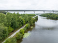
(3) Cross this very busy road. Follow the path down towards Le Coudray and the River Mayenne.
At the end of the track, turn right. After 1 km, before the Rongère mill, turn right towards
La Rouillère-sous-l’Eau. On the opposite bank of the Mayenne, you’ll be able to see the magnificent château of
La Rongère and its listed gardens. Follow the path back, which is shared with route no. 8.

(4) Before the N162, turn left, then right to go through the tunnel. Continue along the path which
leads to the lake and the holiday village. After passing the second lake, turn right
Rue Saint-Martin to reach the church car park (S/E)

Waypoints

  1. S/E : mi 0 - alt. 292 ft - Place de l’Église
  2. 1 : mi 0.3 - alt. 256 ft - D109
  3. 2 : mi 2.09 - alt. 292 ft - On the right after the Ferme de la Gaulerie
  4. 3 : mi 5.04 - alt. 246 ft - Cross the N162 (a very busy road)
  5. 4 : mi 7.46 - alt. 226 ft - Before the N162, turn left then right
  6. S/E : mi 8.37 - alt. 292 ft - Place de l’Église

Notes

At the start of the walk, on Place de l’Église, there are plenty of parking spaces available. Right next to the church, the lake is an ideal spot for a picnic or to relax.

Villiers-Charlemagne Town Hall – 7 rue Saint-Martin, 53170 Villiers-Charlemagne // 02 43 07 70 16

Restaurant: Le Café de la Place

Toilets: by the lake, Place du Commerce, holiday village and fishing area

Worth a visit

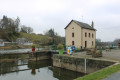
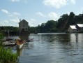
The River Mayenne and the towpath: once a key transport route, the River Mayenne
is now a delight for boaters. In days gone by, boats would travel upstream ‘by tow’, pulled
by horses or men from the path running alongside the river. Today, this path forms an 85 km route linking Mayenne to Daon through an exceptional natural setting.

Lakes and holiday village: the Tannerie and Erveux lakes were created in 1990 by farmers who needed to irrigate their crops. This area was expanded in 1995 with the creation of a fishing-themed holiday village featuring chalets on the water’s edge.

Domaine de Mauvinet, Ruillé-Froids-Fonds: built in 1890 by a bronze sculptor with a passion for horses, it took 20 years to complete this impressive monument. Today, the estate comprises several gardens and offers event venues for hire to the public.

Château de la Rongère, La Roche-Neuville: built in the 16th century and subsequently remodelled in the 19th, it comprises three wings of different periods and architectural styles. A notable feature is the park, which has the characteristics of a formal garden, featuring a round pond, a maze, arbours and green rooms.

Reviews and comments

5 / 5
Based on 1 review

Reliability of the description
5 / 5
Ease of following the route
5 / 5
Route interest
5 / 5
chtidu29
chtidu29

Overall rating : 5 / 5

Date of your route : Jun 11, 2018
Reliability of the description : ★★★★★ Very good
Ease of following the route : ★★★★★ Very good
Route interest : ★★★★★ Very good

A lovely walk, and in glorious sunshine too. The GPS track came in very handy as the signposts on the ground aren’t very visible anymore. Best regards

Machine-translated

Other walks in the area

For more walks, use our search engine .

The GPS track and description are the property of this route's author. Please do not copy them without permission.