Route through the countryside around La Pérouille

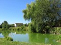
La Pérouille is a small village situated on the edge of the Brenne Nature Park. This walk allows you to explore the surrounding countryside starting from the Étang communal de la Roche.

Details

309347
Creation:
Last update:
Last review:
  • Walking
    Activity: Walking
  • ↔
    Distance: 5.89 mi
  • ◔
    Average duration: 2h 45 
  • ▲
    Difficulty: Easy

  • ⚐
    Back to start: Yes
  • ↗
    Ascent: + 33 ft
  • ↘
    Descent: - 33 ft

  • ▲
    Highest point: 525 ft
  • ▼
    Lowest point: 466 ft

Photos

Description of the walk

The route starts at Étang de la Roche, 800m from the village of La Pérouille. Follow the yellow signposts.

(S/E) Take the small road on the right, heading east, pass through the hamlet of La Roche and reach the D14. Continue straight on along a grassy track, skirting a woodland, then pass through the Pertubrault farm: you will then be on a small road.

(1) At the crossroads, turn right, walking alongside a private pond.

(2) When you reach the D20, turn right and continue towards the hamlet of Les Morgards.

(3) Just before the first house in the hamlet, turn sharply left onto a grassy path and continue for about 1.5 km.

(4) At the junction with a small road, take it, veering slightly to the left. Then carry on straight ahead on the D1 until you reach the hamlet of Le Ratz.

(5) Carry on straight ahead at the junction, leaving the D1 on your left. Continue for 300 metres, passing two streets on your left.

(6) Take the left-hand bend, leaving the straight path behind, and continue along the small road until you reach the D14. At the crossroads, carry on straight ahead along the wide path opposite. Follow this white-gravel path to the hamlet of Les Boudichons. You will then come to a small road; take this to the left for 150 metres.

(7) Once out of the hamlet, turn left and continue along a small road which joins the D20.

(8) Turn left and follow the D20 to the village of La Pérouille, taking care as this road is quite busy.

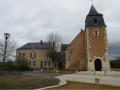
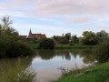
(9) At the church, take the road on the right towards the lake. After 100 metres, turn left onto the small road that leads back to the starting point (S/E).


Waypoints

  1. S/E : mi 0 - alt. 492 ft - Start from Étang de la Roche
  2. 1 : mi 1.52 - alt. 482 ft - Road on the right running alongside the lake
  3. 2 : mi 1.72 - alt. 486 ft - On the right, at the D20
  4. 3 : mi 2.13 - alt. 479 ft - Grassy path on the left
  5. 4 : mi 2.96 - alt. 489 ft - Road veering slightly to the left
  6. 5 : mi 3.3 - alt. 492 ft - Go straight on at the junction
  7. 6 : mi 3.47 - alt. 492 ft - Turn left onto the road
  8. 7 : mi 4.67 - alt. 509 ft - Turn left on leaving Les Boudichons
  9. 8 : mi 5.01 - alt. 522 ft - D20 on the left
  10. 9 : mi 5.42 - alt. 505 ft - On the right, by the church
  11. S/E : mi 5.89 - alt. 492 ft - Return to Étang de la Roche

Notes

Toilets and drinking water at Étang de la Roche

Worth a visit

Lake route

Reviews and comments

4.6 / 5
Based on 3 reviews

Reliability of the description
4.3 / 5
Ease of following the route
5 / 5
Route interest
4.3 / 5
sweetsmoke
sweetsmoke

Overall rating : 4.7 / 5

Date of your route : May 20, 2024
Reliability of the description : ★★★★☆ Good
Ease of following the route : ★★★★★ Very good
Route interest : ★★★★★ Very good
Very busy route : No

Very pleasant, with plenty of walking and quiet roads. Beautiful countryside all around.

Machine-translated

mimipo
mimipo

Overall rating : 4.7 / 5

Date of your route : Mar 28, 2021
Reliability of the description : ★★★★★ Very good
Ease of following the route : ★★★★★ Very good
Route interest : ★★★★☆ Good
Very busy route : No

Hello,

A lovely walk in the beautiful spring sunshine as nature comes to life.
My feet would have appreciated a bit less tarmac! Still, these are quiet little roads with little traffic.
No difficulties

Machine-translated

giovanni36
giovanni36

Overall rating : 4.3 / 5

Date of your route : Jun 02, 2020
Reliability of the description : ★★★★☆ Good
Ease of following the route : ★★★★★ Very good
Route interest : ★★★★☆ Good
Very busy route : No

I did this route again for practical reasons: it’s not far from home and not too far to walk at the end of the day...

The route is fairly straightforward, taking you through fields, hamlets, wooded countryside and hedgerows...

No difficulties.

Machine-translated

Other walks in the area

For more walks, use our search engine .

The GPS track and description are the property of this route's author. Please do not copy them without permission.