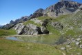
Cime de la Condamine, descent via the Col de la Pisse

This walk offers a very interesting loop, ascending to the Cime de la Condamine via the Col de la Trancoulette and descending via the Col de la Pisse – a descent that is poorly marked and somewhat steep at the start, as you leave the summit.

Details

n°26458719
Creation:
Last update:
Last review:
  • Walking
    Activity: Walking
  • ↔
    Distance: 11.08 mi
  • ◔
    Average duration: 8h 35 
  • ▲
    Difficulty: Difficult

  • ⚐
    Back to start: Yes
  • ↗
    Ascent: + 3,996 ft
  • ↘
    Descent: - 3,999 ft

  • ▲
    Highest point: 9,639 ft
  • ▼
    Lowest point: 5,640 ft

Description of the walk

Access by car to the car park above Puy-Chalvin, just past the chapel, where there are only a few spaces. It is also possible to drive a little further along the track to park in the bends that follow, or to park earlier, at the exit from Puy-Chalvin, where there is a large car park, and then walk to the start of the route.

(S/E) Follow the track to the hamlet of Les Combes.

(1) Walk through the hamlet, past a small car park, and carry on until you reach a designated rest area.

(2) Carry on to the left to quickly reach a crossroads of paths at the end of the track.

(3) Turn left and continue uphill to reach the Col de la Trancoulette via a final climb.

(4) Take the path on the right and continue through the mountain pastures on a gentle climb to reach the Peyre du Feu valley.

(5) Continue up a steeper slope to reach the Col de Vallouise.

(6) Go back a few steps and then take the path on the left. You’ll come to a short narrow passage.

(7) Pass through it – you may need to use your hands – then easily complete the ascent by following the ridge to reach the summit of the Cime de la Condamine.

(8) Head slightly to the right to find a narrow path heading due north; it is steep at the start, with faint but visible switchbacks. You’ll reach a small, clearly marked pass.

(9) Walk along the flank of the Crête de Coste Groselière on your right-hand side, following the cairns towards a small pass, just before a summit.

(10) Follow the cairns heading due north towards the Col de la Pisse. Below the pass, veer right to join the path leading to the Col de la Pisse.

(11) Turn right onto this track to descend into the Ravin Mélivrin valley. Turn right to go round the shoulder of La Paria and reach Lac des Partias.

(12) Walk alongside the lake – which is often dry – to reach the Bergerie des Partias and then the crossroads of the track you passed on the way out.

(:3) Follow the route you took on the way there in the opposite direction to return to the car park you chose at the start (S/E).

Waypoints

  1. S/E : mi 0 - alt. 5,643 ft - Car park near Puy Chalvin
  2. 1 : mi 1 - alt. 6,047 ft - Les Combes
  3. 2 : mi 1.63 - alt. 6,217 ft - Developed area
  4. 3 : mi 2.04 - alt. 6,532 ft - Crossroads of the circular loop
  5. 4 : mi 2.76 - alt. 7,490 ft - Col de la Trancoulette (2332m)
  6. 5 : mi 3.86 - alt. 8,028 ft - Peyre du Feu
  7. 6 : mi 4.44 - alt. 8,471 ft - Col de Vallouise (2621m)
  8. 7 : mi 4.97 - alt. 9,121 ft - Change of slope
  9. 8 : mi 5.48 - alt. 9,639 ft - Cime de la Condamné (2940m)
  10. 9 : mi 5.91 - alt. 8,799 ft - Coste Groselière Ridge
  11. 10 : mi 6.33 - alt. 8,465 ft - Small intermediate pass
  12. 11 : mi 6.77 - alt. 8,018 ft - Col de la Pisse path
  13. 12 : mi 8.18 - alt. 6,919 ft - Lac des Partias
  14. S/E : mi 11.08 - alt. 5,640 ft - Car park near Puy Chalvin

Notes

The descent is marked out from the summit at the start and is a little steep initially but not dangerous; you then need to follow the cairns and faintly marked paths until you rejoin the Col de la Pisse path.

Alternative route: It is also possible to descend via the Fond de Closis and the Ravin de Jafaret (off-trail at the start; the path rejoins the main route towards the bottom of the descent).

Author’s note: It takes 2½ hours to climb up and 2½ hours to complete the loop, walking at a brisk pace.

This route passes through a protected area, which may be subject to special regulations:

Worth a visit

(12) Please note: a large part of this walk is within a Natura 2000 area. Please check the restrictions in force for this area.

Reviews and comments

4.7 / 5
Based on 1 review

Reliability of the description
5 / 5
Ease of following the route
4 / 5
Route interest
5 / 5
jeffVendra
jeffVendra

Overall rating : 4.7 / 5

Date of your route : Jul 03, 2023
Reliability of the description : ★★★★★ Very good
Ease of following the route : ★★★★☆ Good
Route interest : ★★★★★ Very good
Very busy route : No

A lovely walk!
We took a shortcut via La Paria (the signposted path towards Lac des Partias) instead of following the suggested route

Machine-translated

Other walks in the area

For more walks, use our search engine .

The GPS track and description are the property of this route's author. Please do not copy them without permission.