Country:
 City:
City:


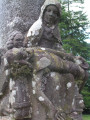
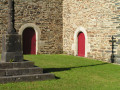
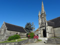
Access: from the Pouilhot junction on the N165 (Brest–Quimper road), take the D88 towards the industrial estate, turn right onto the D48 and follow it to the Kroaz Nu junction (cross). Turn left, then right at the Croaz Pennod junction to reach the chapel on the left.
From Pleyben, follow the D785 towards Brasparts and, at the junction with the D48 (signposted ‘Le Cloître-Pleyben’ on the right), turn left to reach the Kroaz Nu junction (cross). Turn right, then right again at the Croaz Pennod junction to reach the chapel on the left.
Yellow markings (old and sometimes missing on sections where the route is unclear)
(S/E) From the chapel, head down the road towards the hamlet of Koz Kenkis and pass the first few houses.
(1) In the middle of the hamlet, at the signpost, turn right onto a farm track; continue along the edge of the field where the path is sometimes faint (tall grass) until you reach a gate.
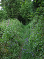
(2) Go down a vague staircase made of logs, then turn left into the undergrowth. Pass over an area of coniferous woodland that has been largely devastated and arrive at a small hut with a corrugated iron roof.
(3) Turn right onto a rustic flight of steps, cross the stream and, at the end, turn left. The start of this section has been churned up by machinery and remains muddy (May 2020). Carry on, keeping the stream on your left, then walk alongside a small pond.
(4) At the corner of the pond, turn right then left onto a wide path which winds through plantations of firs, wild cherries and oaks whilst following a stream. Look out for a sign on your right marked ‘Toull an Diaoul’ (Devil’s Hole in Breton), indicating a former slate quarry worked by the inhabitants of the neighbouring hamlet in the 1870s
(approach with care; there is a small viewing point). Carry on, passing a hut with a table and bench bearing the inscription “Au bon refuge du promeneur” (A welcome refuge for walkers), until you reach a white footbridge.
(5) Cross the stream via the footbridge and head uphill along a grassy path (note a fine oak tree on the left) until you reach the hamlet of Gorz, consisting of three pretty little houses.
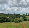
(6) Turn right onto the dirt track which climbs steeply between fields (a lovely view of the Monts d’Arrée range and Brasparts). At the small road, turn right, pass the first two houses in the hamlet of Lézalain and continue to the centre of the hamlet, where you leave this road.
(7) Turn left at the corner of the last building (there are no signs indicating this turn-off) and continue along the stony farm track which descends into the valley. This area contains many trees that have been felled or have fallen as a result of various storms. You’ll reach a hairpin bend in the track.
(8) A faint yellow mark on a felled tree trunk indicates you should turn left into the woodland. Follow this lovely, flower-lined path as it descends gradually, overlooking the Douffine. Continue through the woodland, occasionally skirting the river, until you reach a tarmac road (with a view to the right of the Moulin de la Marche fish farm). Follow this road to the next junction.
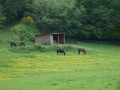
(9) Turn left, leaving the bridge leading to the fish farm on your right, then turn right at the three-way junction into a lovely shaded lane that follows the Douffine valley (grey herons are often seen here). Walk alongside some beautiful horse pastures.
No signposting
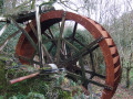
Pass a sign for the “Route la Trinité”, which points to a path on the left that you will take later, and continue along the lovely track suitable for vehicles leading to the Moulin de Pennaud (Meilh Pennod on the map), running alongside the old leat that once powered this mill, which is currently being restored as a residence (May 2020).
(10) Turn round and return to the junction indicated by the sign.
Yellow markings
Turn right onto the path which climbs steadily through the woods. A sign reading ‘Aqueduct’ grandly informs you that you are about to cross a stream. Continue uphill, then take a hairpin bend to the left (a sign is strangely placed here, even though there are no other markings). Carry on through this relatively overgrown section of woodland until you reach a three-way junction (not shown on the map), where a sign would be welcome.
Turn left; the ground levels out and you’ll pass just above a horse shed before reaching a road. Turn right to begin a lovely climb.
(1) Pass through the hamlet of Koz Kenkiz and carry on, still climbing, to the Chapelle de la Trinité (S/E).

 Visorando Member
 Easy
Easy 
 Local authority
 Difficult