The Gorré to Brasparts route

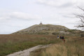
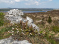
Hiking in Brasparts means exploring the undulating terrain on the southern slopes of the Monts d’Arrée, with varied landscapes and sites steeped in history.

Details

n°29602278
Creation:
Last update:
–
Last review:
  • Walking
    Activity: Walking
  • ↔
    Distance: 8.47 mi
  • ◔
    Average duration: 4h 50 
  • ▲
    Difficulty: Moderate

  • ⚐
    Back to start: Yes
  • ↗
    Ascent: + 1,115 ft
  • ↘
    Descent: - 1,112 ft

  • ▲
    Highest point: 1,020 ft
  • ▼
    Lowest point: 305 ft

Photos

Description of the walk

The route starts in the village of Braspart on Rue Saint-Michel, at the entrance to the village hall car park.

(S/E) Take the alleyway on the right. At the junction, keep left by the fire hydrant, cross a courtyard and follow a sunken path.

(1) Follow this sunken lane to the edge of the Bois de l’Isle.

(2) Turn left to join a local road and follow it to the right for 350 m until you reach the path on the right before the village of Le Rhun.

(3) Return to the woods. Head up to the left along a forest track that runs alongside a stream. Cross the stream and then join the road.

(4) Turn left onto the road to reach Kerrohan.

(5) Turn right at the gable end of a house and head up to the D785, keeping to the right at all times.

(6) Cross the road and continue straight ahead until you reach a three-way junction.

(7) Follow the stony track to the left for about 500 metres until you reach the first junction.

(8) At the edge of a coniferous woodland, turn left and head into a spruce forest. In the centre of the woodland, turn right and continue, ignoring all the paths branching off to the right, until you come out onto the D30.

(9) Walk a few steps to the right, then turn left onto a sunken track which leads out onto a village road. Continue straight ahead. 100 metres further on, turn right towards Runavoualc’h.

(10) On leaving the village, a sunken track starting near a shed leads to Le Goël, running alongside a stream. Follow the track to reach the local road and the junction with the GR® 37 – GR® de Pays des Monts d’Arrée.

(11) From the road, turn left and follow the GR® as it descends to a crossroads. Turn right onto a wide, stony sunken track. At the top, turn right and then leave the GR® almost immediately.

(12) Walk straight down towards the Benniel junction. Continue straight on along the road, then turn left at the end of it until you reach the three-way junction. (Off the route, the Saint-Sébastien chapel and its cross are 400 m away via the road on the right). Continue to the right until you reach a fork in the paths.

(13) Leave the village road and turn left onto a path crossing a stream. When the path joins the road, turn right to reach the village of Botquest. In the centre of the village, take a path on the left. Continue, passing two farm buildings on your left. Cross a stream. A steep path leads to the church of Notre-Dame and Saint-Tugen. On the Route de Morlaix, turn left twice and return to the starting point by turning right at the third junction.

Waypoints

  1. S/E : mi 0 - alt. 449 ft - Brasparts village: Rue Saint Michel
  2. 1 : mi 0.13 - alt. 479 ft - Sunken lane
  3. 2 : mi 0.72 - alt. 344 ft - Bois de l’Isle
  4. 3 : mi 1.01 - alt. 371 ft - T-junction before the village of Le Rhun
  5. 4 : mi 1.93 - alt. 440 ft - Route
  6. 5 : mi 2.17 - alt. 535 ft - Village of Kerrohan
  7. 6 : mi 2.74 - alt. 850 ft - D785
  8. 7 : mi 3.27 - alt. 991 ft - Gravel track
  9. 8 : mi 3.55 - alt. 1,010 ft - Junction
  10. 9 : mi 5.05 - alt. 653 ft - D30
  11. 10 : mi 5.48 - alt. 525 ft - Runavoulc’h
  12. 11 : mi 6.01 - alt. 505 ft - GR37 and GRP
  13. 12 : mi 6.34 - alt. 522 ft - Junction
  14. 13 : mi 6.74 - alt. 371 ft - Footpath
  15. S/E : mi 8.47 - alt. 449 ft - Brasparts village: Rue Saint Michel

Notes

Route also surveyed by Michel Floch.

County roads: take care when crossing and walking along these roads!

Worth a visit

A bit of history.
This is an area with a very ancient history, as evidenced by the alignment of Neolithic menhirs situated below Mont Saint-Michel: ‘La Noce de Pierres’ and ‘An Eured Vein’. As early as the 16th century, the village boasted a market hall (now demolished), a sign of vibrant economic activity, fairs, markets and a thriving commercial and agricultural life that endured until the mid-20th century.

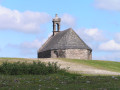
Chapel and cross of Saint Sebastian.
A chapel built in 1660 from locally quarried granite (from the Goël quarry). Novenas were recited here to ensure that the sick would recover more quickly. Of particular note are the contemporary stained-glass windows (M-G Le Bars-Ateliers Loire) on either side of the nave. The monumental cross, erected in 1632, bears on its eastern side (beneath the plinth of the Virgin and Child) the coat of arms of the Huon family, owners of the neighbouring Squiriou manor house.

Church of Our Lady and Saint Tugen.
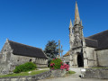
The church’s construction spanned several periods, with the main phase dating back to the 16th century. Beneath the south porch, niches house statues of the apostles. There are numerous sculpted elements, notably on the gables of the ossuary (an angel, the Ankou, etc.). The 16th-century calvary, which has been altered several times, features some magnificently carved works. Inside, note the 17th-century pulpit with its exquisitely fine carvings. Set like a crown, the sounding board is surmounted by the Archangel Michael.

Always be cautious and plan ahead when you're outdoors. Visorando and the author of this route cannot be held responsible for any accidents occurring on this route.

The GR® and PR® markings are the intellectual property of the Fédération Française de Randonnée Pédestre.

Reviews and comments

4 / 5
Based on 2 reviews

Reliability of the description
4.5 / 5
Ease of following the route
3.5 / 5
Route interest
4 / 5
User 10682923

Overall rating : 4.7 / 5

Date of your route : Jun 22, 2026
Reliability of the description : ★★★★★ Very good
Ease of following the route : ★★★★☆ Good
Route interest : ★★★★★ Very good
Very busy route : No

A rather nice walk. There are lots of sunken paths, which don’t always allow you to take in the scenery. The route is very shaded, which we really appreciated given the temperature that day.

Machine-translated

laurentlepage29
laurentlepage29
• Edited:

Overall rating : 3.3 / 5

Date of your route : Mar 03, 2025
Reliability of the description : ★★★★☆ Good
Ease of following the route : ★★★☆☆ Average
Route interest : ★★★☆☆ Average
Very busy route : No

A very challenging route at this time of year. Mud almost all the way along. And challenging in any case compared to the average routes in the department.

Machine-translated

Other walks in the area

For more walks, use our search engine .

The GPS track and description are the property of this route's author. Please do not copy them without permission.