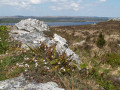
The Ménez route starting from Brasparts

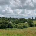
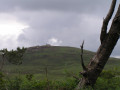
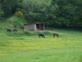
A wonderful day’s walk in the Monts d’Arrée, exploring a Neolithic site and landscapes of hills, woods, moors and green valleys through which rivers and streams flow peacefully.

Details

n°29586249
Creation:
Last update:
–
Last review:
  • Walking
    Activity: Walking
  • ↔
    Distance: 10.98 mi
  • ◔
    Average duration: 5h 55 
  • ▲
    Difficulty: Difficult

  • ⚐
    Back to start: Yes
  • ↗
    Ascent: + 1,007 ft
  • ↘
    Descent: - 1,020 ft

  • ▲
    Highest point: 1,010 ft
  • ▼
    Lowest point: 295 ft

Photos

Description of the walk

Park in the village of Brasparts, on Rue Saint-Michel (Pleyben–Morlaix road), at the entrance to the Salle des Fêtes car park.

(S/E) Take Rue de Gwaremm Edern; you’ll soon come to a right-angle bend.

(1) Turn left at the fire hydrant, cross a courtyard and head down the sunken path towards the fields. Reach the edge of the Bois de l’Isle, formerly owned by La Fayette.

(2) Turn left onto a local road and follow it to the right for 350 m. Take a sharp right onto a track before the village of Le Rhun to return to the woods. Head up to the left along the forest path which runs alongside a stream to reach a local road near the hamlet of Treoffrec.

(3) Head left up the road towards Kerrohan. At the gable end of the house, continue uphill to the D785.

(4) Cross the road with care, continuing uphill along the path opposite. At the junction with the GR®37 – GR® de Pays des Monts d’Arrée, turn right and rejoin the D785.

(5) Cross the road with great care. Continue straight ahead for about 1 km until you reach the ‘Chasse Nature’ Training Centre at Ty Blaise.

(6) Take the path on the right and pass under the power line. At the next fork, keep right to reach Le Cosquer (Kosher on IGN maps). Follow the access track to reach a local road.

(7) Head straight on towards Menglaz and continue along a dirt track until you reach Pennarous. Take the road straight ahead for 400 m.

(8) At the top of a hill, at the corner of a house, turn left towards Kerbloc’h.

(9) Turn left onto the road and follow it for 600 m, crossing the River La Douffine.

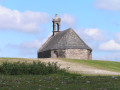
(10) On the hill, turn right onto the stony track towards Meilh ar Groaz. Cross a small bridge, walk alongside a field and enter a wood to reach the Chapel of the Cross (in the parish of Loqueffret). Walk up the road running alongside a field.

(11) At the stony track, which follows the route of the old Plouescat–Rosporden railway line, turn right. 100 metres further on, continue to the right along a grassy track for 2.8 km.

(12) Where the path joins a local road, follow it to the right to reach the former Brasparts railway station on the D21; follow the D21 to the right for 1.2 km towards the centre of Brasparts to return to the Brasparts car park (S/E).

Waypoints

  1. S/E : mi 0 - alt. 443 ft - Brasparts – Rue Saint-Michel
  2. 1 : mi 0.21 - alt. 482 ft - Junction on a sunken lane
  3. 2 : mi 0.8 - alt. 344 ft - Junction on a local road
  4. 3 : mi 2.08 - alt. 440 ft - Junction
  5. 4 : mi 2.88 - alt. 846 ft - Crossing the D785
  6. 5 : mi 4.06 - alt. 955 ft - Road D785
  7. 6 : mi 4.54 - alt. 896 ft - ‘Chasse Nature’ Training Centre at Ty Blaise - La Noce de Pierres
  8. 7 : mi 6.02 - alt. 564 ft - Crossing a local road
  9. 8 : mi 6.76 - alt. 443 ft - Junction
  10. 9 : mi 7.23 - alt. 367 ft - The village of Kerbloc’h
  11. 10 : mi 7.61 - alt. 430 ft - Junction on a stony track
  12. 11 : mi 8.18 - alt. 433 ft - T-junction - Chapelle de La Croix
  13. 12 : mi 9.96 - alt. 322 ft - Local road
  14. S/E : mi 10.98 - alt. 443 ft - Brasparts – Rue Saint-Michel

Notes

District roads: take care when crossing and walking along them

Worth a visit

Always be cautious and plan ahead when you're outdoors. Visorando and the author of this route cannot be held responsible for any accidents occurring on this route.

The GR® and PR® markings are the intellectual property of the Fédération Française de Randonnée Pédestre.

Reviews and comments

5 / 5
Based on 1 review

Reliability of the description
5 / 5
Ease of following the route
5 / 5
Route interest
5 / 5
Arthur 29
Arthur 29

Overall rating : 5 / 5

Date of your route : Apr 15, 2024
Reliability of the description : ★★★★★ Very good
Ease of following the route : ★★★★★ Very good
Route interest : ★★★★★ Very good
Very busy route : No

I had a lovely day on this walk, which alternates between heathland and countryside. Please be aware that some sections can be treacherous in wet weather.

Machine-translated

Other walks in the area

For more walks, use our search engine .

The GPS track and description are the property of this route's author. Please do not copy them without permission.