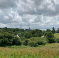
Along the water’s edge to the west of Brasparts

A short, easy walk, featuring a few stream crossings.

Details

2290695
Creation:
Last update:
Last review:
  • Walking
    Activity: Walking
  • ↔
    Distance: 3.80 mi
  • ◔
    Average duration: 2h 10 
  • ▲
    Difficulty: Easy

  • ⚐
    Back to start: Yes
  • ↗
    Ascent: + 453 ft
  • ↘
    Descent: - 469 ft

  • ▲
    Highest point: 476 ft
  • ▼
    Lowest point: 259 ft
  • ⚐ Country: France
  • ⚐ City: Brasparts (29190)
  • ⚑
    Start/End: N 48.30133° / W 3.956273°
  • ❏
    IGN map(s): Ref. 0517OT, 0617OT
  • Hour-by-hour weather

Description of the walk

Start from the car park in front of Brasparts church.

(S/E) Opposite the church, take a few steps to the right and follow the small path that starts between two houses and leads towards the cemetery. Walk downhill and cross a stream. Then walk past a farm on your right.

(1) You’ll come out onto a road; follow it to the right for about 150 metres.

(2) Then turn onto a narrow path on the left. At a Fork in the road, veer left and head downhill. Cross a small wooden bridge. Further on, you’ll come to a road.

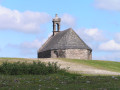
(3) Follow the road to the left. Walk past the Saint-Sébastien Chapel and through the hamlet of Doulvenn Vraz. You’ll come to a wider road, the D21, and follow it to the left.

(4) After about 200 m, don’t miss the first small path on the left. Head downhill and cross two streams via footbridges.

(5) As you come off the second footbridge, head diagonally left and walk uphill. Further up, ignore a path branching off to the right. The path becomes a road, which you continue along.

(6) At the crossroads, turn left.

(1) Back at the hamlet of Botquest, follow the route you took on the way out in the opposite direction to return to the starting point (S/E).

Waypoints

  1. S/E : mi 0 - alt. 430 ft - Brasparts Church
  2. 1 : mi 0.61 - alt. 440 ft - Botquest – Junction of the circular loop
  3. 2 : mi 0.77 - alt. 472 ft - Start of the trail
  4. 3 : mi 1.58 - alt. 371 ft - Small road - Chapelle Saint-Sébastien (Pleyben)
  5. 4 : mi 2.26 - alt. 308 ft - Start of the trail
  6. 5 : mi 2.47 - alt. 276 ft - Two footbridges. Fork in the road
  7. 6 : mi 2.97 - alt. 400 ft - Crossroads
  8. S/E : mi 3.8 - alt. 430 ft - Brasparts Church

Reviews and comments

4.3 / 5
Based on 3 reviews

Reliability of the description
4 / 5
Ease of following the route
5 / 5
Route interest
4 / 5
Gars Djo
Gars Djo

Overall rating : 3 / 5

Date of your route : May 26, 2025
Reliability of the description : ★★☆☆☆ Disappointing
Ease of following the route : ★★★★★ Very good
Route interest : ★★☆☆☆ Disappointing
Very busy route : No

A disappointing route; very wet, even though it hadn’t rained for a long time. Few interesting views; the route is very often set in a valley. Not very interesting.

Machine-translated

Boudigsev
Boudigsev

Overall rating : 5 / 5

Date of your route : Aug 26, 2020
Reliability of the description : ★★★★★ Very good
Ease of following the route : ★★★★★ Very good
Route interest : ★★★★★ Very good
Very busy route : No

A lovely, peaceful walk
if it has rained in the days leading up to your visit, make sure you wear waterproof shoes to get through certain sections

Machine-translated

ClgBrest
ClgBrest

Overall rating : 5 / 5

Date of your route : Sep 20, 2019
Reliability of the description : ★★★★★ Very good
Ease of following the route : ★★★★★ Very good
Route interest : ★★★★★ Very good

A huge thank you for the detailed instructions. I have absolutely no sense of direction and so I regularly get lost on hiking routes, but I didn’t hesitate for a moment here – the description is so clear and precise.
A very interesting route, featuring plenty of sunken paths, streams and bridges, with some lovely views of Brasparts along the way. Thank you again.

Machine-translated

Other walks in the area

For more walks, use our search engine .

The GPS track and description are the property of this route's author. Please do not copy them without permission.