


Refine your search for walks in Champorcher
Champorcher walks
 Lillaz - Chardonney
 Association / Club / Walk leader
 15.14 mi
 +4,308 ft
 -4,908 ft
 10h 45
 Very difficult
 Departure from Cogne (Aosta Valley)
An easy but long day. No complaints about the climb. However, be careful towards the end as there are many paths that look alike. From Chardonney, there is little public transport. It is possible to hitchhike to Pont-Saint-Martin. With all the French place names, you wouldn’t think you were in Italy. From Pont-Saint-Martin, there are buses to Gressonney-Saint-Jean.
From Gimillan to Lago Money
 Visorando Member7.72 mi
+2,713 ft
-2,687 ft
5h 55
Visorando Member7.72 mi
+2,713 ft
-2,687 ft
5h 55
 Moderate
Departure from Cogne (Aosta Valley)
Moderate
Departure from Cogne (Aosta Valley)
An easy walk from the beautiful village of Gimillan to Lago Money.
You can decide what to do when you arrive at waypoint 2:Most people walk to the Laghi di Lussert, which is also very beautiful, but a 1-hour longer walk.I did it a few years ago, that's why we walked to the silent and very beautiful Lago Money.
From Gimillian to the Grauson Refuge
 8.10 mi
+2,444 ft
-2,428 ft
5h 50
8.10 mi
+2,444 ft
-2,428 ft
5h 50
 Difficult
Departure from Cogne (Aosta Valley)
Difficult
Departure from Cogne (Aosta Valley)
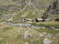
A lovely hike in the Cogne area with stunning views of Gran Paradiso.
Circular around Cly Castle
4.85 mi
+1,759 ft
-1,785 ft
3h 45
Moderate
Departure from Nus (Aosta Valley)
A lovely autumn circular with magnificent views of the Aosta Valley and Cly Castle. Parking in Nus, pleasant climb in stages. On the way back, a meal or refreshment in Nus is a must!
Return trip to the Vittorio Sella Refuge from Valnontey
 6.16 mi
+3,087 ft
-3,087 ft
5h 30
Moderate
Departure from Cogne (Aosta Valley)
6.16 mi
+3,087 ft
-3,087 ft
5h 30
Moderate
Departure from Cogne (Aosta Valley)
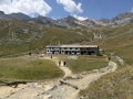
A fairly popular hike that takes you close to the foothills of Gran Paradiso. You might spot some ibex if you’re lucky!
 Valnontey Valley
 4.18 mi
+348 ft
-348 ft
2 hrs
4.18 mi
+348 ft
-348 ft
2 hrs
 Easy
Departure from Cogne (Aosta Valley)
Easy
Departure from Cogne (Aosta Valley)
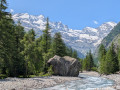
This pleasant route offers spectacular views of the Gran Paradiso massif. You’ll be able to see numerous ice waterfalls, which attract ice climbers from all over the world.
Refuge Vittorio Sella - Valnontey
8.33 mi
+846 ft
-3,825 ft
4h 35
Moderate
Departure from Cogne (Aosta Valley)
Spectacular view over Gran Paradiso.
Ascent to the Piccoli Lakes
7.95 mi
+2,972 ft
-2,959 ft
6h 15
Difficult
Departure from Issime (Aosta Valley)
This circular walk takes you up to the little-visited lakes of Siaua and allows you to explore a historic valley associated with Walser settlement, featuring numerous old stone and timber dwellings from that period. The route is well signposted and follows paths nos. 1, 1F, 1A and GSW in succession.
Monte Chatelard from Mongnod
 3.52 mi
+919 ft
-915 ft
2h 25
Moderate
Departure from Torgnon (Aosta Valley)
3.52 mi
+919 ft
-915 ft
2h 25
Moderate
Departure from Torgnon (Aosta Valley)
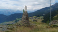
A lovely walk to a small peak overlooking the village of Torgnon. On this rocky outcrop stands a monument dedicated to the Madonna degli Alpini (Our Lady of the Alpine Hunters). At the summit, you’ll enjoy a panoramic view of the southern peaks of the Aosta Valley.
Col de Saint Pantaléon from Torgnon
 3.75 mi
+666 ft
-682 ft
2h 20
Moderate
Departure from Torgnon (Aosta Valley)
3.75 mi
+666 ft
-682 ft
2h 20
Moderate
Departure from Torgnon (Aosta Valley)
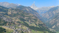
A pleasant route offering several views of the village of Torgnon and the neighbouring peaks: Le Zerbion and Le Tantané. At the small chapel (3), you can enjoy a panoramic view stretching from Valtournenche all the way to the Matterhorn.
Becca d’Aver – Cima Longhede
 5.40 mi
+2,326 ft
-2,326 ft
4h 30
Difficult
Departure from Torgnon (Aosta Valley)
5.40 mi
+2,326 ft
-2,326 ft
4h 30
Difficult
Departure from Torgnon (Aosta Valley)
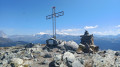
A superb route to the Becca d’Aver, the peak overlooking Torgnon. You’ll enjoy panoramic views of the Matterhorn and the Monte Rosa massif. From the Becca d’Aver, follow the ridge path to reach another peak, the Cima Longhede.
Tour of the Torgnon mountain pastures
 9.60 mi
+1,204 ft
-1,230 ft
5h 30
Moderate
Departure from Torgnon (Aosta Valley)
9.60 mi
+1,204 ft
-1,230 ft
5h 30
Moderate
Departure from Torgnon (Aosta Valley)
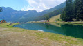
A pleasant route that alternates between mountain pastures and forests. The northern section of the route takes you past peaks exceeding 3,000 metres: Becca de Salé, Pointe du Tsan and Pointes de Chavacour. On the way back, you ’ll pass close to Monte Meabé and Becca d’Aver
Antecima Monte Meabé
 3.47 mi
+2,270 ft
-2,267 ft
3h 35
Moderate
Departure from Torgnon (Aosta Valley)
3.47 mi
+2,270 ft
-2,267 ft
3h 35
Moderate
Departure from Torgnon (Aosta Valley)
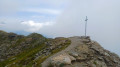
A beautiful route to the Antécime du Meabé, another peak overlooking Torgnon. In good weather, you’ll enjoy panoramic views of the Matterhorn and the Monte Rosa massif. At the start, the path shares the route with the Col Fenêtre trail. From this pass, it’s also possible to reach the Antécime du Meabé.
Palasinaz Lakes Plateau
9.83 mi
+3,100 ft
-3,114 ft
7h 15
Difficult
Departure from Brusson (Aosta Valley)
The upper Palasinaz valley boasts some truly valuable natural treasures, including the famous plateau of lakes. An easy but long walk from Estoul (1,884 metres) takes you up to the plateau of lakes in four hours via a marked forest road (Route No. 6). Trail No. 5A then leads to the Valfredda Lakes (2,564 metres), with the option of a variant, while No. 4 continues towards the Bataille Lakes (2,484 m), Potcha (2,517 m) and Long (2,632 m), the route of this hike.
Lakes of Estoul and Chamen
6.29 mi
+2,838 ft
-2,838 ft
5h 20
Difficult
Departure from Brusson (Aosta Valley)
The trail winds through the forest for a good while and, after a near-flat section, becomes steeper... and remains moderately steep until you reach the small Lac d'Estoul (2,434 m). Leave trail No. 6B on your right and stay on trail No. 6A, which in a few minutes reaches the magnificent Lac Chamen.On the way back, our route goes around Lac Chamen to the east and becomes steeper, even very steep at times, to reach Colletto Valnera at 2,681m. Then follow the trail heading north-east (i.e. to the right) to the summit of Punta Valnera (2,754 m). This short route to the summit is not difficult, apart from the steepness of the slope. In good weather, this beautiful peak, which is relatively easy to reach, offers a vast panorama. The return journey follows the same route.
From Lignod to Mont Zerbion via the Col de Portela
6.76 mi
+3,593 ft
-3,570 ft
6h 15
Very difficult
Departure from Ayas (Aosta Valley)
Wait until there is no snow to do this hike safely. Round trip hike. You must be sure-footed and experienced in mountain walking.
Starting from Lignod, pass in front of the church, which is currently being renovated, with its pretty fresco. Well-marked paths in the village allow you to leave it and climb towards Borbey. Pass a car park and take the path that continues to climb and gain altitude. You are on a Way of the Cross that climbs up to the Virgin of Mount Zerbion. The Col de Portela is visible and recognisable with its pylon. Cross the pass to reach Mount Zerbion and its virgin located at 2,723 metres above sea level, overlooking the Ayas valley.
Santuario di Gilliarey
 5.73 mi
+1,952 ft
-1,952 ft
4h 20
Moderate
Departure from Torgnon (Aosta Valley)
5.73 mi
+1,952 ft
-1,952 ft
4h 20
Moderate
Departure from Torgnon (Aosta Valley)
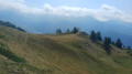
A beautiful route which initially follows the “Petit Monde” stream. The climb continues towards the Cret mountain pasture and joins the track leading to the hamlet of Gilliarey. On the right, a small path leads to the Gilliarey sanctuary. You’ll enjoy a panoramic view of the Valtournenche and the Matterhorn. The return journey follows the same route as the outward journey
Circular route via the Col de Gardaz, the Frudière Lakes and the small pass of Taf
9.29 mi
+3,802 ft
-3,819 ft
7h 35
Very difficult
Departure from Gressoney-Saint-Jean (Aosta Valley)
This circular route, which passes over two mountain passes, allows you to explore the Frudière lakes in the Ayas Valley and to admire magnificent views of the Monte Rosa massif throughout the walk. This route is very difficult and is reserved for experienced walkers. Indeed, the ascent to Colletto de Taf from the Col de Frudière follows a narrow, vertiginous path where sure-footedness is essential. This climb also requires you to use your hands in certain sections. The route follows paths nos. 3A, 9B and 1A (EE) in succession.
Pilaz Pass
 4.12 mi
+2,024 ft
-2,021 ft
2 hrs
Moderate
Departure from Chamois (Aosta Valley)
4.12 mi
+2,024 ft
-2,021 ft
2 hrs
Moderate
Departure from Chamois (Aosta Valley)
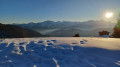
A superb winter route starting from Chamois. At Col Pilaz, you will be surprised to discover the Matterhorn to the north. A giant red bench offers a superb photo opportunity with the Cervinio in the background. On the south side, a magnificent panorama of the Paradis massif awaits you. The village of Chamois is the only car-free village in Italy. It is only accessible on foot, by bicycle or by cable car.
Monte Tantané
 9.32 mi
+3,320 ft
-3,307 ft
7h 10
Very difficult
Departure from Chamois (Aosta Valley)
9.32 mi
+3,320 ft
-3,307 ft
7h 10
Very difficult
Departure from Chamois (Aosta Valley)
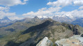
A superb hike to the summit of Monte Tantané. The ascent along the ridge is quite challenging, but once you reach the summit you’ll be rewarded with a magnificent panoramic view, particularly of the Matterhorn and the Monte Rosa massif.
Col Pilaz and Col Champlong, Lago Charey and the Champlong lakes
 6.65 mi
+1,857 ft
-1,864 ft
4h 40
Moderate
Departure from Chamois (Aosta Valley)
6.65 mi
+1,857 ft
-1,864 ft
4h 40
Moderate
Departure from Chamois (Aosta Valley)
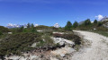
A magnificent hike starting from Chamois. The route is very varied, offering superb panoramic views of the Gran Paradiso massif at the Col du Pilaz. You’ll appreciate the beauty of Lakes Charey and Champlong. From time to time, you’ll catch glimpses of the Matterhorn, which plays hide-and-seek for a good half of the journey.
The village of Chamois is the only car-free village in Italy. It is accessible only on foot, by bike or by cable car.
Monte Charvaz circular walk from Chamois
 4.94 mi
+1,729 ft
-1,722 ft
3h 45
Moderate
Departure from Chamois (Aosta Valley)
4.94 mi
+1,729 ft
-1,722 ft
3h 45
Moderate
Departure from Chamois (Aosta Valley)
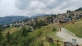
This circular walk above Chamois passes by Monte Charvaz, a viewpoint offering a panoramic view of the western part of the Valtournenche valley. You’ll recognise the mountain range above Torgnon, stretching from Becca d’Aver to Cima Bianca. The return to Chamois follows the course of the stream of the same name.
Rosaire and Clermont campsite – Ollomont
13.68 mi
+4,426 ft
-8,681 ft
10h 10
Very difficult
Departure from Quart (Aosta Valley)
A very long day. The descent to Oyace seems never-ending. On the other hand, once again, the scenery is magnificent and wild. It’s best to have a good rest in Oyace, as the final climb to the Col de Brison is very long. It’s almost over
Gressonney - Di Frachey Refuge
10.85 mi
+5,758 ft
-3,533 ft
10h 00
Very difficult
Departure from Gressoney-Saint-Jean (Aosta Valley)
That’s the end of the southern section. This hike takes in a different landscape, with the Swiss Alps in view. It feels like we’re in Germany. It’s a lovely day. After the climb, the hike descends back into the valley. As with Eaux Rousses, it’s best to book in advance as the refuge is very popular. In fact, there are two of them and they’re full by early July.
Punta Falinère
 6.58 mi
+1,880 ft
-3,343 ft
4h 40
Difficult
Departure from Chamois (Aosta Valley)
6.58 mi
+1,880 ft
-3,343 ft
4h 40
Difficult
Departure from Chamois (Aosta Valley)
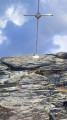
Punta Falinère is the peak overlooking the Chamois slopes. It offers views of its neighbours, the Petit and Grand Tournalin. To the north, you will discover more than 4000 Swiss peaks, including the Dent Blanche d'Hérens and the Matterhorn. To the south, the Grand Paradis will catch your eye.
Mascognaz waterfall in Champoluc
2.25 mi
+1,017 ft
-1,007 ft
1h 55
Moderate
Departure from Ayas (Aosta Valley)
A pleasant hike, suitable for the whole family, to reach the village of Mascognaz via its beautiful waterfalls. The route starts in Champoluc and continues along the path through the forest, following the stream and reaching the village of Mascognaz. From there, it is possible to take several longer routes.
Champoluc - Refuge de l'Arp
6.16 mi
+3,829 ft
-988 ft
6h 10
Difficult
Departure from Ayas (Aosta Valley)
Starting from the church square, this hike follows the Evançon torrent before turning left onto Rue de l'Ostrion, which gradually climbs. Passing by the small chapel overlooking the village of Champoluc and the Ayas Valley, you will reach the village of Mascognaz, an authentic and beautiful Walser village. The hike passes through Col de Palasina and then, after a slight descent, you will reach the wild Bataille lakes and then the Arp refuge at 2,400 metres.
From Chemonal to Alpenzu and Walser villages
6.24 mi
+2,047 ft
-2,051 ft
4h 40
Moderate
Departure from Gressoney-Saint-Jean (Aosta Valley)
The walk begins with a strenuous climb to a mountain hut (Alpenzu).
Afterwards, it slopes gently downhill past various Walser houses. Along the way, you can enjoy the amazing views of the valley.
The return is partly through the forest.
From Gressoney-La-Trinité to Claval/Staffal via Lago Gabiet
5.95 mi
+2,490 ft
-1,873 ft
4h 55
Moderate
Departure from Gressoney-La-Trinité (Aosta Valley)
The beginning of the route is easy enough (follow route 4 to Lake Gabiet), but it's more than a 600-meter climb!
The lake is beautiful, and you can see the snow on top of the Monte Rosa in the distance.
Col de Champillon from Plan Debat
4.26 mi
+2,073 ft
-2,073 ft
3h 45
Moderate
Departure from Doues (Aosta Valley)
A lovely walk leading to the Col de Champillon via the Champillon Refuge. You can have a meal at the refuge if you book in advance.
Along the Ru de By starting from Champillon car park
7.56 mi
+646 ft
-627 ft
4h 00
Moderate
Departure from Doues (Aosta Valley)
Drive via Doues to the Doues - Champillon parking lot below the Refugio Champillon (a beautiful drive with magnificent views). From here, you can walk to the Refugio (1-hour climb) or take a relaxed stroll along the Rû (water channels), which is what I did (see route). Enjoy the beautiful views of both the mountains and the Ollomont valley. You can keep walking for as long as you like. Return the same way.
Ollomont – Saint-Rhémy
11.82 mi
+5,410 ft
-4,649 ft
10h 10
Very difficult
Departure from Ollomont (Aosta Valley)
An average day on paper, but the fatigue is setting in. But it’s the penultimate day. The route is still clearly marked, so we don’t waste too much time getting lost. A stop at the Refuge de Champillon is a must. There’s a climb through the fields. The Col de Champillon is the last major pass before the finish.