Return trip to the Vittorio Sella Refuge from Valnontey

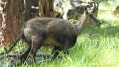
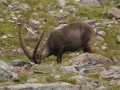
A fairly popular hike that takes you close to the foothills of Gran Paradiso. You might spot some ibex if you’re lucky!

Details

10545673
Creation:
Last update:
Last review:
  • Walking
    Activity: Walking
  • ↔
    Distance: 6.16 mi
  • ◔
    Average duration: 5h 30 
  • ▲
    Difficulty: Moderate

  • ⚐
    Back to start: Yes
  • ↗
    Ascent: + 3,087 ft
  • ↘
    Descent: - 3,087 ft

  • ▲
    Highest point: 8,478 ft
  • ▼
    Lowest point: 5,443 ft

Photos

Description of the walk

Park in the car park on Rue du Grand Paradis in Valnontey.

(S/E) From the car park, follow Rue du Grand Paradis, cross the wooden bridge and turn left. Signs point to the V Sella refuge (number 18)

(1) The path is well signposted. The estimated time to reach the refuge is 2 hours 30 minutes. Take the dirt track that runs alongside the alpine garden and then winds its way up through a wooded area. You will come to a bridge.

(2) Continue straight on after the bridge, leave the woodland and arrive at the hamlet of Toules.

(3) Cross the hamlet and continue along the path, passing in front of the two ruined houses. The path then climbs through a wooded section.

(4) Cross a stream via a small bridge and continue the climb.

(5) Turn left here.

(6) The old path is closed due to erosion. Turn right and follow the markings for number 18. Continue along the path to the Vittorio Sella Refuge.

(7) From the refuge, take the same route back down to Valnontey (S/E).

Waypoints

  1. S/E : mi 0 - alt. 5,443 ft - Car park on the edge of Rue du Grand Paradis
  2. 1 : mi 0.2 - alt. 5,505 ft - Signs
  3. 2 : mi 1.14 - alt. 6,486 ft - Bridge
  4. 3 : mi 1.29 - alt. 6,585 ft - Toules
  5. 4 : mi 2.03 - alt. 7,457 ft - Bridge
  6. 5 : mi 2.16 - alt. 7,680 ft - Turn left
  7. 6 : mi 2.33 - alt. 7,815 ft - Path number 18
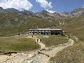
  8. 7 : mi 3.08 - alt. 8,478 ft - Refugio Vittorio Sella - Refuge Vittorio Sella
  9. S/E : mi 6.16 - alt. 5,443 ft - Car park on the edge of Rue du Grand Paradis

Notes

Water and toilets at the refuge.
The path is an old mule track: it is wide and presents no technical difficulties.

Worth a visit

Reviews and comments

4.5 / 5
Based on 7 reviews

Reliability of the description
4.7 / 5
Ease of following the route
4.9 / 5
Route interest
4 / 5
john31200
john31200

Overall rating : 5 / 5

Date of your route : Jul 29, 2026
Reliability of the description : ★★★★★ Very good
Ease of following the route : ★★★★★ Very good
Route interest : ★★★★★ Very good
Very busy route : Yes

The climb up to the refuge is pleasant and steady, partly in the shade, but very busy at the end of July. The route guidance is excellent (GPS track and instructions). On arrival at the lodge, you can have something to eat and you’re given a very warm welcome.
Thank you for publishing this route.

Machine-translated

cima_grande
cima_grande

Overall rating : 3.7 / 5

Date of your route : Jul 21, 2026
Reliability of the description : ★★★☆☆ Average
Ease of following the route : ★★★★☆ Good
Route interest : ★★★★☆ Good
Very busy route : Yes

To add to the description: In the village of Valnontey, to park your car, there is either the pay-and-display car park at the entrance (2026 rates: €2 per hour or €8 for the day), or a little further on, just after crossing the bridge, on the left there are around thirty free spaces along the river. To head towards the refuge, after the bridge, carry on straight ahead and take the road leading uphill on the left to reach the car park of a restaurant: there you’ll find the only sign pointing towards the refuge… The climb is gentle at first but then becomes steeper almost all the way to the top. For those who have run out of water, there are two small drinking troughs in the second half of the climb. Throughout the climb, there are no signs indicating direction, distance or duration (except 10 minutes before the end), but it’s hard to go wrong: there’s only one wide path, regularly paved with slabs, and generally speaking, you just need to follow all the walkers heading up it with their rucksacks on...

Machine-translated

yoguini
yoguini

Overall rating : 5 / 5

Date of your route : Aug 18, 2025
Reliability of the description : ★★★★★ Very good
Ease of following the route : ★★★★★ Very good
Route interest : ★★★★★ Very good
Very busy route : Yes

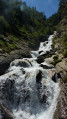
A pleasant route with waterfalls on the way up. The path is enjoyable despite the steep slope, and there are also two fountains along the way.
You can continue to Lake Lauson after the Sella refuge. There are lots of chamois there and it's not far away.
Be careful because the bridges were washed away during the heavy floods in December 2024, so it is not possible to make a loop via Alpe Money. Make a return trip as indicated.
There is no more confusion with the farm as there are now very clear signs.
great hike, thank you.

Machine-translated

Fontenotte
Fontenotte

Overall rating : 5 / 5

Date of your route : Jun 25, 2025
Reliability of the description : ★★★★★ Very good
Ease of following the route : ★★★★★ Very good
Route interest : ★★★★★ Very good
Very busy route : No

It's hard to get lost as the path is in very good condition and easy to follow! Still, it's a huge relief when you arrive at the refuge.

Machine-translated

Pascale73
Pascale73

Overall rating : 4.3 / 5

Date of your route : Jun 18, 2025
Reliability of the description : ★★★★★ Very good
Ease of following the route : ★★★★★ Very good
Route interest : ★★★☆☆ Average
Very busy route : Yes

A long and fairly difficult hike where you are unlikely to see any animals. The arrival point at the refuge is unclear (confusion with a farm below).

Machine-translated

muse_88_
muse_88_

Overall rating : 4.3 / 5

Date of your route : May 29, 2022
Reliability of the description : ★★★★★ Very good
Ease of following the route : ★★★★★ Very good
Route interest : ★★★☆☆ Average
Very busy route : Yes

Hello,
There is a charge for parking: 4 euros per day.
The hike is lovely, but we have the same view of the Grand Paradis from start to finish; I would have preferred to see other slopes higher up once we reached the refuge.
There are plenty of chamois on the trail.
Not too difficult, fairly steady climb.
At this time of year, the refuge is not open.

Machine-translated

muse_88_
muse_88_

Overall rating : 4.3 / 5

Date of your route : May 29, 2022
Reliability of the description : ★★★★★ Very good
Ease of following the route : ★★★★★ Very good
Route interest : ★★★☆☆ Average
Very busy route : Yes

Hello,
There is a charge for parking: 4 euros per day.
The hike is lovely, but we have the same view of the Grand Paradis from start to finish; I would have preferred to see other slopes higher up once we reached the refuge.
There are plenty of chamois on the trail.
Not too difficult, with a fairly steady climb.

Machine-translated

Other walks in the area

For more walks, use our search engine .

The GPS track and description are the property of this route's author. Please do not copy them without permission.