Country:
 City:
City:


The village of Saint-Cry, a former parish of Nivillac, can be reached from La Roche-Bernard via the RD176, or via the RD34, though this is a less direct route. Park near the chapel.
(S/E) From the chapel, head back towards the RD176 and follow it to the left for about 250 m. Turn right at the first opportunity. The small road that winds its way into a wooded valley becomes a farm track after the Saint-Cry fountain.
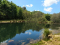
(1) As you pass the nearby pond, please do not disturb the anglers, some of whom appear to be permanent residents.
After the pond, the path climbs back up towards the RD176, which you should follow until you pass through the village of Sainte-Anne. Take care along this road.
(2) When you reach the magnificent Gothic Chapel of Sainte-Anne (well worth a visit if it’s open), leave the RD176 to the right and follow the cul-de-sac, which leads onto a wide farm track. After a bend to the left, the track climbs back up towards the RD176, which you then follow to the right once more. Pass the Croix de Caumont on your left and continue towards the crossroads below Bel-Air.
(3) At the crossroads, leave this departmental road and enter the hamlet, passing between the houses. As you go, note the curious dome-shaped house on the right.
After the village, you enter the woodland area that covers the southern slope of the Vilaine. In winter, there are a few glimpses through the vegetation towards the vast marshes bordering the river below. The path descends and then climbs the hill, emerging onto a small road below Maison-Neuve. Turn left and head down towards La Mayais, then onto the Route de la Rigaudais.
(4) At the crossroads, turn left to follow a farm track between two agricultural plots, then walk along the edge of the woods through which you were previously walking. Go round a property with a very stony garden on the right. You’ll soon come out onto the road leading to La Ruelmin.
(5) Turn right, then head straight on towards the marsh as soon as the road bends to the right. You’ll pass between two farmhouses with beautiful stone window frames to take the flat path leading to the marsh. Turn left before crossing the first ditch, then follow this path uphill until you rejoin the small road further up which runs along the foot of the hillside. At the road, turn right.
(6) A hundred metres further on, take the path that climbs the hillside to the left of the road. This path winds its way up through the woods before curving to the left as it reaches the plateau. Continue along a path flanked by hedges, which soon leads into the village of Caumont.
Turn right and follow the straight road to the village of La Touche. To the left, on the other side of the wide valley, you can see the hamlet of Saint-Cry.
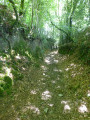
(7) In the centre of the village of La Touche, turn right onto the small dead-end road and then, when it continues to the right, head straight down the sunken track that winds its way down the hillside. Please be careful: in wet weather, the water running along it and the exposed schist can make this section very slippery. Shortly after the wash house and the fountain, you’ll come out onto a small winding road, which you follow uphill to the left to reach La Grée Ruault.
(8) At the entrance to the village, leave the road to the right and head down the hillside again along a very steep path, which may be slippery, just like the previous one. About twenty metres before reaching the road that runs along the foot of the hillside, turn onto the path that winds its way parallel to the hillside. This area was once quarried for schist, and the path, which winds its way through the old excavations, is particularly uneven. Watch out for the roots and slippery stones scattered along it.
You’ll eventually come out onto the access road to the hamlet of Truhel, which you follow downhill until you reach the lower road.
(9) At the crossroads, turn left and follow the road running alongside the marshes for about two hundred metres. Take the path leading into the woods on the left, immediately after the farm field. It climbs steeply at first, making a wide bend, before levelling out as it passes over the farm field you have just skirted. Leave this path on the right to enter the recently cleared and replanted area, then follow the track crossing it to the right to rejoin the woodland. As the terrain becomes increasingly rugged, you will soon reach the Volée viewpoint, which overlooks a large ledge of the Vilaine and the Bovenant marshes. A quick note: as this viewpoint is right in the middle of the woods, you may not be able to see much when the vegetation is dense.
(10) Walk round the viewpoint to find a wide forest track that climbs up the ridge of the Bovenant hill, crossing the logged area once more. As the view opens up, you’ll reach the highest point, where you can enjoy a lovely view of the village and the bell tower of Saint-Dolay in the distance, lying in line with the path. Then head down this path until you reach the road that goes round the hill.
(11) At the crossroads, turn right, then immediately left, and head down towards the pink house at Kerio. Pass this hamlet and continue straight on to Ville Roux.
(12) After this hamlet, the road begins to climb the hill towards Saint-Cry. You approach the village, passing the very colourful school on your right, before reaching the centre where the route began (S/E).

 Visorando Member
 Easy
Easy