The Brivet between Branduca and Coisnongle

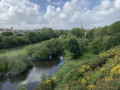
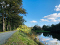
At Pontchâteau, the Brivet flows into a gorge in the Sillon de Bretagne before heading off towards the Brière marshes. But upstream of this gorge, it meanders through the marshes that fill the basin between Dréfféac and Sainte-Anne-sur-Brivet. The suggested route takes you along this very tranquil river, through beautiful wooded countryside, before following its course as closely as possible. And you might even be lucky enough to spot the storks that nest here.

Details

10016107
Creation:
Last update:
Last review:
  • Walking
    Activity: Walking
  • ↔
    Distance: 7.34 mi
  • ◔
    Average duration: 3h 25 
  • ▲
    Difficulty: Moderate

  • ⚐
    Back to start: Yes
  • ↗
    Ascent: + 49 ft
  • ↘
    Descent: - 49 ft

  • ▲
    Highest point: 82 ft
  • ▼
    Lowest point: 0 ft
  • ⚐ Country: France
  • ⚐ City: Drefféac (44530)
  • ⚑
    Start/End: N 47.452898° / W 2.067015°
  • ❏
    IGN map(s): Ref. 1022ET, 1122SB
  • Hour-by-hour weather

Description of the walk

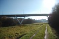
(S/E) Park at the edge of the railway embankment, right next to the bridge crossing the access road to the Branducas Valley. Walk up the road that runs alongside the railway line until you reach the bridge that crosses over it and leads to Branducas.

(1) On the other side of the tracks, follow the winding road through the village, initially ignoring a road on the left and then another on the right. The village consists of a succession of farmhouses with tall façades, which you pass one after the other until you reach a three-way junction.

(2) Leaving to your right the usual features of Breton farmsteads (oven, fountain, etc.) – which the locals here seem to take particular care of – take the left-hand path and continue up through the village via a more recently built area. Turn onto the first path on the left, cross the field behind the houses, then turn right onto a long cross-path. Follow it to the hamlet known as Le Rossignol, where you’ll come to a road. Turn right and you’ll soon reach the village of Catiho.

(3) Turn left before reaching the centre of the village, opposite the bus shelter. Follow the small road for about a hundred metres, then turn right onto the first path you come to. This path, which leads to the marshes along the Brivet, makes two sharp bends to the left before a path branches off to the right. Follow it whilst walking alongside the high-voltage power line that cuts across the landscape. Don’t miss: there’s a huge stork’s nest on one of the pylons.
The path skirts a group of meadows on the right, running parallel to the river’s bend. Turn right before the fourth left-hand bend to reach the footbridge that takes you across the river.

(4) When you reach the opposite bank, turn right to walk alongside the river. You’ll stay on the riverbank until you’re back near Catiho, just past the Tremblaie marshes. As you go, pass the first path on the left which heads up towards the village of My. Then, after skirting a higher embankment, the river makes a fairly tight right-left turn as it winds its way between the hills of Catiho and Tinfois.

(5) Directly opposite the hill on the other side, a path branches off to the left, heading up towards My. This is the path you should take if the water level in the Tremblaie marshes prevents you from continuing along the bank of the Brivet.
If possible, carry on straight ahead and pass the next bend to the right, where the track climbs slightly. Leave the riverbank and climb the embankment to reach the hilltop, where you’ll find a farm track that leads to the Champ Blanc

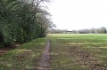
(6) When you reach this track, turn right and follow it for two and a half kilometres. It winds its way through farmland and marshy meadows, beneath a beautiful canopy of trees. As you pass the Balasson marshes, ignore the three tracks on your left that lead up towards the village of the same name.

(7) When this track meets another crossing it, turn right to reach the river and the footbridge that takes you across the canal running parallel to it.
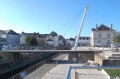
Follow the river upstream for six hundred metres before reaching the bridge at Branducas.

(8) Cross the Brivet a second time and turn left as the path climbs. Continue straight on for about 600 metres, passing two paths branching off to the right, then take the third path as it descends towards the marshes, level with the footbridge you crossed earlier, on the opposite bank.
Walk a few hundred metres before reaching the village of Vallée de Branducas.

(9) At the central junction, turn left and follow the small road uphill until you pass under the railway bridge. The start is a few metres further on, on the right (S/E).


Waypoints

  1. S/E : mi 0 - alt. 33 ft - Bridge under the railway line
  2. 1 : mi 0.29 - alt. 82 ft - Branducas Bridge
  3. 2 : mi 0.59 - alt. 62 ft - Village councils
  4. 3 : mi 1.77 - alt. 46 ft - Catiho
  5. 4 : mi 3.06 - alt. 3 ft - Footbridge over the Brivet
  6. 5 : mi 4.22 - alt. 0 ft - Opposite is the Catiho hill
  7. 6 : mi 4.64 - alt. 26 ft - La Villaugeais
  8. 7 : mi 6.18 - alt. 7 ft - Before the second footbridge
  9. 8 : mi 6.63 - alt. 0 ft - Branducas Bridge - Brivet (rivière)
  10. 9 : mi 7.22 - alt. 23 ft - The Branducas Valley
  11. S/E : mi 7.34 - alt. 33 ft - Bridge under the railway line

Notes

There are no facilities for refuelling along the route.
Before setting off, you must ensure that the water level of the Brivet is high enough to complete the circular route, as three points on the route are prone to flooding:
- 500 m after point (4), between the footbridge and the access path to the village of My (no alternative route)
- 300 metres after the point (5), whilst crossing the Tremblais marshes. For this section, which is slightly lower than the previous one, it is possible to leave the route via the path leading uphill to the left, climb back up to the village of My via the path overlooking the marsh, then bypass it via La Tremblais and Le Champ Blanc, following the small road that connects them. You rejoin the route at the point (6) .
- about a hundred metres after the footbridge at point (7) (no alternative route)

Worth a visit

Canoes can be hired at the Ponchâteau water sports centre to retrace the route by water, travelling up the River Brivet.
The stork’s nest seen on one of the electricity pylons is not a fake and does indeed house a family of these wading birds, which can be spotted around the marshes during the warmer months. Its thickness suggests that they have been settled in the area for several years now, even though this nest remains isolated.

Reviews and comments

4.1 / 5
Based on 3 reviews

Reliability of the description
4.7 / 5
Ease of following the route
4.3 / 5
Route interest
3.3 / 5
motoveve
motoveve

Overall rating : 4 / 5

Date of your route : Aug 12, 2022
Reliability of the description : ★★★★★ Very good
Ease of following the route : ★★★★☆ Good
Route interest : ★★★☆☆ Average
Very busy route : No

A route well worth a stroll; the Brivet is the main attraction; it’s very peaceful and well-maintained.

Machine-translated

JEAN-MARC P
JEAN-MARC P

Overall rating : 4.3 / 5

Date of your route : May 26, 2022
Reliability of the description : ★★★★☆ Good
Ease of following the route : ★★★★☆ Good
Route interest : ★★★★★ Very good
Very busy route : Yes

I did this route with my wife in late May 2022 after a month with almost no rain; it was a shame that the banks of the Brivet between points 5 and 6 were still a bit flooded just before point 6 (but this is mentioned in the description, so it was at my own risk).
We did, however, manage to complete the circuit by heading back up through the fields.
Otherwise, I’d recommend it – it’s a lovely walk and, although I live quite close by, I’d never had the chance to walk alongside the Brivet so closely before.
Best done in summer, then (or make sure you’ve got wellies ;-)
Thanks to the creator.

Machine-translated

philrandovilaine
philrandovilaine

I find your opinion rather disappointing.
Why not try suggesting routes in an environment like this, where land consolidation has left its mark, and where there are only a few straight paths – though they do have the advantage of being mostly shaded?
And you can indeed take the shortest route by crossing a residential area via a tarmac road, rather than seeking out the easiest and most rural paths.
For my part, I found that this route offered a lovely opportunity to explore the Brivet marshes and their inhabitants (what about the animals and birds you might spot in your review?).
But everyone has their own tastes and interests.
PhilRV

Machine-translated

JPBellocq
JPBellocq

Overall rating : 4 / 5

Date of your route : Sep 04, 2021
Reliability of the description : ★★★★★ Very good
Ease of following the route : ★★★★★ Very good
Route interest : ★★☆☆☆ Disappointing
Very busy route : No

Only 2 km are scenic, along the Brivet between 4 and 5 and from 7 to just past 8. The rest consists of wide, stony or partially tarmacked tracks through vast meadows. It’s very monotonous.
Tip: At point 2, at the three-way junction, turn right and rejoin the route via the path on the left.

Machine-translated

Other walks in the area

For more walks, use our search engine .

The GPS track and description are the property of this route's author. Please do not copy them without permission.