


Refine your search for walks in Canal de Provence
Canal de Provence walks


 The canyon, the hill, the Canal de Provence and the village of Simiane-Collongue
 Visorando Member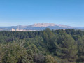
 4.70 mi
 +571 ft
 -568 ft
 2h 40
2h 40
 Easy
Easy
 Departure from Simiane-Collongue (Bouches-du-Rhône)
This hike takes you through different environments in a very short time
Peycaï hill from Simiane-Collongue
4.49 mi
+620 ft
-610 ft
2h 35
Easy
Departure from Simiane-Collongue (Bouches-du-Rhône)
A short, unpretentious walk with lovely views of the Aix countryside, and longer in good weather.
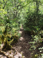
Font Belle circular route starting from Gardanne
 8.04 mi
+663 ft
-636 ft
4h 15
8.04 mi
+663 ft
-636 ft
4h 15
 Moderate
Departure from Gardanne (Bouches-du-Rhône)
Moderate
Departure from Gardanne (Bouches-du-Rhône)
A lovely circular route above Gardanne. Most of the route is through wooded areas.
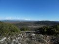
The Pain de Munition oppidum at the start of Pourrières
 8.68 mi
+906 ft
-909 ft
4h 45
Moderate
Departure from Pourrières (Var)
8.68 mi
+906 ft
-909 ft
4h 45
Moderate
Departure from Pourrières (Var)
A beautiful walk among rockroses, thyme and rosemary with lovely views of all the mountains around Pourrières, including Sainte-Victoire and Mont Aurélien.
Best done in spring when the rockroses and wild orchids are in bloom.
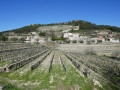
The Abus hill above Sainte-Anne d’Évenos
 5.17 mi
+833 ft
-840 ft
3h 05
Easy
Departure from Évenos (Var)
5.17 mi
+833 ft
-840 ft
3h 05
Easy
Departure from Évenos (Var)
If you’re looking for an easy, peaceful walk amongst vineyards and pine trees, or perhaps a picnic sheltered from the wind with a beautiful view before you, this unpretentious walk is for you. Two-thirds of the route is on tarmac, but there’s virtually no traffic. It’s a lovely, peaceful alternative to give your legs a rest, for example, between two more challenging hikes.
Walks near Canal de Provence
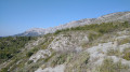
The Sainte-Victoire ridge from Puyloubier to the Anchois car park
 7.92 mi
+2,661 ft
-2,887 ft
6h 00
7.92 mi
+2,661 ft
-2,887 ft
6h 00
 Difficult
Departure from Puyloubier (Bouches-du-Rhône)
Difficult
Departure from Puyloubier (Bouches-du-Rhône)
Route along the ridges of Montagne Sainte-Victoire from Puyloubier to the Anchois car park (leave a car there). A fairly long hike, with a few tricky sections (chains) and slippery patches depending on the season. Magnificent 360° views.
11/09/2024: The Imoucha trail will be closed for 3 months, from 1 October to 31 December (2024 and 2025). The hike cannot be undertaken during these periods. See practical information.
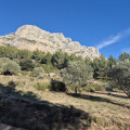
From the Refuge Cézanne to the Deux Aiguilles car park via the Trou
 1.80 mi
+387 ft
-407 ft
1h 10
Easy
Departure from Saint-Antonin-sur-Bayon (Bouches-du-Rhône)
1.80 mi
+387 ft
-407 ft
1h 10
Easy
Departure from Saint-Antonin-sur-Bayon (Bouches-du-Rhône)
This trail is an alternative known to local hikers for reaching the Saint-Antonin car parks when they have just completed a circular in Sainte-Victoire: it avoids following the brown-marked route, passing through the Col de l'Oppidum (alt. 580 m), then descending a very steep and rugged path. There is a 40-metre less elevation gain, and when you are in a hurry to get to the car park or tired, taking this Trou trail is a good option, especially in bad weather.
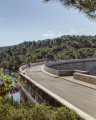
Chemin de Roques Hautes from the Bimont dam
 4.01 mi
+709 ft
-850 ft
2h 30
Easy
Departure from Saint-Marc-Jaumegarde (Bouches-du-Rhône)
4.01 mi
+709 ft
-850 ft
2h 30
Easy
Departure from Saint-Marc-Jaumegarde (Bouches-du-Rhône)
This short loop from the Bimont dam allows you to visit Roques Hautes. It is very accessible, even for families. You will see a marble quarry, numerous busy meadows and, of course, a beautiful view of the Sainte-Victoire mountain.
There are a few changes to the route in the reserve, see the notices
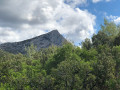
La Sainte Victoire
 6.71 mi
+2,385 ft
-2,169 ft
5h 10
Difficult
Departure from Saint-Marc-Jaumegarde (Bouches-du-Rhône)
6.71 mi
+2,385 ft
-2,169 ft
5h 10
Difficult
Departure from Saint-Marc-Jaumegarde (Bouches-du-Rhône)
Une magnifique promenade sur l'un des plus hauts massifs de Provence qui convient pour une sortie du club de randonnée en autocar (le départ du parking du barrage de Bimont et l'arrivée à Vauvenargues). La montée au Prieuré et à la Croix de Provence se fait par le sentier Imoucha et la descente par le sentier des Venturiers. De sublimes paysages de Paul Cézanne en 3D au sommet : la basse Provence jusqu'à la mer et l'étang de Berre, le sommet du mont Ventoux, les contours des Alpes au Nord.Attention. Un randonneur signale le 17 septembre 2024 :- Fermeture du Sentier Imoucha pour travaux du 01/10/2024 au 31/12/2024 et du 01/10/2025 au 31/10/2025.- Fermeture du Prieuré pour travaux jusqu'au 31/12/2024.
From Peypin to La Destrousse via the Col du Marseillais
6.20 mi
+1,365 ft
-1,680 ft
4h 00
Moderate
Departure from Peypin (Bouches-du-Rhône)
This lovely walk, winding from valley to valley, takes you from Peypin to the Col du Marseillais. Stunning views of Sainte-Victoire, as well as of Roquevaire and the Huveaune valley from the pass. Then the descent back down to the village of La Destrousse.
- The walk is accessible at the start and finish via the free bus network of the Pays d’Aubagne et de l’Etoile (line 17).