Canal Walk in Pourrières

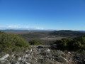
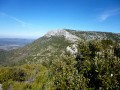
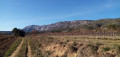
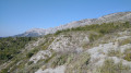
A Sunday walk suitable for children. Start from the centre of Pourrières, then follow a forest track alongside the canal. Return to the village along a quiet road.

Details

n°8707389
Creation:
Last update:
Last review:
  • Walking
    Activity: Walking
  • ↔
    Distance: 3.38 mi
  • ◔
    Average duration: 1h 45 
  • ▲
    Difficulty: Easy

  • ⚐
    Back to start: Yes
  • ↗
    Ascent: + 213 ft
  • ↘
    Descent: - 213 ft

  • ▲
    Highest point: 1,148 ft
  • ▼
    Lowest point: 932 ft

Description of the walk

Park in the car park on Avenue des Bastides, near the roundabout.

(S/E) With your back to the roundabout, walk down Avenue des Bastides and out of the village. You’ll reach the junction with Chemin de la Renardière.

(1) Turn left and follow the track uphill to the canal. Cross the bridge and join the forest track running above it.

(2) Turn left and follow the canal to the next bridge.

(3) Carry on straight ahead until you reach the Brise-Charge.

(4) Retrace your steps.

(3) Cross the canal again to join the ‘Chemin de la Santé’. Carry on straight ahead until you reach the junction with Rue Fontvieille.

(5) Turn right to head back towards the village centre. Walk past the fountain and continue for about fifty metres.

(6) Turn left onto Rue Marius Caius. At the junction after the rural police station, turn left. Go round the roundabout on the left and head back down towards the car park (S/E).

Waypoints

  1. S/E : mi 0 - alt. 935 ft - Car park on Avenue des Bastides
  2. 1 : mi 0.21 - alt. 951 ft - Chemin de la Renardière
  3. 2 : mi 1.1 - alt. 1,148 ft - Forest track after the - Canal de Provence
  4. 3 : mi 1.57 - alt. 1,129 ft - Second bridge
  5. 4 : mi 1.91 - alt. 1,125 ft - Brise-Charge
  6. 5 : mi 2.95 - alt. 951 ft - Rue Fontvieille
  7. 6 : mi 3.17 - alt. 981 ft - Rue Marius Caius
  8. S/E : mi 3.38 - alt. 935 ft - Car park on Avenue des Bastides

Reviews and comments

4 / 5
Based on 2 reviews

Reliability of the description
4.5 / 5
Ease of following the route
4.5 / 5
Route interest
3 / 5
J.oxibar
J.oxibar

Overall rating : 4.3 / 5

Date of your route : Oct 09, 2023
Reliability of the description : ★★★★★ Very good
Ease of following the route : ★★★★★ Very good
Route interest : ★★★☆☆ Average
Very busy route : No

A short, easy route with no significant elevation gain. Suitable for families. However, it offers little of interest in terms of scenery.

Machine-translated

cho13
cho13

Overall rating : 3.7 / 5

Date of your route : Oct 11, 2021
Reliability of the description : ★★★★☆ Good
Ease of following the route : ★★★★☆ Good
Route interest : ★★★☆☆ Average
Very busy route : No

Lots of walking on tarmac, along quiet country lanes with few cars.
No difficulties; suitable for children.

Machine-translated

Other walks in the area

For more walks, use our search engine .

The GPS track and description are the property of this route's author. Please do not copy them without permission.