Country:
 City:
City:


Coming from Ollioules or Le Beausset, in the centre of Sainte-Anne d’Évenos, head towards Évenos – Le Broussan, crossing the Reppe.
Park about 100 m after the bridge; there are angled parking spaces available opposite the playgrounds.
(S/E) Walk back down the road, cross the Reppe and turn left towards Ollioules for 400 m, passing the town hall first and leaving two streets on your right.
(1) Turn right onto Chemin de Font Vive. First, pass a large block of Sainte-Anne sandstone on your left and, at a wash house in the shade of a plane tree, turn left (towards “Font Vive – Le Beausset – Le Castellet”). Continue for about 2.5 km along this road, which passes through vineyards before heading into the pine forest.
(2) Just as the road crosses the very damp Font Vive valley in a left-hand bend, you’ll come to a three-way junction. Turn right, towards “Poterie Beausset Vieux”, then right again and head up the valley along the right bank of the stream. On the right, you’ll first come across the ruins of an industrial building, then a water tower and finally a cluster of houses.
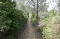
(3) At the houses, leave the road that branches off at a right angle to the left and take the forest track to the right. Immediately afterwards, as the track curves to the left, turn right onto the path which initially heads south-east, then curves slightly to the left.
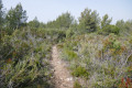
(4) After 200 m along the path, you’ll reach a clearing. A little further ahead, you can make out the ruins of a small house. Turn right – heading south – and stay on the path which crosses the clearing as it descends, running alongside a large pile of stones before climbing slightly again, with the forest on your left and numerous abandoned terraces.
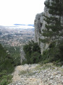
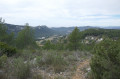
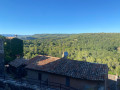
When you reach the highest point, where you can enjoy a beautiful view over the Val d’Aren, leave a path on your right (which climbs up from the Font Vive track) and continue along your path, which soon turns left, skirting the summit ridge of the Abus, which you can make out on your right.
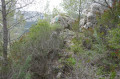
(5) On reaching a junction, take a short detour along the path leading off to the right. Further east, you can see an isolated and apparently uninhabited house. Just near the junction, you can venture onto the rocks that form part of the Barre de l’Abus itself.
Return to the previous path and continue along it, to the right, heading north-east. After about 500 m, turn right onto the forest track you come to. You’ll pass close to a small hut, apparently a private hunters’ lodge (no entry). The track now runs alongside and overlooks a large, amphitheatre-shaped vineyard.
(6) Turn right to pass beneath the embankment and walk along the top of the vineyards for a short while: this spot is very well exposed in winter and ideal for a picnic. Furthermore, there is a geological curiosity here which I have highlighted in a photo.
Retrace your steps to take in the view from the rocky promontory overlooking Sainte-Anne d’Évenos. Then take the forest track that descends towards the north-west.
(7) In a clearing at the top of a steep vineyard slope, take the track that descends north-eastwards through the terraced vineyards.
(8) Almost at the bottom of the track’s descent, you can see two picnic tables on a terraced plot to the left. A little further down, leave the heavily eroded path on your right, which descends steeply and is blocked (for the past two or three years at the time of our visit) by an uprooted tree. This was the old route down. Instead, turn left onto the track that runs horizontally between two terraces. You’ll pass above the buildings of the Font des Pères estate. Follow the signs for “Route rando 2”, then “Route rando 3”, etc. (referring to a locally organised route).
(9) This brings you down to the level below; walk past a restaurant and the wine cellar buildings, and leave the estate to the east at the end of the car park, where the old, badly eroded descent path joins on the right.
Continue along the road, which is initially poorly surfaced but improves further on, though it remains narrow and flanked by high embankments. After a hairpin bend to the left and a long slope, you’ll reach the Fontaine des Pères. Turn right towards the Route du Beausset (DN8).
(10) Cross it (carefully, as traffic moves quickly here!) and carry on straight ahead until you reach the Chemin des Serres (the old road from Marseille to Toulon, as indicated by a sign). Turn right to follow the Reppe, which is very narrow here and hidden by reeds.
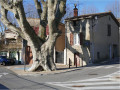
Walk past the cemetery, then past an entrance to the Domaine d’Estienne-d’Orves, and you’ll come to the Church of Sainte-Anne on your right. Continue past the church until you reach Place Père d’Orgère, lined with monumental plane trees.
(11) A little further along the Reppe, cross the footbridge and head back up through the boules courts to the starting car park (S/E).



 Visorando Member

 Moderate
 Difficult
 Very difficult