


Refine your search for walks in Cabane-des-Ludines (1630m)
Cabane-des-Ludines (1630m) walks


 Quioulès Hut and return via the Orri des Ludines
 Visorando Member
 9.18 mi
 +2,933 ft
 -2,913 ft
 6h 45
6h 45
 Difficult
 Departure from Ariège
Circular route to the Quioules hut, returning via the Rieufort de Gascous and Ludines huts.
No technical difficulties (a bit steep at times – this is the Ariège, after all), but the second part of the route is mainly off-track, sometimes a faint track, sometimes nothing at all, and therefore requires good sense of direction or careful following of your GPS track.Classified as difficult due to the unmarked route and the steep gradients in places.
Stunning views of the Aston massif, the Pic de l’Homme Mort, the beautiful huts and, on the return journey, the Soularac, Saint Barthélémy and Pic du Han. The outward leg along the Ruisseau de Quioulès offers the chance to discover some lovely pools.
This walk can be done in the opposite direction, which would certainly offer a fine view of the Aston massif, but the ascent would then be concentrated in the first section.
Walks near Cabane-des-Ludines (1630m)
Étang des Castellasses
4.31 mi
+2,648 ft
-322 ft
4h 15
 Moderate
Departure from Ariège
Moderate
Departure from Ariège
A short, not too difficult hike – very enjoyable. You follow streams all the way, first through the forest, then across a plateau. A very wild, natural atmosphere. Countless spots, ideal for pitching a tent, with trees galore, majestic rocks and a fast-flowing yet calm river. A very good population of brown trout in the river. The lake, too, is teeming with fish – large brown trout and rainbow trout – to potentially delight the palates of food lovers.
Ascent to the Refuge du Rulhe via the Col de la Didorte and the Crête des Isards
 5.33 mi
+3,002 ft
-902 ft
5h 05
Difficult
Departure from Ariège
5.33 mi
+3,002 ft
-902 ft
5h 05
Difficult
Departure from Ariège
First day of the trip at the Refuge du Rulhe.
This stage can be classified as difficult due to the climb up to the Col de la Didorte and the section along the Crête des Isards.
The route follows paths that are very clearly marked on the ground, whether signposted or not.
In the event of fog or rain: take extra care on the ridge between (4) and (7).
Laparan - La Peyre - Passerelle - Fontargente - Aston - Refuge du Rulhe
 6.31 mi
+2,976 ft
-883 ft
5h 30
Moderate
Departure from Ariège
6.31 mi
+2,976 ft
-883 ft
5h 30
Moderate
Departure from Ariège
Please note: the approach walk along the road is the only part of the hike that is in the shade if you set off early enough in the morning. This is the only way to complete this loop. It may seem tedious, but the landscape is very beautiful.The hike can be classified as quite difficult. After the footbridge over the Ruisseau de la Coume de Varilhes, the path is not easy: steep, with steps, a paved scree slope, a ledge to cross, etc. But once you reach the top, you will be rewarded. Then the GR®T66 from the largest of the Étang de Fontagente lakes to the refuge is more of the same. This is definitely a mountain hike.
Étang du Rouch via Étang de Gnioure
 8.63 mi
+6,322 ft
-1,004 ft
10 hrs
8.63 mi
+6,322 ft
-1,004 ft
10 hrs
 Very difficult
Departure from Siguer (Ariège)
Very difficult
Departure from Siguer (Ariège)
Climb the ridge marking the border with Andorra to the beautiful Étang du Rouch, which seems to sit at the foot of the Pic de Font Blanca, passing by the majestic Étang de Gnioure and its lovely, long valley:
- numerous waterfalls during the fairly steep and very stony climb up to the Peyre bridge;
- a short, slightly vertiginous ledge section to reach the immense Étang de Gnioure;
- a long path running alongside the lake, then the stream, and winding its way into the valley;
- a hillside climb that starts off fairly gentle but ends up quite steep, leading up to the Étang du Rouch.
Descent from the Étang du Rouch via the Llassiès and Peyregrand ponds
 8.35 mi
+62 ft
-5,410 ft
7 hrs
Very difficult
Departure from Siguer (Ariège)
8.35 mi
+62 ft
-5,410 ft
7 hrs
Very difficult
Departure from Siguer (Ariège)
A very long descent crossing the delightful Llassiès Ponds and the valley of the Peyregrand Pond. The first section is fairly gentle and idyllic across a plateau, allowing you to explore all the Llassiès Ponds. This is followed by a very beautiful but challenging descent into the valley (Jasse de Bélesta) via a steep section with an exposed grassy chimney, followed by a long, flat stretch to the peaceful Étang de Peyregrand and a more demanding descent to the Jasse des Planes. The final section consists of a flat path to the Pont de la Peyre, followed by a descent lined with waterfalls, which is quite strenuous due to the rocky and stony terrain.
Refuge du Ruhle - Col de Belh - de la Didorte - Cabane Rieutort - Laparan
 5.31 mi
+1,198 ft
-3,297 ft
3h 30
Moderate
Departure from Ariège
5.31 mi
+1,198 ft
-3,297 ft
3h 30
Moderate
Departure from Ariège
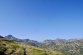
From the start of the hike, pay attention to the common white and red GR® T66 and GR®10 markings, as there are several crossroads and forks in the trail. Please note: the hike is in open terrain until the descent into the forest, well after the Rieutort hut.From the refuge, via the Crête des Isards and up to the Col de la Didorte, what a view! Of course, you need to be very careful on this ridge, which is often steep and jagged. But as soon as you stop, you can enjoy a 360° panorama.The steep descent to the Rieutort hut is on a narrow but safe path, offering beautiful views. The return to the road is not easy, but the path (GR®T66), although steep in places, is well marked throughout the descent.
Refuge du Rulhe - Castelet
11.00 mi
+958 ft
-5,958 ft
5h 55
Difficult
Departure from Ariège
This second day is exceptional. Most of it takes place on ridges from which you can see the Ax 3 Domaines resort on one side and the Plateau de Beille on the other. And everywhere, there are lakes and breathtaking landscapes. This stage is long (nearly 18 km), but you'll never want it to end before you descend into the valley through the forest. It's best to have someone waiting for you in the valley, or else you can reach Ax-les-Thermes on foot or by bus. Be aware that as you will be taking photos and spending time admiring the landscape, you should allow 6½ to 7 hours for the whole trip.
Ruhle Mountain Hut – Mérens-les-Vals
 7.75 mi
+1,339 ft
-5,069 ft
4h 45
Moderate
Departure from Ariège
7.75 mi
+1,339 ft
-5,069 ft
4h 45
Moderate
Departure from Ariège
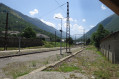
The final stage of the journey. We set off from the refuge to descend back into the valley, passing through spectacular high-mountain scenery whilst following the well-markedGR®10. There are no particular difficulties apart from a few rather tricky scree slopes.
Étang Fourcat - Port de Caraussans
 3.04 mi
+889 ft
-1,411 ft
2h 10
Moderate
Departure from Auzat (Ariège)
3.04 mi
+889 ft
-1,411 ft
2h 10
Moderate
Departure from Auzat (Ariège)
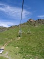
More magnificent lakes are on the agenda, with the added bonus of a short chairlift ride on the Andorran side to rest your legs before the descent to L'Étang de Soulcem, which is very challenging in the last section.
Pradières d’en haut car park – Étang d’Izourt – Refuge du Fourcat
 4.80 mi
+4,298 ft
-75 ft
5h 55
Difficult
Departure from Auzat (Ariège)
4.80 mi
+4,298 ft
-75 ft
5h 55
Difficult
Departure from Auzat (Ariège)
First stage of the journey through the Haute-Ariège.
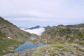
A beautiful, steady climb takes you to the Étang d’Izourt, steeped in human history.
This is followed by a gruelling climb up to the Orri de la Caudière.
Once you’ve crossed the rustic footbridge, there’s another very steep climb up to the small Étang du Fourcat.
The rest of the route to the Étang du Fourcat refuge is more gentle.
A very steep climb to the Fourcat refuge with an average gradient of 17 per cent.
Please note: from the Étang d’Izourt to the refuge, the gradient is 24 per cent.