Country:

 City:
City:


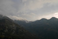
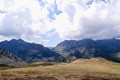
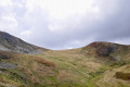
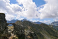
From Tarascon-sur-Ariège, head towards Andorra via the N20-E9. At the entrance to Les Cabannes, turn right onto the D520a towards Château-Verdun. Cross the Aston via a road bridge. Drive through the village of Aston and continue towards Étang de Laparan. There are twenty kilometres left to cover on a narrow road that climbs steeply. Park on the left-hand side of the road in a large, designated area.
Red and white markings for the GRT66
(S) From the car park, head straight up into the forest via the GRT66 cross-border path. The start is quite tough. Further up, the flatter path runs alongside the Rieutort torrent at varying distances.
You’ll reach a footbridge on your right.
No markings
(1) Leave the footbridge behind and continue along the same right bank towards the beautiful, recently restored hut.
‘A lovely spot for a short break before the very steep 27 per cent climb that follows.’
Cairns and a clearly marked path.
(2) Pass the hut and head up perpendicular to the stream into the mountain pasture. After about thirty metres, before starting the steep climb, make sure you spot the excellent path, which is perfectly marked on the ground, signposted with cairns and clearly visible. You’ll finally reach the Col de la Didorte at an altitude of 2,092 metres, with its magnificent 360° panorama.
Another lovely spot for a break before another climb. Signpost.
(3) Turn right onto theGR®10, climbing steeply up the ridge towards the east.
After the 2,206-metre mark, the gradient eases. The path turns south-east and reaches a junction and aGRP® at the 2,277-metre mark. Signpost. A lovely spot for a restorative break.
(4) Continue straight ahead along the stunning Crête des Isards. Caution: do not underestimate this section, which involves a series of ascents and descents.
The scenery on either side during this ridge walk makes the effort required on this rather rough path well worth it.
(5) Pass through an arch formed by stacked stones. Then, further on, reach the Col de Belh at an altitude of 2,247 metres.
“A lovely spot for a short break.” Continue along the path, which climbs steeply one last time.
(6) Further up, reach the Col de Terre Nègre at an elevation of 2,304 metres. The refuge is visible below.
(7) Ignore the incorrect route shown on the IGN map.
A little further down, you’ll come to a fork in the path and theGR®66access point.
Red and white markings forthe GR®10and the GRT66 access route
(8) Turn left towards the refuge.
(E) Rulhe mountain hut. Stopover and overnight stay.

 Visorando Member
 Moderate
 Very difficult