Country:

 City:
City:


Park in the car park by the penstock, at the end of the EDF track which branches off to the right after the Riete dam: altitude 1,540 m.
(S) Follow the path that runs along the western flank of the Pic du Col de Gos, until you reach a junction near the Ruisseau de Quioulès.
(1) Do not head down towards the footbridge, but follow the path towards the Quioulès hut. Pass the penstock, then head left to reach the EDF water intake at the Coume de Jas.
(2) Take the path on the right, which follows the left bank of the Coume de Jas stream. A slightly steeper climb takes you over a small ridge, and the path then leads to the entrance of a wide, open valley, the Jasse de Boussoula.
(3) Continue to follow the valley’s axis alongside the stream. The terrain is gentle and open. Carry on climbing up through the jasses until the valley gradually narrows, signalling that you are approaching the Cabane des Pradettes.
(4) From the hut, continue due south along the torrent.
(5) Cross the torrent, follow it along the left bank for about 400 m, then head uphill to the right.
(6) Pass two small rocky outcrops (verrous) by following the cairns. The path is not very well marked but is obvious, thanks to the stream.
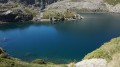
(7) At the upper ‘verrou’ of Les Castellasses, continue up the upper ledge. The path becomes almost level and opens out onto the suspended cirque containing the lake, which is clearly visible as you approach from the left. Reach the Étang des Castellasses, where there are several possible bivouac sites set back from the banks (E).
 Visorando Member
 Difficult
 Very difficult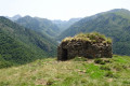
 Easy
Easy