


Refine your search for walks in Cabane de Caillou de Soques (1400 m)
Cabane de Caillou de Soques (1400 m) walks


 Lake Arrious in winter
 Visorando Member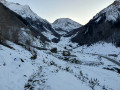
 5.48 mi
 +2,910 ft
 -2,913 ft
 4 hrs
4 hrs
 Difficult
 Departure from Laruns (Pyrénées-Atlantiques)
This winter hike through majestic scenery takes you to the lovely Lac d’Arrious, which may be frozen over in winter, and offers views across the valley to the string of lakes at Artouste and Arrémoulit.
A hiking app or GPS is strongly recommended.
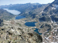
 Pic d'Arriel via the north-west route and Petit Pic d'Arriel loop
 8.30 mi
+4,754 ft
-4,760 ft
7h 55
Difficult
Departure from Laruns (Pyrénées-Atlantiques)
8.30 mi
+4,754 ft
-4,760 ft
7h 55
Difficult
Departure from Laruns (Pyrénées-Atlantiques)
This loop in the Ossau Valley offers a wide variety of peaks, lakes, rivers, waterfalls, aerial passages and remarkable 360° views. It is a challenging hike due to its significant elevation gain and passages where you will need to use your hands, but it is sure to leave a lasting impression.You will be following in the footsteps of Henry Russel, who made the ascent in July 1874 and gave a faithful account of it in the Bulletin de la Société Ramond, under the title "Explorations pyrénéennes" in October 1874.Writing a description of it yourself requires a certain amount of humility, as his style, always generous, often lyrical and sometimes emphatic, commands respect! All this with the limited technical means of the time!
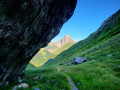
Three peaks of the Massif d'Arrious: Lac d'Arrious, Arriel, Petit Pic d'Arriel
 8.58 mi
+5,190 ft
-5,190 ft
10 hrs
8.58 mi
+5,190 ft
-5,190 ft
10 hrs
 Very difficult
Departure from Laruns (Pyrénées-Atlantiques)
Very difficult
Departure from Laruns (Pyrénées-Atlantiques)
This loop in the Ossau Valley offers a wide variety of peaks, lakes, rivers, waterfalls, aerial passages and remarkable 360° views. It is a challenging hike due to its significant elevation gain and passages where you need to use your hands, but it is not one you will forget. It adds difficulty and also enjoyment to the traditional loop by passing through the famous Passage d'Orteig, the Pic d'Arrious and the cliffs of the Barre d'Arrious!You will be following in the footsteps of Henry Russel, who climbed the Arriel via the normal route in July 1874 and gave a faithful account of his ascent in the Bulletin de la Société Ramond, under the title "Explorations pyrénéennes" in October 1874.Writing a description yourself forces a certain amount of humility, as his style, always generous, often lyrical and sometimes emphatic, commands respect! All this with the limited technical means of the time!
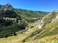
Saoubiste Hut circular loop
 6.28 mi
+1,755 ft
-1,755 ft
4h 25
6.28 mi
+1,755 ft
-1,755 ft
4h 25
 Moderate
Departure from Laruns (Pyrénées-Atlantiques)
Moderate
Departure from Laruns (Pyrénées-Atlantiques)
A very attractive circular path on paper but a little challenging in practice, between the two huts: 560 m of elevation gain, a fairly steep climb through the forest, followed by a traverse in the sun, before descending back into the forest to rejoin the wide path along the Brousset to the car park.
Along the Gave de Brousset from Soques
 Association / Club / Walk leader
 2.62 mi
+584 ft
-594 ft
1h 45
2.62 mi
+584 ft
-594 ft
1h 45
 Easy
Departure from Laruns (Pyrénées-Atlantiques)
Easy
Departure from Laruns (Pyrénées-Atlantiques)
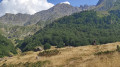
A round trip along the Gave de Brousset, offering superb views of the surrounding mountains. The route is often shaded. If you are not sensitive to the cold, you can swim in the river.
Walks near Cabane de Caillou de Soques (1400 m)
Pombie – Astún
 6.75 mi
+2,838 ft
-2,490 ft
5h 35
Difficult
Departure from Laruns (Pyrénées-Atlantiques)
6.75 mi
+2,838 ft
-2,490 ft
5h 35
Difficult
Departure from Laruns (Pyrénées-Atlantiques)
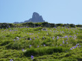
Day two: return to Astún from the Pombie Refuge, via the Col and the Peyreget hut, then Lake Castérau and the Col des Moines. Compared to the first day, the elevation gains are a little steeper, with the final ascent covering nearly 520 m. The atmosphere is different: no ridges, but lakes and valleys!
From the Cabane de l’Araille to Lac de Roumassot
8.25 mi
+2,595 ft
-2,162 ft
6h 05
Difficult
Departure from Laruns (Pyrénées-Atlantiques)
The first stage of this beautiful hike. Not particularly demanding, with no specific difficulties apart from the distance. Featuring magnificent scenery, views of the south face of the Pic du Midi d’Ossau and the lakes. The route includes a bivouac at Lac de Roumassot with a breathtaking view of the Ossau! The path is well signposted from start to finish, with quite varied scenery: mountain pastures, rocky outcrops and lakes.
Astún - Pombie
 5.96 mi
+1,706 ft
-2,070 ft
4h 15
Moderate
Departure from Jaca (Huesca)
5.96 mi
+1,706 ft
-2,070 ft
4h 15
Moderate
Departure from Jaca (Huesca)
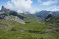
This is the first day of a cross-border hike that takes you to the Pic du Midi d'Ossau, starting from an unusual point, the Col du Somport, rather than the Col du Pourtalet.Overnight stay at the Refuge de Pombie is essential, so remember to book in advance.
The Chiniprés hut
 2.29 mi
+1,161 ft
-177 ft
2h 05
Moderate
Departure from Canfranc (Huesca)
2.29 mi
+1,161 ft
-177 ft
2h 05
Moderate
Departure from Canfranc (Huesca)
A relatively short route to one of the best viewpoints in the upper Canfranc Valley, offering views of both Canfranc-Gare international station and the Candanchú ski resort.
From the Refuge Wallon to Cauterets via the Col d'Arratille and the Col des Mulets
 13.24 mi
+2,789 ft
-5,502 ft
8h 30
Difficult
Departure from Cauterets (Hautes-Pyrénées)
13.24 mi
+2,789 ft
-5,502 ft
8h 30
Difficult
Departure from Cauterets (Hautes-Pyrénées)
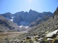
This circular is best done from mid-June until the first cold spells.
This isthe third and fairly longday of a three-day route in the Central Pyrenees National Park.
In case of bad weather or unforeseen circumstances, it is possible to shorten the route by descending directly from the (1) to the (8).
From the Ilhéou Refuge to the Wallon Refuge via the Opale Lakes
 8.41 mi
+3,114 ft
-3,507 ft
6h 35
Difficult
Departure from Estaing (Hautes-Pyrénées) (Hautes-Pyrénées)
8.41 mi
+3,114 ft
-3,507 ft
6h 35
Difficult
Departure from Estaing (Hautes-Pyrénées) (Hautes-Pyrénées)
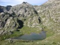
Second day of a three-day route in the Central Pyrenees National Park.The day will begin with a fairly steep climb, but will allow you to see a multitude of high-altitude lakes before arriving at the Wallon refuge.If there is not enough time, the visit to the Opale lakes can be omitted.
On the Way of St James, between Etsaut and Urdos
 2.90 mi
+807 ft
-413 ft
2h 00
Easy
Departure from Etsaut (Pyrénées-Atlantiques)
2.90 mi
+807 ft
-413 ft
2h 00
Easy
Departure from Etsaut (Pyrénées-Atlantiques)
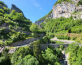
The work carried out by the Pyrénées-Atlantiques department and the Haut-Béarn community of municipalities to facilitate access to the Fort du Portalet, as well as the route through the upper Aspe valley for hikers and pilgrims (GR®65), has been completed and now allows visitors to discover this exceptional site in the best conditions of visibility and safety. Let's make the most of it!
Lac de Gaube - Cabane des Tousaus
 13.88 mi
+3,950 ft
-3,638 ft
9h 50
Difficult
Departure from Cauterets (Hautes-Pyrénées)
13.88 mi
+3,950 ft
-3,638 ft
9h 50
Difficult
Departure from Cauterets (Hautes-Pyrénées)
Second stage of the four-day adventure from Cauterets to Luz-Saint-Sauveur via Petit Vignemale and Gavarnie. It can be done in one day, but I think it would be more enjoyable to split it into two days to take the time to appreciate the magnificent scenery!
On the Way of St James, between Villanúa and Castiello de Jaca
 5.83 mi
+203 ft
-912 ft
2h 50
Easy
Departure from Villanúa (Huesca)
5.83 mi
+203 ft
-912 ft
2h 50
Easy
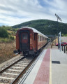
Departure from Villanúa (Huesca)
The Camino de Santiago (or "Camino francés") leaves the mountains here and follows the Aragon valley towards the stopover town of Jaca. Between the two villages mentioned, the route is easy but picturesque, with beautiful views of the peaks and forests... and a convenient train to return to the starting point. The route can easily be done in reverse, which may or may not be convenient depending on train timetables. With a few adjustments at the start, the route can be done by mountain bike.