Lake Artouste

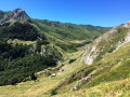
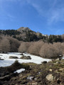
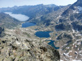
The high-altitude lakes of the Pyrenees have always been of interest to EDF. To expand them, the company raised the water level of a large number of them, including Lake Artouste. As part of this work, a railway line was built, which has now become a tourist attraction. This walk takes in all these points.

Details

94223
Creation:
Last update:
Last review:
  • Walking
    Activity: Walking
  • ↔
    Distance: 11.43 mi
  • ◔
    Average duration: 9h 00 
  • ▲
    Difficulty: Difficult

  • ⚐
    Back to start: Yes
  • ↗
    Ascent: + 4,341 ft
  • ↘
    Descent: - 4,367 ft

  • ▲
    Highest point: 7,690 ft
  • ▼
    Lowest point: 4,094 ft

Description of the walk

Park in the large car park to the south of the Fabrèges power station.

(S/E) Take the path that heads due west into the forest; after a steep but easy climb, you’ll reach the Lurien hut, beautifully situated in the large mountain pasture.

(1) Then follow the Lurien stream and, continuing to climb up a much gentler slope, reach Lurien Lake.

(2) Complete the short ascent to the pass of the same name.

(3) Begin the descent towards Lake Artouste, heading first north-east then south-east at the 2,136-metre mark. Continue to the dam.

(4) Cross over and easily reach the tourist train station.
Take the minibuses along a virtually flat but 7 km-long route to reach the departure station at the Sagette cable car.

(5) Take the cable car back to the power station car park.

(6) Make your way to the starting car park (S/E) via the fitness trail running alongside Lake Fabrèges.

Waypoints

  1. S/E : mi 0 - alt. 4,121 ft - Car park at the Fabrèges power station
  2. 1 : mi 0.8 - alt. 5,541 ft - Lurien Hut
  3. 2 : mi 2.09 - alt. 7,260 ft - Lake Lurien
  4. 3 : mi 2.52 - alt. 7,690 ft - Lurien Pass
  5. 4 : mi 4.25 - alt. 6,463 ft - Lac d'Artouste
  6. 5 : mi 9.72 - alt. 6,220 ft - Sagette Upper Station
  7. 6 : mi 10.9 - alt. 4,131 ft - Lower station of La Sagette
  8. S/E : mi 11.43 - alt. 4,108 ft - Car park at the Fabrèges power station

Notes

Shelter at the Lurien hut and the Artouste dam.
A water source among those found along the route.
Check the operating days and times of the Artouste tourist train, as well as the fares.

This route passes through a protected area, which may be subject to special regulations:

Worth a visit

Of course, the highlight of the trip is the return journey on the charming little tourist train, which is particularly enjoyable, especially the passage through the tunnels.

Reviews and comments

4.5 / 5
Based on 2 reviews

Reliability of the description
4.5 / 5
Ease of following the route
4 / 5
Route interest
5 / 5
Guyhome
Guyhome

Overall rating : 4 / 5

Date of your route : Oct 02, 2022
Reliability of the description : ★★★★☆ Good
Ease of following the route : ★★★☆☆ Average
Route interest : ★★★★★ Very good
Very busy route : No

We did it the other way round: starting at the train station and finishing in the forest:
A magnificent walk, but be careful as there are no markings or signposts (Col de Lurien), so it’s easy to lose your way at the Col de Lurien. With children, it can be a bit long (5 hours)
We didn’t come across a single soul; it was magical – Lake Lurien, marmots, cows roaming free, …

Machine-translated

micheldoudeau
micheldoudeau

Overall rating : 5 / 5

Date of your route : Aug 20, 2018
Reliability of the description : ★★★★★ Very good
Ease of following the route : ★★★★★ Very good
Route interest : ★★★★★ Very good

A brilliant walk – and we carried on to Lake Migouelou as well...

Machine-translated

Other walks in the area

For more walks, use our search engine .

The GPS track and description are the property of this route's author. Please do not copy them without permission.