


Refine your search for walks in Bussières (Loire)
Bussières (Loire) walks
 Circular walk along the paths of Néronde
 Visorando Member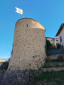
 5.83 mi
 +741 ft
 -748 ft
 3h 20
3h 20
 Moderate
 Departure from Néronde (Loire)
This walk along the paths of the small medieval village of Néronde offers some lovely sights, such as the Place du Pilori, the old railway line, the chapel and the orientation board, the lake, the wash house and the Tour Coton.
Circular walk taking in the chapels of Saint-Marc and Les Odiberts, starting from Néronde
 9.71 mi
+1,371 ft
-1,391 ft
5h 40
Moderate
Departure from Néronde (Loire)
9.71 mi
+1,371 ft
-1,391 ft
5h 40
Moderate
Departure from Néronde (Loire)
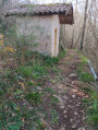
Starting from the medieval village of Néronde, this route takes us to the Hermitage of Saint-Marc, then to the Chapel of the Odiberts in Pouilly-lès-Feurs.
The Pont Marteau Viaduct route in Sainte-Colombe-sur-Gand
 5.55 mi
+728 ft
-758 ft
3h 10
5.55 mi
+728 ft
-758 ft
3h 10
 Easy
Departure from Sainte-Colombe-sur-Gand (Loire)
Easy
Departure from Sainte-Colombe-sur-Gand (Loire)
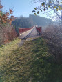
This circular route, which starts in Sainte-Colombe-sur-Gand, follows an old railway line through countryside and forest, finally crossing the vertiginous Pont Marteau bridge, which is 320 m long and 50 m high.
This route follows the signs for "Sur les traces du tacot" (In the footsteps of the old train) and, in the forest, the yellow and red markings ofthe GRP® "Terre de tisseurs en forêt" (Land of weavers in the forest).
Crêtes route starting from Saint-Cyr-de-Valorges
 8.92 mi
+1,345 ft
-1,345 ft
5h 15
Moderate
Departure from Saint-Cyr-de-Valorges (Loire)
8.92 mi
+1,345 ft
-1,345 ft
5h 15
Moderate
Departure from Saint-Cyr-de-Valorges (Loire)
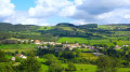
Starting from Saint-Cyr-de-Valorges, this route runs along the ridges surrounding this small village in the Montagnes du Matin. The first ridge is open. The second part, on theGR®7, is in the forest.
Located halfway along the route, the Lac de Saint-Cyr, which is more of a pond, is ideal for a break in the shade.
The return journey offers beautiful unobstructed views of the plain and the Monts du Forez.
From Saint-Cyr-de-Valorges to Violay in a circular route along the ridges
12.22 mi
+1,841 ft
-1,857 ft
7h 15
Moderate
Departure from Saint-Cyr-de-Valorges (Loire)
A very beautiful hike starting from the car park at the bar in Saint-Cyr-de-Valorges. You will travel through the Saint-Cyr and Violay countryside, passing by the Échanssieux dam and then Violay, returning via Les Crêtes (GR®7) where you will enjoy two magnificent landscapes: on your right, the Monts du Lyonnais (and, on a clear day, the Alps and Mont Blanc); on your left, the Monts du Forez, Auvergne and Cantal.
Route of the castle in Saint-Marcel-de-Félines
 5.93 mi
+925 ft
-932 ft
3h 30
Moderate
Departure from Saint-Marcel-de-Félines (Loire)
5.93 mi
+925 ft
-932 ft
3h 30
Moderate
Departure from Saint-Marcel-de-Félines (Loire)
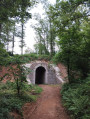
The route, which starts at the castle, winds through the Félino countryside, passing the Pont des Bonnets and the narrow-gauge railway line, then continues past the mill between the river and the forest.
Route of the cave in Saint-Marcel-de-Félines
 5.40 mi
+663 ft
-673 ft
3h 05
Easy
Departure from Saint-Marcel-de-Félines (Loire)
5.40 mi
+663 ft
-673 ft
3h 05
Easy
Departure from Saint-Marcel-de-Félines (Loire)
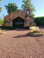
This route leads to the Grotte des Félines, which is directly inspired by the grotto at Lourdes, before continuing through the woods to the hamlet of Nérondet and then on to the village.
The view from Panissières
 9.42 mi
+1,230 ft
-1,227 ft
5h 25
Moderate
Departure from Panissières (Loire)
9.42 mi
+1,230 ft
-1,227 ft
5h 25
Moderate
Departure from Panissières (Loire)
An easy hike offering beautiful panoramic views of the Monts du Lyonnais. The route alternates between woodland, hamlets and farmland.
Circular route around Salvizinet
 4.41 mi
+397 ft
-407 ft
2h 20
Easy
Departure from Salvizinet (Loire)
4.41 mi
+397 ft
-407 ft
2h 20
Easy
Departure from Salvizinet (Loire)
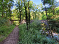
Short hike in the Montagnes du Matin offering a 180° view of the Monts du Forez and following part of the old monorail track linking Panissières to Feurs.
On the heights of Feurs, starting from Donzy Castle (circular)
 3.52 mi
+404 ft
-404 ft
2h 00
Easy
Departure from Salt-en-Donzy (Loire)
3.52 mi
+404 ft
-404 ft
2h 00
Easy
Departure from Salt-en-Donzy (Loire)
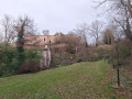
A circular route starting from the ruins of Donzy Castle, following the Charpassonne via the heights of Feurs. There are some lovely photo opportunities halfway along the route, with the setting sun reflecting on the ponds of the Loire and the Forez mountains in the background.
Loop starting from Joux
 8.89 mi
+1,654 ft
-1,624 ft
5h 30
Moderate
Departure from Joux (Rhône)
8.89 mi
+1,654 ft
-1,624 ft
5h 30
Moderate
Departure from Joux (Rhône)
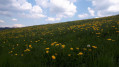
I recommend this hike when nature is waking up in mid-April, to enjoy the green meadows and bright yellow dandelions. There are unobstructed views over much of the route. The ridge offers beautiful views of the Loire and Rhône departments. Picnics by the pond are very enjoyable and peaceful. The return trail near the river (Turdine) is very wild and quiet.
The Panissières monorail
9.44 mi
+1,099 ft
-1,099 ft
5h 20
Moderate
Departure from Jas (Loire)
Alternative route via the Panissières monorail: 15.2 km instead of 26 km. Take this route for the view of the Forez Mountains, passing through Donzy – a must-see and well worth a visit. Yellow and white signposted route with a black locomotive from Jas to La Valette, then from Chez Grizonnet back to Jas.
Following a comment from the author, it is preferable to park at (4) to start the hike.
The coordinates for the car park in the village of Donzy are: Longitude: 4.27990° Latitude: 45.74670°.
Circular from Jas to Salt-en-Donzy along the Doise
 4.99 mi
+807 ft
-830 ft
3h 00
Easy
Departure from Jas (Loire)
4.99 mi
+807 ft
-830 ft
3h 00
Easy
Departure from Jas (Loire)
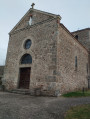
A circular that starts in Jas and takes us through forests and countryside to the small village of Salt-en-Donzy.
La Tête de Cochon starting from the Col du Pin Bouchain
 10.98 mi
+1,949 ft
-1,926 ft
6h 45
Moderate
Departure from Les Sauvages (Rhône)
10.98 mi
+1,949 ft
-1,926 ft
6h 45
Moderate
Departure from Les Sauvages (Rhône)
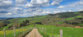
A magnificent hike around the countryside of Machézal and Amplepuis. The views of the Roanne and Haut-Beaujolais regions are breathtaking.
Route du Pin Bouchain, Amplepuis, Cublize, Col du Pilon les Sauvages
20.97 mi
+2,306 ft
-2,293 ft
11h 40
 Difficult
Departure from Les Sauvages (Rhône)
Difficult
Departure from Les Sauvages (Rhône)
On this route, you’ll enjoy splendid scenery: the Forêt du Roannais plain and its hills, the Monts de Tarare and Monts du Lyonnais along theGR®7, and Rochefort Castle to your right, plus a section along parts of the Route Napoléon.
A challenging route due to its length and elevation gain. See the ‘Practical Information’ section.
The Mont des Salles loop starting from Les Sauvages
 7.76 mi
+1,358 ft
-1,358 ft
4h 45
Moderate
Departure from Les Sauvages (Rhône)
7.76 mi
+1,358 ft
-1,358 ft
4h 45
Moderate
Departure from Les Sauvages (Rhône)
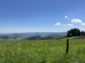
This circuit with pleasant trails allows us to admire views of Amplepuis and its surroundings, the Château de Rochefort and splendid views of the Monts du Lyonnais, Tarare and its surroundings. Not to be missed.
Following work to install wind turbines, the French Hiking Federation has significantly modified the route at point (8) to divert theGR®7. I have redrawn the route as indicated by the FFR, so please follow this modification to complete the circuit.
More walks in Bussières (Loire)
Select a point of interest below: