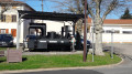
The Panissières monorail

Alternative route via the Panissières monorail: 15.2 km instead of 26 km. Take this route for the view of the Forez Mountains, passing through Donzy – a must-see and well worth a visit. Yellow and white signposted route with a black locomotive from Jas to La Valette, then from Chez Grizonnet back to Jas.
Following a comment from the author, it is preferable to park at (4) to start the hike.
The coordinates for the car park in the village of Donzy are: Longitude: 4.27990° Latitude: 45.74670°.

Details

19650015
Creation:
Last update:
Last review:
  • Walking
    Activity: Walking
  • ↔
    Distance: 9.44 mi
  • ◔
    Average duration: 5h 20 
  • ▲
    Difficulty: Moderate

  • ⚐
    Back to start: Yes
  • ↗
    Ascent: + 1,099 ft
  • ↘
    Descent: - 1,099 ft

  • ▲
    Highest point: 1,942 ft
  • ▼
    Lowest point: 1,152 ft

Description of the walk

Park in the centre of the village of Jas in the boules car park.

(S/E) Turn left from the car park, turn left again a few metres further on and follow the yellow-and-white markings and the black locomotive. You will reach a crossroads with a Black Cross.

(1) Turn right into Rue de la Croix Charmette. You will reach the hamlet of La Borgia. Continue straight on and pass the hamlet of Les Sapins. Take the path here and cross the River Doise. Then turn right onto theGR®89and head for the village of Salt-en-Donzy.

(2) Turn left towards the church and the town hall, then turn right onto theGR® to reach the junction with the D60.

(3) Turn left into the housing estate, then right; cross the D60 very carefully and continue straight on to the Ruines de Donzy neighbourhood. Continue right along theGR® to reach the monorail junction just before the Medieval Castle.

(4) Continue left, following the Ruisseau de la Charpassonne, along the monorail route until you reach the D113 just after the hamlet of La Valette.

(5) Turn right onto the Chemin du Bois de Serre to reach the hamlet of La Pelletière.

(6) Continue straight ahead on the D113 to reach the Y-junction near the hamlet of Chez Paradis.

(7) Turn almost 180° to the right towards the industrial estate and the junction with the D60.

(8) Cross it carefully and take the tarmac path straight ahead. Turn left at the next junction and arrive at the hamlet of Lachat.

(9) Turn right and you will find the yellow and white marker with the black locomotive. Continue straight along the path, ignoring all turnings to the right or left. At the edge of the woods, you will reach the Ruisseau de Vernailles.

(10) Follow its right bank, then cross it before reaching the D111.

(11) Cross it carefully and take the path opposite. Go straight on for a few metres, cross the bridge and then the Jas treetop adventure park until you reach the D111.1

(12) Cross this road carefully too, and take the path running parallel to it. Cross over again further on, taking care. Continue straight on, turn right at the cemetery, and you will then reach the boules car park in the centre of Jas (S/E).


Waypoints

  1. S/E : mi 0 - alt. 1,686 ft - Car park by the boules court in the centre of Jas
  2. 1 : mi 0.16 - alt. 1,647 ft - Crossroads
  3. 2 : mi 1.36 - alt. 1,198 ft - Salt-en-Donzy
  4. 3 : mi 1.79 - alt. 1,217 ft - D60 junction
  5. 4 : mi 2.7 - alt. 1,201 ft - Donzy
  6. 5 : mi 4.1 - alt. 1,329 ft - Bois de Serre
  7. 6 : mi 5.27 - alt. 1,755 ft - La Pelletière
  8. 7 : mi 6.06 - alt. 1,834 ft - At Paradis
  9. 8 : mi 6.74 - alt. 1,798 ft - D60 junction
  10. 9 : mi 7.13 - alt. 1,936 ft - Lachat
  11. 10 : mi 7.76 - alt. 1,670 ft - Vernailles stream
  12. 11 : mi 8.55 - alt. 1,542 ft - D111 junction
  13. 12 : mi 8.88 - alt. 1,496 ft - D111.1 junction
  14. S/E : mi 9.44 - alt. 1,686 ft - Car park by the boules court in the centre of Jas

Notes

With the many rivers, you’ll find water all along the route.
In summer, bring at least two litres of water per person.

Worth a visit

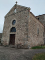
(2) Salt-en-Donzy: see the 11th-century Romanesque church.
(4) Donzy: the medieval ruins.
Just before (5) the 11th-century Chapel of La Valette, a short detour of about 200 m.
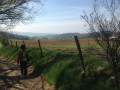
Nearby (9) a beautiful view of the Forez mountains.
(E) Visit the village of Jas.

Always be cautious and plan ahead when you're outdoors. Visorando and the author of this route cannot be held responsible for any accidents occurring on this route.

The GR® and PR® markings are the intellectual property of the Fédération Française de Randonnée Pédestre.

Reviews and comments

4.9 / 5
Based on 4 reviews

Reliability of the description
5 / 5
Ease of following the route
5 / 5
Route interest
4.8 / 5
maxli42
maxli42

Overall rating : 4.7 / 5

Date of your route : Apr 14, 2024
Reliability of the description : ★★★★★ Very good
Ease of following the route : ★★★★★ Very good
Route interest : ★★★★☆ Good
Very busy route : No

A lovely walk, despite a rather monotonous stretch along the road.
Varied scenery and the interesting ruins of Donzy.

Machine-translated

pilou457
pilou457

Thanks for the comment. Personally, I prefer starting from the Donzy car park, but in either case the scenery is magnificent

Machine-translated

Elizabeth
Elizabeth

Overall rating : 5 / 5

Date of your route : Oct 18, 2023
Reliability of the description : ★★★★★ Very good
Ease of following the route : ★★★★★ Very good
Route interest : ★★★★★ Very good
Very busy route : No

• Thanks to the author for this walk. I’d already done a route in Salt-en-Donzy, but this time I followed the route and instructions to the letter. I set off from Jas, where it’s easy to park, and made my way down to Salt-en-Donzy. The view was stunning, and there was a magnificent rainbow! To reach Old Donzy, it’s definitely more interesting to approach from below rather than via the castle ruins.
• Since early 2021, work has been carried out to enhance the chapel and its surroundings. I was amazed by the work done by the volunteers (whose faces are displayed in the chapel). A garden has been created, along with a picnic area.
• Do make sure to visit the chapel at La Valette, which is very pretty. When you’re below the hamlet of La Valette, there’s a spot where you’ll find steps leading up to the village, signposted ‘Toilets’, I believe.

Machine-translated

pilou457
pilou457

Thank you for your feedback; it’s true that this route is a good option for those who want to enjoy the stunning scenery without having to complete the full circuit.

Machine-translated

Phil 42
Phil 42

Overall rating : 5 / 5

Date of your route : Jun 02, 2023
Reliability of the description : ★★★★★ Very good
Ease of following the route : ★★★★★ Very good
Route interest : ★★★★★ Very good
Very busy route : No

There are some lovely stretches along this route and some beautiful views.

Machine-translated

pilou457
pilou457

Thank you for your comments. I created this alternative route for those who find 26 km too much. Especially as the finish at Panissières is really tough...

Machine-translated

gilbonson
gilbonson

Overall rating : 5 / 5

Date of your route : Feb 06, 2023
Reliability of the description : ★★★★★ Very good
Ease of following the route : ★★★★★ Very good
Route interest : ★★★★★ Very good
Very busy route : Yes

Hello:
We were short on time but wanted to do part of the route. We set off from Salt-en-Donzy and left the route at La Valette. We rejoined it at Jas.
Thanks to the route’s creator.
We plan to complete the whole route very soon

Machine-translated

pilou457
pilou457
• Edited:

Hello, as far as I can remember, I think it’s possible to do it on horseback (subject to change). I can’t see any real obstacles along the route. That said, it’s been a long time since I last did it!!! If you get stuck, there are plenty of ways to alter the route.

Machine-translated

Cavaliers Utopie
Cavaliers Utopie

Hello,

Is it possible to do this hike on horseback?
Are all the paths accessible? Are there any barriers or other obstacles that would prevent a horse from passing through?

Thank you. Have a nice day.

Machine-translated

Other walks in the area

For more walks, use our search engine .

The GPS track and description are the property of this route's author. Please do not copy them without permission.