Route of the castle in Saint-Marcel-de-Félines

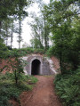
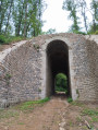
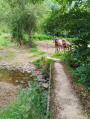
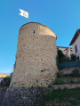
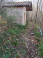
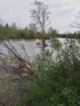
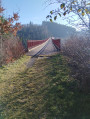
The route, which starts at the castle, winds through the Félino countryside, passing the Pont des Bonnets and the narrow-gauge railway line, then continues past the mill between the river and the forest.

Details

56321383
Creation:
Last update:
Last review:
  • Walking
    Activity: Walking
  • ↔
    Distance: 5.93 mi
  • ◔
    Average duration: 3h 30 
  • ▲
    Difficulty: Moderate

  • ⚐
    Back to start: Yes
  • ↗
    Ascent: + 925 ft
  • ↘
    Descent: - 932 ft

  • ▲
    Highest point: 1,572 ft
  • ▼
    Lowest point: 1,184 ft

Photos

Description of the walk

The route starts in Saint-Marcel-de-Félines; park at Place de la Mairie.

(S/E) Facing the castle, walk past the town hall and follow the footpath alongside the castle. Cross the Route du Morillon and take the path opposite, the one furthest to the left.

(1) Take the path on the right leading to the Pont des Bonnets and cross it.

(2) When you reach the Chemin des Bonnets, turn left.

(3) At the Fork in the road, turn left towards Les Charmeaux, then turn right onto the Chemin des Charmeaux. As the hamlet is private, follow the signs and take the path on the left that leads downhill; cross the bridge over the Revoute and continue along a grassy path. At the junction, continue to the right.

(4) At the Y-junction, turn right and cross the bridge. Continue to the Route du Morillon, cross it carefully and head straight ahead. Cross the Chemin de la Varenne and take the Chemin du Moulin opposite.

(5) When you reach the railings, follow the path to the left leading to the mill. Turn right, then at the Fork in the road, leave the Chemin du Moulin and turn left; at the T-junction, turn left again. Cross the bridge and take the path furthest to the left, into the woods. The path leads to the Chemin du Moulin à Vent.

(6) Pass through the hamlet, then, at the T-junction, turn right. Shortly afterwards, take the Chemin de Randanay on the left.

(7) When you reach Puy Bayard, turn right, then follow the path to the left at the Black Cross. At a Y-junction, turn right, then right again. Cross the bridge and, a little further on, you’ll come to a road running perpendicular to the path.

(8) Turn left to reach Lozy. Turn right onto Chemin de la Philiponnière, then follow Route de Néronde.

(9) Pass the pond, continue along Rue des Tilleuls, then turn left onto Rue du Télégraphe, which leads to Place de la Bascule and then to the car park (S/E).


Waypoints

  1. S/E : mi 0 - alt. 1,568 ft - Town Hall Square in Saint-Marcel-de-Félines
  2. 1 : mi 0.59 - alt. 1,378 ft - The Pont des Bonnets
  3. 2 : mi 0.86 - alt. 1,421 ft - Les Bonnets
  4. 3 : mi 1.33 - alt. 1,506 ft - Les Charmeaux
  5. 4 : mi 2.32 - alt. 1,309 ft - junction
  6. 5 : mi 2.78 - alt. 1,362 ft - The Mill
  7. 6 : mi 3.85 - alt. 1,470 ft - The Windmill
  8. 7 : mi 4.46 - alt. 1,539 ft - Puy Bayard
  9. 8 : mi 5.26 - alt. 1,322 ft - Lozy
  10. 9 : mi 5.61 - alt. 1,490 ft - The Pond
  11. S/E : mi 5.93 - alt. 1,568 ft - Town Hall Square in Saint-Marcel-de-Félines

Notes

(9) You can stop for a picnic by the pond (tables available).
(3) The descent is steep; bring a walking stick for greater comfort.

Worth a visit

(S/E) The church
The castle is open to visitors and the gardens are freely accessible.

Reviews and comments

4.6 / 5
Based on 3 reviews

Reliability of the description
4.3 / 5
Ease of following the route
4.3 / 5
Route interest
5 / 5
aven83
aven83

Overall rating : 5 / 5

Date of your route : Feb 24, 2025
Reliability of the description : ★★★★★ Very good
Ease of following the route : ★★★★★ Very good
Route interest : ★★★★★ Very good
Very busy route : Yes

A lovely little path and a very clear description of the route.

Machine-translated

TotoB
TotoB

Overall rating : 3.7 / 5

Date of your route : Aug 06, 2024
Reliability of the description : ★★★☆☆ Average
Ease of following the route : ★★★☆☆ Average
Route interest : ★★★★★ Very good
Very busy route : No

It was a lovely walk, which we rounded off with the cave route (in fact, we combined the two walks to cover just over 14 km and a total elevation gain of around 400 metres).
However, without a GPS, mistakes are inevitable (and even with one, if you rely solely on the description, as the map is illegible in certain key places): for example, at point 1) ‘Take the path on the right leading to the Pont des Bonnets and cross it’... Where exactly – below it, above it, straight ahead (there’s a path running past it...)??? The same goes for after the mill, at point 5; the instructions are incomprehensible... As a result, due to a lapse in concentration, we ended up at La Philiponnière!!!
Not to mention that, due to a lack of maintenance, many paths are virtually invisible (the junction after Les Charmeaux, the path alongside the motorway (which, incidentally, is of no interest...) after the cave.
In short, a pleasant and interesting walk, but not easy to follow if you’re not paying attention.

Machine-translated

Elizabeth
Elizabeth

Overall rating : 5 / 5

Date of your route : Jul 13, 2024
Reliability of the description : ★★★★★ Very good
Ease of following the route : ★★★★★ Very good
Route interest : ★★★★★ Very good
Very busy route : No

• A lovely walk through the countryside this very morning. No difficulties. Nothing to report. The weather was delightfully cool.
• I added a few kilometres to make it 14.5 km, passing through Félines (to see the Lourdes Grotto) and Nérondet. I walked up to the Saint-Marcel cemetery to see the chapel, and then walked back down along the castle wall, which took me back along the path I’d taken on the way there.
• NB: the castle is open to visitors from Monday 15 July to Sunday 25 August (every day), and so it was 13 July!
• Thanks to the author!

Machine-translated

Other walks in the area

For more walks, use our search engine .

The GPS track and description are the property of this route's author. Please do not copy them without permission.