Circular walk along the paths of Néronde

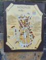
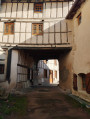
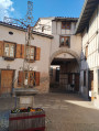
This walk along the paths of the small medieval village of Néronde offers some lovely sights, such as the Place du Pilori, the old railway line, the chapel and the orientation board, the lake, the wash house and the Tour Coton.

Details

47343001
Creation:
Last update:
Last review:
  • Walking
    Activity: Walking
  • ↔
    Distance: 5.83 mi
  • ◔
    Average duration: 3h 20 
  • ▲
    Difficulty: Moderate

  • ⚐
    Back to start: Yes
  • ↗
    Ascent: + 741 ft
  • ↘
    Descent: - 748 ft

  • ▲
    Highest point: 2,028 ft
  • ▼
    Lowest point: 1,460 ft

Photos

Description of the walk

Park in the square by the church in Néronde.

(S/E) Turn left onto the Grande Rue, then immediately right onto the Rue de la Magna Porta. Pass under the pointed archway to reach the Place du Pilori. Head left up the Rue des Écoles for a few metres, then turn right onto the Chemin du Petit Bois. When you reach a hairpin bend, turn almost 180° to the left onto the Chemin du Tacot. Continue to the junction with the Route de l’Ancienne Gare.

(1) Follow this road until you come to a dirt track on the right. Take this track and continue on it until you reach the hamlet of Four.

(2) Turn left, then immediately take the path on the right just before the road. Continue slightly uphill and then join a road to reach the hamlet of La Frénée.

(3) Cross the D83 with care and continue straight ahead along the Allée des Tilleuls. Pass the hamlet of Le Rioux and continue to the crossroads at Château de la Côte.

(4) Carry on until you reach a multi-way junction in the hamlet of Four à Chaux.

(5) At the junction, turn left onto the D11 for about 30 metres, then turn right onto the Chemin du Colombet to reach the hamlet of Colombet.

(6) Take the path on the left as you leave the hamlet. Stay on this path, which runs parallel to the D11, until you rejoin it at the junction leading to the cemetery.

(7) Head straight on, walk alongside the cemetery, then reach the chapel and the viewpoint at the orientation table.

(8) Return to the previous junction.

(7) Cross the D11 with care and take the Chemin de Lafay straight ahead, passing through the hamlet of Lafay. Walk gently downhill through the woods to join the D1.

(9) Cross it very carefully and turn left onto a path running parallel to the road and protected by a crash barrier. When you reach the lake, take the path opposite through the woodland, then turn left, still running parallel to the road, until you reach a wash house.

(10) Continue, then cross the road carefully once more, take the path furthest to the left and reach the Lycée Pierre Coton. Take the Chemin de la Tour Coton opposite. When you reach the tower, turn left into Rue du Père Coton and then head for the church car park (S/E)


Waypoints

  1. S/E : mi 0 - alt. 1,565 ft - Car park at Néronde Church
  2. 1 : mi 0.54 - alt. 1,627 ft - Route de l’Ancienne Gare
  3. 2 : mi 1.12 - alt. 1,663 ft - Oven
  4. 3 : mi 1.77 - alt. 1,709 ft - The Linden Tree Avenue
  5. 4 : mi 2.55 - alt. 1,880 ft - Château de la Côte crossroads
  6. 5 : mi 2.84 - alt. 1,942 ft - The Lime Kiln
  7. 6 : mi 3.26 - alt. 2,005 ft - Le Colombet
  8. 7 : mi 3.89 - alt. 1,818 ft - La Chapelle crossroads
  9. 8 : mi 4.09 - alt. 1,778 ft - Chapel and information board
  10. 9 : mi 4.84 - alt. 1,745 ft - D1
  11. 10 : mi 5.51 - alt. 1,470 ft - Washing house
  12. S/E : mi 5.83 - alt. 1,568 ft - Car park at Néronde Church

Notes

(8) Picnic tables

Worth a visit

Reviews and comments

4.7 / 5
Based on 3 reviews

Reliability of the description
4.7 / 5
Ease of following the route
5 / 5
Route interest
4.3 / 5
larandodespros
larandodespros

OK, great... thanks, see you later

Machine-translated

larandodespros
larandodespros

Overall rating : 4.7 / 5

Date of your route : Jan 19, 2025
Reliability of the description : ★★★★☆ Good
Ease of following the route : ★★★★★ Very good
Route interest : ★★★★★ Very good
Very busy route : No

Hello,
We had a brilliant day out on that route in the sunshine yesterday in Néronde, with the freezing fog below us!!!!!

One thing to improve:
at stage 5, add “At the crossroads, head left onto the D11 for about 30 metres, then”
(the rest remains unchanged) turn right onto the Chemin du Colombet to reach the hamlet of Colombet.

Machine-translated

toyo1972
toyo1972

Overall rating : 4.7 / 5

Date of your route : Jun 10, 2024
Reliability of the description : ★★★★★ Very good
Ease of following the route : ★★★★★ Very good
Route interest : ★★★★☆ Good
Very busy route : No

A very accessible walk with no particular difficulties and very pleasant scenery – in short, a lovely stroll

Machine-translated

grandlarge
grandlarge

Overall rating : 4.7 / 5

Date of your route : Apr 26, 2024
Reliability of the description : ★★★★★ Very good
Ease of following the route : ★★★★★ Very good
Route interest : ★★★★☆ Good
Very busy route : No

Hi, we walked this route on 21 April 2024 in gloomy weather and strong winds.
The description was spot on; there were quite a few spots for a picnic. Given the weather, we ate sheltered under the porch of the chapel in Néronde Cemetery, plot No. 8.
Some lovely little climbs, but nothing too difficult.
Please note: there’s likely to be little space in the car park indicated when the weather’s fine.
Make the most of it and visit the village on your way back. Everything’s closed on Sundays!

Machine-translated

Other walks in the area

For more walks, use our search engine .

The GPS track and description are the property of this route's author. Please do not copy them without permission.