Country:

 City:
City:




The route starts in Saint-Marcel-de-Félines; park at Place de la Mairie.
(S/E) Head left towards Place de la Bascule. Take Rue du Télégraphe, then Rue des Tilleuls. Walk alongside the pond, then take Chemin de la Philiponnière opposite. At the Fork in the road, take the path on the left.
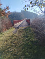
(1) At Lozy, turn left. At the Fork in the road, keep left. Cross the bridge.
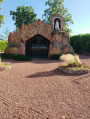
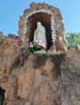
(2) At Chemin du Puy Bayard, turn left. At the cross, walk alongside Route de Néronde, following the sign for “Grotte de Félines”.
(3) At the next junction, on the left, is the Grotte de Félines. After visiting it, take the Chemin de Félines straight ahead. Pass through the hamlet and, at a Black Cross, take the path on the left. At the Route de Néronde, turn right, then immediately take the path on the left.
(4) Turn left to reach the hamlet of Nérondet. Turn right, then immediately left onto the Chemin de Manouvret, which passes through the Bois du Noyer; cross the bridge. At the Fork in the road, turn left.
(5) Continue along the Chemin de la Côte on the right, which becomes the Chemin des Étangs.
(6) At the pond, turn right, then left onto the Route de Saint-Just. Follow the road, pass the church and head for the car park. (S/E)

 Visorando Member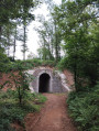
 Moderate