


Refine your search for walks in Brison-Saint-Innocent
Brison-Saint-Innocent walks


 La Combe aux Moines, the Fairy Cave
 Visorando Member
 7.10 mi
 +1,673 ft
 -1,660 ft
 3h 25
3h 25
 Easy
Easy
 Departure from Brison-Saint-Innocent (Savoie)
A walk offering a variety of landscapes, points of interest and pleasant views of Lake Bourget.In autumn, you can find chestnuts and mushrooms.
13/05/2026: Start of the modified walk.
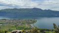
The Fairy Cave from Brison-Saint-Innocent
 2.49 mi
+906 ft
-932 ft
1h 55
2.49 mi
+906 ft
-932 ft
1h 55
 Moderate
Departure from Brison-Saint-Innocent (Savoie)
Moderate
Departure from Brison-Saint-Innocent (Savoie)
A family walk taking around two hours there and back, including a visit to the cave. An easier alternative to the existing hike, the Combe aux Moines and the Grotte des Fées, which is a bit long for young children. Starts from the last accessible car park on the Chemin de la Grotte des Fées
Following comments, the difficulty has been changed to "Medium", which wasn’t my initial impression as the walk was done with young children. Take particular care on the Chemin du Singe.
⚠️ To reach the car park at the start of the Grotte des Fées, from Aix-Les-Bains, follow the “Chemin du Ponsonnet” to the left of the D48, then turn right onto the “Chemin de la grotte des fées”.
Corsuet Forest and Cross
5.71 mi
+968 ft
-968 ft
3h 30
Easy
Departure from Aix-les-Bains (Savoie)
The Corsuet Forest is criss-crossed, indeed criss-crossed by numerous paths and trails. It is an open space that allows you to escape the urban environment whilst remaining close to the town.
The numerous signposts will provide useful guidance for walkers.
The route described here is just a modest example of the possibilities offered by the Corsuet Forest.
Here, the paths have taken their names from the animal kingdom.
Loop above Brison
 8.20 mi
+2,326 ft
-2,359 ft
5h 50
Easy
Departure from Brison-Saint-Innocent (Savoie)
8.20 mi
+2,326 ft
-2,359 ft
5h 50
Easy
Departure from Brison-Saint-Innocent (Savoie)
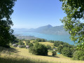
This loop starts in Brison and climbs to the Croix de Meyrieu, then follows the ridge line to La Chambotte and returns to the starting point via a path through old vineyards. This walk offers numerous views of Lake Bourget.
Mont de Corsuet via the Meyrieux crosses
 7.21 mi
+2,195 ft
-2,172 ft
5h 15
Moderate
Departure from Brison-Saint-Innocent (Savoie)
7.21 mi
+2,195 ft
-2,172 ft
5h 15
Moderate
Departure from Brison-Saint-Innocent (Savoie)
This is a hike with magnificent views of Lake Bourget, the Chat Mountains, the Chartreuse Mountains, as well as the Albanais and Bauges regions, on a well-maintained path.
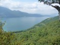
Sentier des Granges trail starting from Lac du Bourget
 9.68 mi
+2,651 ft
-2,644 ft
6h 45
9.68 mi
+2,651 ft
-2,644 ft
6h 45
 Difficult
Departure from Brison-Saint-Innocent (Savoie)
Difficult
Departure from Brison-Saint-Innocent (Savoie)
A hike mainly through woodland with beautiful views of Lac du Bourget.
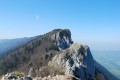
The Dent du Chat and the Roc de Cornillon
 4.25 mi
+2,720 ft
-2,703 ft
4h 20
Difficult
Departure from La Chapelle-du-Mont-du-Chat (Savoie)
4.25 mi
+2,720 ft
-2,703 ft
4h 20
Difficult
Departure from La Chapelle-du-Mont-du-Chat (Savoie)
This is a lovely half-day hike with beautiful views of Lac Du Bourget, Aix-Les-Bains and the Chambérien basin, the Belledonne massif and Mont Blanc on one side, and the Savoyard foothills (Yenne, Belley, Grand Colombier) on the other.
Please note: Those who are afraid of heights may be affected by some technical sections equipped with cables or ladders.
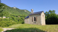
From Col du Chat to Petit Villard
 7.35 mi
+1,539 ft
-1,526 ft
4h 45
Moderate
Departure from La Chapelle-du-Mont-du-Chat (Savoie)
7.35 mi
+1,539 ft
-1,526 ft
4h 45
Moderate
Departure from La Chapelle-du-Mont-du-Chat (Savoie)
A lovely little walk with lots of views of the lake. Much of the route is in the forest, making this hike ideal on a hot day.
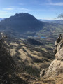
Circular Mont de la Charvaz route via the southern ridge
 8.66 mi
+2,520 ft
-2,530 ft
6h 10
Difficult
Departure from Saint-Jean-de-Chevelu (Savoie)
8.66 mi
+2,520 ft
-2,530 ft
6h 10
Difficult
Departure from Saint-Jean-de-Chevelu (Savoie)
A circular route allowing you to walk along the wild ridge that runs from the Col du Chat to the summit of Mont de la Charvaz, returning to the foot of the mountain. Much of the ridge route is off-trail but presents no real difficulty other than orientation.
Circuit de la Chapelle du Mont-du-Chat
 5.04 mi
+1,529 ft
-1,496 ft
3h 40
Difficult
Departure from Bourdeau (Savoie)
5.04 mi
+1,529 ft
-1,496 ft
3h 40
Difficult
Departure from Bourdeau (Savoie)
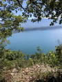
This hike takes place in a setting dear to Lamartine. The first part, which runs alongside Lac du Bourget, offers beautiful views, and a good climb leads to the Chapelle Notre-Dame de l'Étoile. Be sure to linger around the building and take advantage of the facilities to admire the panorama.
On the way back through the forest, there are other viewpoints over the Savoyard countryside. Finally, the descent to Bourdeau also offers some sought-after views.
19/09/2023 Message from the moderator: the section between (2) and (3) is very steep and slippery on the way up and requires a good level of fitness for around 500 m. Some sections between (8) and (9) are also slippery on the way down. This route should be attempted in dry weather. Not recommended for young children.
From Bourdeau to Hautecombe overlooking Lake Bourget
 13.41 mi
+3,802 ft
-3,799 ft
9h 30
Difficult
Departure from Bourdeau (Savoie)
13.41 mi
+3,802 ft
-3,799 ft
9h 30
Difficult
Departure from Bourdeau (Savoie)
Here is a good route connecting Bourdeau to Hautecombe Abbey.
The outward journey takes you above the wild shores of Lake Bourget with numerous viewpoints, all on a somewhat rugged route.
After climbing a little higher, the return route takes you in the shadow of Mont de la Charvaz before coming back via the Col du Chat.
Cat Tunnel Circular Loop
 4.54 mi
+2,546 ft
-2,539 ft
4h 20
Moderate
Departure from Bourdeau (Savoie)
4.54 mi
+2,546 ft
-2,539 ft
4h 20
Moderate
Departure from Bourdeau (Savoie)
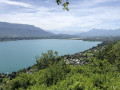
Exploring the Cat Tunnel via the safety gallery. This gallery, running parallel to the road tunnel, serves as an emergency exit in the event of an incident. Normally, this passage is used by many cyclists as well as pedestrians to get from the Lac du Bourget side to the Yenne Valley and the Chevelu Lakes. The tunnel has been converted into the “Musée du Chat” and features an impressive collection of murals created by contemporary artists, inspired by Savoyard tradition. In my opinion, it is unique in France. A note on the route: you will see an elevation gain of 732 m, which is incorrect, as the software includes the mountain height above the tunnel; you must therefore subtract 321 m, bringing the route’s total elevation gain down to 455 m.
On the route of the old rack railway between Mouxy and Pugny Chatenod
 Tourism professional
 2.33 mi
+748 ft
-741 ft
1h 50
Easy
Departure from Mouxy (Savoie)
2.33 mi
+748 ft
-741 ft
1h 50
Easy
Departure from Mouxy (Savoie)
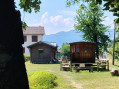
This walk follows the route of the Crémaillère, a railway line that opened on 15 August 1892 and once linked the spa town of Aix-les-Bains to Mont-Revard. It’s a very pleasant walk in summer, as it mainly passes through woodland and the mountain pastures of Mont-Revard.
It was in 2001 that the ‘Association Tourisme et Culture Autour de la Crémaillère’ began developing the Sentier de la Crémaillère, starting from Mouxy. Originally, the first station was situated in the centre of the spa town, very close to the Hôtel Bernascon. This walk covers the first section, between Mouxy and Pugny-Chatenod.
From Mouxy to the Saint-Maurice Chapel
4.83 mi
+673 ft
-679 ft
2h 50
Easy
Departure from Mouxy (Savoie)
A country walk between Lac du Bourget and the foothills of Le Revard. Along the way, you will discover wash houses, a bread oven, a number of metal crosses perched on stone blocks, the slightly secluded Saint-Maurice Chapel, the old village of Clarafond, etc. And, weather permitting, more distant panoramic views.
There are no specific markings, but there are a few mountain bike markers here and there.
La Biolle Mountain
 8.06 mi
+1,732 ft
-1,762 ft
5h 15
Moderate
Departure from La Biolle (Savoie)
8.06 mi
+1,732 ft
-1,762 ft
5h 15
Moderate
Departure from La Biolle (Savoie)
This route, starting from Villette in the commune of La Biolle, offers magnificent panoramic views of the Bauges Massif during the climb and a 360° view from the new Croix de Meyrieu (Lake Bourget, Aix-les-Bains and the surrounding mountains). The return journey is via a little-used and unmarked path, but with the Visorando app, there's no need to worry.