


Refine your search for walks in Lac de Longet
Lac de Longet walks


 Towards the Col de Longet
 Visorando Member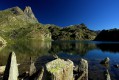
 17.00 mi
 +2,651 ft
 -2,644 ft
 12 hrs
 Very difficult
 Departure from Saint-Paul-sur-Ubaye (Alpes-de-Haute-Provence)
A beautiful hike towards Lac de Longet and its eponymous pass. TheGRP® "Petit tour du Bric de Rubren" will take you to the pass and its many lakes, following the Ubaye river.
Horse riding in Queyras and Ubaye
 30.50 mi
+10,669 ft
-10,666 ft
4 days
30.50 mi
+10,669 ft
-10,666 ft
4 days
 Difficult
Departure from Saint-Véran (Hautes-Alpes)
Difficult
Departure from Saint-Véran (Hautes-Alpes)
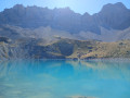
Here is a simple 4-day route that alternates between Queyras and Ubaye, starting from the hamlet of Cros before Saint-Véran. The Queyras valley will be the first stop for a night by Lac de la Blanche at the refuge of the same name. The route through Ubaye will take you over the Col de la Noire before descending to the hamlet of Maljasset. You will return to Queyras on day 3 via the Col Girardin before returning to the starting point via the Col des Estronques on the fourth day.
Refuge de la Blanche - Maljasset
10.03 mi
+1,532 ft
-3,494 ft
5h 55
Difficult
Departure from Saint-Véran (Hautes-Alpes)
Here, the names change from white to black with great dexterity. Indeed, the passage from Queyras, Refuge de la Blanche, to Ubaye is via the Col de la Noire. Original, isn't it?
Refuge de la Blanche – Franco Boerio Bivouac
 8.91 mi
+4,465 ft
-2,543 ft
8h 00
Difficult
Departure from Saint-Véran (Hautes-Alpes)
8.91 mi
+4,465 ft
-2,543 ft
8h 00
Difficult
Departure from Saint-Véran (Hautes-Alpes)
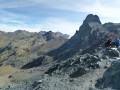
A foray into the Haute Ubaye to round off the route in style at its highest point. With the option of watching the sunset from the summit of the Bric de Rubren.
The route deliberately moves away from the border to take the easiest route up the hill.
Walks near Lac de Longet
From Rubren to Marinet
 12.45 mi
+4,498 ft
-6,201 ft
10 hrs
Very difficult
Departure from Saint-Paul-sur-Ubaye (Alpes-de-Haute-Provence)
12.45 mi
+4,498 ft
-6,201 ft
10 hrs
Very difficult
Departure from Saint-Paul-sur-Ubaye (Alpes-de-Haute-Provence)
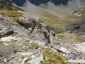
A very long day criss-crossing the border. But what breathtaking scenery! And you won’t be bothered by the neighbours... there’s little chance of coming across other two-legged creatures. But perhaps some ibex, vultures, including (apparently) a pair of bearded vultures.
Refuge de la Blanche – Le Raux
 11.04 mi
+2,641 ft
-4,770 ft
7h 25
Difficult
Departure from Saint-Véran (Hautes-Alpes)
11.04 mi
+2,641 ft
-4,770 ft
7h 25
Difficult
Departure from Saint-Véran (Hautes-Alpes)
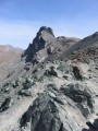
On the second day of this trip, the plan is to walk the Tour de la Tête des Toillies and finish the day with a long walk back to Le Raux.
Col Agnel - L'Echalp
7.80 mi
+2,090 ft
-4,961 ft
5h 25
Difficult
Departure from Molines-en-Queyras (Hautes-Alpes)
Fifth stage with the recommended ascent of Pain de Sucre.
Agnel Mountain Hut – La Monta Mountain Hut
 8.25 mi
+1,434 ft
-4,390 ft
5h 00
Difficult
Departure from Molines-en-Queyras (Hautes-Alpes)
8.25 mi
+1,434 ft
-4,390 ft
5h 00
Difficult
Departure from Molines-en-Queyras (Hautes-Alpes)
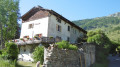
The third stage of this journey presents no major difficulties, with exceptional views around the lakes. Only the descent from the Col Vieux to the Refuge de la Monta quickly takes its toll on your legs.
The abundance of flora makes this stage even more beautiful.
Saint-Véran – Agnel Mountain Hut
 9.64 mi
+3,963 ft
-2,103 ft
7h 55
Difficult
Departure from Saint-Véran (Hautes-Alpes)
9.64 mi
+3,963 ft
-2,103 ft
7h 55
Difficult
Departure from Saint-Véran (Hautes-Alpes)
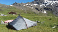
This is the second stage ofthe GR®®58, but it takes a variant route via the Col de Saint-Véran or the Col de la Cavale and includes an ascent to an altitude of 3,000 metres at the Pic de Caramantran. There’s a magnificent view of Mount Viso at the highest point of this route. At the start of the season, there were still plenty of snowfields. This is a very wild route, which I recommend as an alternative to the Col de Chamoussière path, which tends to be quite busy.
Saint Véran - Col Agnel
 8.02 mi
+3,468 ft
-1,683 ft
6h 45
Difficult
Departure from Saint-Véran (Hautes-Alpes)
8.02 mi
+3,468 ft
-1,683 ft
6h 45
Difficult
Departure from Saint-Véran (Hautes-Alpes)
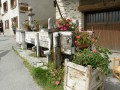
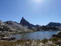
The fourth stage takes you towards the Italian border, offering beautiful views of Mont Viso.
Saint Véran – Refuge de la Blanche
 10.15 mi
+4,537 ft
-3,035 ft
8h 35
Difficult
Departure from Saint-Véran (Hautes-Alpes)
10.15 mi
+4,537 ft
-3,035 ft
8h 35
Difficult
Departure from Saint-Véran (Hautes-Alpes)
This serves as an introduction to a cross-border trek between Saint-Véran and Larche. We set off from the mountain pastures for a gentle approach to the border, through a rocky and colourful landscape that can at times be quite disorientating. There are no real difficulties, but a good understanding of how to read the terrain is sometimes necessary to avoid losing your way.
From Saint-Véran to Larche: Ubaye Transfrontière
49.21 mi
+20,728 ft
-21,916 ft
5 days
Very difficult
Departure from Saint-Véran (Hautes-Alpes)
A fantastic Franco-Italian ride between Saint-Véran and Larche! It will take you through strange places, from the solitary, green rocky landscapes of Saint-Véran to the fantastical, almost Dolomite-like terrain of the massif between Chambeyron and Orrenaye.
The Refuge de la Blanche, starting from Saint-Véran
 8.69 mi
+1,814 ft
-945 ft
5h 35
8.69 mi
+1,814 ft
-945 ft
5h 35
 Moderate
Departure from Saint-Véran (Hautes-Alpes)
Moderate
Departure from Saint-Véran (Hautes-Alpes)
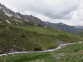
Via the Grand Canal, now completely disused, a long crossing opposite the Grande Tête des Toillies, ending at the Refuge de la Blanche and then at the observatory car park.
Trek around Chambeyron Mountain Range (4) Maljasset - Refuge Campo Base
 9.28 mi
+2,408 ft
-3,304 ft
6h 20
Difficult
Departure from Saint-Paul-sur-Ubaye (Alpes-de-Haute-Provence)
9.28 mi
+2,408 ft
-3,304 ft
6h 20
Difficult
Departure from Saint-Paul-sur-Ubaye (Alpes-de-Haute-Provence)
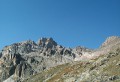
Quite a long stage but a steady route. A climb up to Col de Mary then a long downhill hike all the way to the shelter, in Chiaperra, Italy.