Country:

 City:



Head to Lauf near Sasbachwalden. The car park is on Laufbachstrasse at number 53.
(S/E) Walk up Laufbachstrasse.
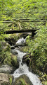
(1) Turn right at the junction, walk past the small hydroelectric power station and follow the Energiepfad path alongside the Laufbach.
(2) Cross a road. Cross Laufbachstrasse and the bridge on the left. Immediately turn right onto the road.
(3) Immediately head up the Energiepfad path on the right. Turn right and cross two footbridges. Turn right and cross the footbridge. Turn left onto the track and continue along the Energiepfad.
(4) Take the Eichelbachweg path on the left. Carry straight on at the fork. Walk past an old quarry and continue to the Mantelstein. It is set back a little from the path, on the left. Go back a little and continue to the left.
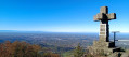
(5) Turn right at the Mantelstein junction towards the Hardstein. Ignore the path on the left. Turn left at the fork. Cross a path and continue to the Hardstein, topped by a cross.
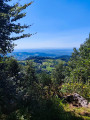
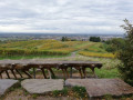
(6) Turn right and enjoy a magnificent panoramic view of the Rhine plain, Strasbourg in the distance and the Vosges on the horizon. There are benches and a picnic table here.
(6) Turn back and take the path on the right towards Glashütte. You’ll see the Hirschfelsen viewpoint on the right. Ignore a path on the right. You’ll see the Lothar Denkmal on the right at the bend to the left. Continue to the Eichelbachweg junction.
(7) Cross the path and head down the signposted trail opposite. Walk alongside the pasture. Go down the road to the right after a house and cross the bridge. Turn right onto the road leading to the reservoir (a good spot for a picnic).
(8) Turn left onto the road at the bus stop and, immediately afterwards, head up the Felsenpfad path on the left. Cross one path, then another, and a third one much further on. Stay on the Felsenpfad.
(9) Turn right onto the track and immediately turn onto the path on the left. Turn right onto the track, then right again onto the track and immediately turn onto the path on the left to reach Hohritt. Turn right past an old hotel and right again until you reach the Hohritt junction.
(10) Turn left onto the track towards Lauf. Keep left on the track, which becomes a footpath.
(11) Turn left onto the track.
(12) Follow the footpath down to the right. Cross the two paths that join and continue down the footpath. Turn right to cross another path.
(13) Follow the path down to the right. Turn right onto the track. Turn left and head down to the road leading from Murberg to Hornenberg.
(14) Turn right onto the road. Pass by the Fatima Grotto and follow this road to the junction.
(15) Turn left and then immediately right. Enter Lauf along Hornenbergstrasse.
(16) Turn right onto Neuwindeckstrasse. Follow this road. You’ll reach the car park at the end of Neuwindeckstrasse (S/E).
 Visorando Member
 Difficult