Country:

 City:


Park at the Ruhestein car park (paid) and take the X45 bus (operated by Karlsruher Verkehrsverbund – KVV) to Hundseck. Check the timetables on their website. The Westweg is signposted with a Red Diamond.
You can also do the walk in the opposite direction by parking at Hundseck (free car park). You can also shorten (there are 5 stops between Ruhestein and Hundseck) or extend the route by starting from Sand or Plättig.
(S/E) Take the Westweg path towards Untersmatt. Turn left at the T-junction.
(1) Take the left-hand path and continue along the Westweg. Leave the path and head up the path on the left. Pass the Hochkopf, then descend to the Untersmatt station. Cross a path and two car parks
(2) Take the path to the left of the ski lift (pass between two buildings). Cross a track.
(3) Turn onto the path on the left. Take the path branching off to the right uphill. Turn onto the path on the left towards the Ochsenstall restaurant.
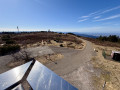
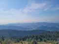
(4) Turn right in front of the Ochsenstall. Immediately take the path on the right. Continue along the path towards the summit of the Hornisgrinde. Ignore a path on the left. Pass to the left of the telecoms tower and the wind turbine. There are magnificent views of the plain on one side and the Black Forest on the other. Turn right towards the Bismarck Tower. You can climb the tower for a wider view.
(5) Turn left onto a paved, then wooded path crossing the bog (temporarily leaving the Westweg, which you’ll rejoin near Mumelsee). Turn right at the Dreifürstenstein junction after the bog and see the inscriptions carved into the large slabs nearby.
(6) Continue along the path leading to some houses and carry on to the Grinde Hütte. Alternative route: you can also descend directly to Seibelseckle via a fairly steep and rocky path, which is therefore not very pleasant.
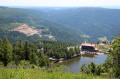
(7) Head down the path on the left (hairpin bend). Turn onto the path on the right (panoramic view of the lake and the valley).
(8) Turn slightly left onto the Westweg, which descends to the lake. Walk behind the Berghotel.
(9) Turn right and head towards the Seibelseckle lift station along the path running alongside the road; follow this to the left. Cross the car park. Walk to the left of the ski lift building.
(10) Follow the path alongside the ski run and through the forest up to halfway up the slope. Turn right onto the path through the forest. Follow the path to the left, then take the track on the right until you reach the crossroads.
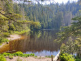
(11) Follow the path on the left uphill to the Darmstädter Hütte. Turn right in front of the Hütte. Turn right. Continue along this path and descend to the Ruhestein. There are several vantage points offering views of the glacial lake Wildsee, situated below. Then continue straight ahead, cross the ski runs via the winding path and head back to the car park (S/E).
 Visorando Member
 Moderate
 Easy