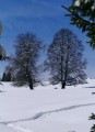
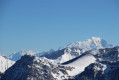
Snowshoes available at the Chalets de l’Epion and at the Col du Potat

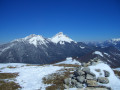
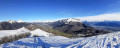
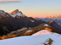
A snowshoe outing in late November in a lovely part of Les Bauges, rounded off with a ‘test’ of fitting crampons on the slopes of Arclusaz.

Details

n°45312
Creation:
Last update:
Last review:
  • Snowshoeing
    Activity: Snowshoeing
  • ↔
    Distance: 5.14 mi
  • ◔
    Duration according to the author: 4 hrs 
  • ▲
    Difficulty: Easy

  • ⚐
    Back to start: Yes
  • ↗
    Ascent: + 2,119 ft
  • ↘
    Descent: - 2,116 ft

  • ▲
    Highest point: 5,102 ft
  • ▼
    Lowest point: 3,120 ft

Description of the walk

Head to Saint-Pierre d’Albigny and then on to the Col du Frène (950 m). Park in the designated car park.
The start of the trails is next to the cross.

(S/E) Head towards Col du Potat – Dent d’Arclusaz.
The path winds through the forest and crosses two small clearings; it emerges onto a track which you cross to immediately join the signposted path: the Sentier de l’Arclusaz.

(1) This path climbs a little more steeply than the previous section.
It passes through a gate and emerges into a valley, and a little further on reaches a junction.

(2) There are two options:
- 50 metres to the right, you can rejoin the track you crossed earlier; simply follow this track to reach the Chalet de l’Épion.
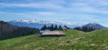
- We opted for an ‘adventure’ route, covering a few hundred metres through the valley before cutting diagonally up the right-hand side of the valley, eventually emerging into a large meadow below the Chalet de l’Épion.

(3) Go round the chalets to take the path that descends gently to the Col du Potat (1,351 m).

(4) Head towards L’Arclusaz – this is a chance to test how well your snowshoes grip on steeper slopes and to add an extra 200 m of elevation gain.

(5) Return to the Col du Potat.

(4) To avoid climbing back up to the Chalet de l’Épion, follow the fence; the path will lead to a small mountain pasture.

(6) Continue along the same level to reach the track mentioned above.

(7) Follow this track down to the point where it crosses the Arclusaz path.

(1) From there, head back along the section you took on the way up to rejoin the (S/E).

Waypoints

  1. S/E : mi 0 - alt. 3,120 ft - Col du Frêne car park
  2. 1 : mi 0.83 - alt. 3,455 ft - Crossroads on the circular loop
  3. 2 : mi 1.69 - alt. 4,265 ft - Alternative routes
  4. 3 : mi 2.19 - alt. 4,544 ft - Chalet de l’Épion
  5. 4 : mi 2.44 - alt. 4,436 ft - Col du Potat
  6. 5 : mi 2.71 - alt. 5,098 ft - Aim of the walk
  7. 6 : mi 3.07 - alt. 4,469 ft - End
  8. 7 : mi 3.41 - alt. 4,367 ft - Trail
  9. S/E : mi 5.14 - alt. 3,120 ft - Col du Frêne car park

Notes

Ensure you have good snowshoe equipment.
Take extreme care on the slopes of Arclusaz if there is snow.
Do not set off too early to allow the sun time to rise and light up the route; in November, setting off at 10.00 is more than enough.

This route passes through a protected area, which may be subject to special regulations:

Worth a visit

In the village of Saint-Pierre d’Albigny, there are two cheese shops where you can stock up on cheese.

Reviews and comments

4.3 / 5
Based on 2 reviews

Reliability of the description
4.5 / 5
Ease of following the route
4.5 / 5
Route interest
4 / 5
oryx381
oryx381

Overall rating : 4.7 / 5

Date of your route : Oct 24, 2021
Reliability of the description : ★★★★★ Very good
Ease of following the route : ★★★★★ Very good
Route interest : ★★★★☆ Good
Very busy route : Yes

The summit is hidden by the foliage; you need to head to the Col du Potat to get a lovely view of the Bauges massif (Trelod and Arcalod), which is made all the more beautiful by the autumn colours. Return via the track.

Machine-translated

Deuxpattes
Deuxpattes

Overall rating : 4 / 5

Date of your route : Jan 10, 2021
Reliability of the description : ★★★★☆ Good
Ease of following the route : ★★★★☆ Good
Route interest : ★★★★☆ Good
Very busy route : Yes

A lovely little route, covered in snow today. We got a bit lost on the route, but it doesn’t matter. There was thick fog and a north wind beyond the chalets, so we didn’t complete the entire route to the peaks.
Thanks for this post

Machine-translated

Other walks in the area

For more walks, use our search engine .

The GPS track and description are the property of this route's author. Please do not copy them without permission.