Country:

 City:


Start from the centre of Chichilianne, on the road to the Col de Menée. Park in one of the car parks behind the church.
(S/E) Head south-east along the small road known as the Passière de Jansonnière and, just before the Ruisseau de Combe-Chaude, turn right onto the stony track heading south-west. Follow it straight on until you reach the Tapas de Begoud junction at Verzelle.
(1) The signposted Pas de l’Essaure path branches off to the left; you can follow this, but we suggest taking an alternative route via the Sentier des Arches.
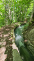
Carry on straight ahead towards the south-west and veer left to climb up along the edge of the meadows. When the path levels out and heads south, veer right to continue climbing until you reach the embankment of the Ruisseau des Arches. Climb up onto this embankment and follow it for a few metres.
(2) A small cairn marks the spot where you cross the stream: descend into its bed and climb up the opposite bank, heading for the start of a path (the cairn marking it is often washed away) on the right bank.
Join the Chemin des Arches, which winds gently upwards through the Banon forest before crossing over to meet the signposted path leading up to the Pas de l’Essaure.
(3) Follow this path as it gradually emerges from the forest and, via a series of hairpin bends, reaches the wide pass of the Pas de l’Essaure.
(4) Head along the flat ground, following the tracks in the grass, first south-west then south towards the Essaure hut. As soon as the slopes on the right level out, cut westwards, following vague tracks that cross the Col de Creuson path at right angles, then descend towards a second path which you follow to the right for about a hundred metres.
(5) Leave this path to the left to approach a hillock riddled with marmot burrows, up which a track allows you to climb. This leads to a valley floor, which you follow upwards, keeping close to the bottom. It opens out onto a lovely meadow with a pond, which you cross to reach a second grassy clearing, a junction of several possible routes.
(6) A path climbs diagonally to the left (south) and takes you up a series of ridges towards La Montagnette; aim for the edge of the south-western ridge: there are several paths leading up to it, with the lower ones on the right being the easiest.
(7) Once on this ridge, follow it more or less straight up towards the summit.
(8) From the summit, descend via the same route or follow a line of cairns westwards, leading to a passage that takes advantage of a weak point in the cliff above the Pas de la Coche. At the foot of this passage, head westwards over easy terrain to rejoin the ascent route and the junction you passed earlier.
(6) Once back on the grassy plateau, head due north with the Tête Chevalière in your sights. Make the most of the grassy sections, avoiding the sharp limestone pavements as much as possible. Descend slightly towards the Col du Creuson area, then climb up the gentle slopes of the Plaine de Chamousset.
(9) Cut across the Col de Creuson path to continue climbing up the Plaine de Chamousset, either directly towards the summit or, to enjoy more interesting views, gradually veering to the right to reach the eastern edge of the plateau and a pond near the 1912-metre altitude, then follow this edge to the left until you reach the summit.
(10) From the summit, follow the ridge line westwards, pass a second summit marked by cairns, then descend south-west down the steeper slopes (cairns) leading to the clearly visible summit of the Combe Chevalière.
(11) Turn right into this grassy valley which descends north-west. At the end of the first grassy plateau, head right to easily cross the slope via a path you’ll find, which descends to join a scree slope.
Notes here: There are several possible routes in this area, where there are numerous herd tracks. You can cut straight across the valley or take a detour to the right, as shown on the GPS track. The aim is to gradually head westwards to reach the Plaine de Chamailloux without being led astray by the torrents rushing off to the right.
This sometimes involves a few short climbs, such as at the foot of a cattle pen or when you need to leave the stream as it heads down into ravined areas.
(12) Once out of the forest, the path lies opposite the Chamailloux refuge, which you can reach to descend to the right towards the Pas de l’Aiguille; alternatively, you can cut across to the right earlier and descend, crossing the Ruisseau du Pas de l’Aiguille (narrow paths) to reach the Monument to the Resistance, which is visible ahead.
(13) From the monument, head for the Pas de l’Aiguille path a few metres away and follow this rugged track as it winds through open terrain and then through the forest down to Les Fourchaux.
(14) At the monument, stop descending and head south along the forest track towards La Rimas. It joins the Ruisseau du Pas de l’Aiguille, which you must fords, then returns to the right bank without losing altitude. The route crosses the Bois des Granges, begins to descend slightly, then at a junction climbs slightly to the right up to the Rimas meadow.
(15) Leave the forest track, which climbs too steeply, and follow a path on the left that runs along the edge of the meadow before entering the forest again and coming to the Ruisseau des Fraches ravine.
Make your way down the ravine as best you can to fords the stream and climb back up the opposite side. Erosion now makes it impossible to climb directly onto the path cut off by the stream, which is clearly visible higher up: you must descend a few metres along the right bank to find footpaths on the passable slopes of the bank, allowing you to climb up into the forest and head back to the right to rejoin the interrupted forest track. Follow it to a junction with a larger forest track.
(16) Take this level track eastwards and continue along it until it begins to descend at the edge of a fenced field.
(17) Go through the fence and cross the field (horses present) via the descending path that leads into the woods. At around 1,100 m, veer to the right onto a small path which levels out and crosses the Ruisseau de la Touche just before joining a gravel road.
(18) Turn left to descend the Plaine de la Touche along this road, which becomes tarmac and joins the Chemin de la Touche, where you turn right towards Chichilianne. Pass through Le Rapon and then La Renardière to reach the centre via Rue de l’Eglise. (S/E)

 Visorando Member
 Moderate

 Easy