Circular walk between Millac and Souillac

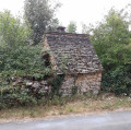
Circular route through varied terrain starting from Millac and heading towards Souillac. Along the way, you’ll encounter remarkable landscapes and monuments: a ruined chapel (Saint-Julien) and a dolmen (Laval).

Details

30947825
Creation:
Last update:
Last review:
  • Walking
    Activity: Walking
  • ↔
    Distance: 6.62 mi
  • ◔
    Average duration: 3h 40 
  • ▲
    Difficulty: Moderate

  • ⚐
    Back to start: Yes
  • ↗
    Ascent: + 689 ft
  • ↘
    Descent: - 686 ft

  • ▲
    Highest point: 1,020 ft
  • ▼
    Lowest point: 305 ft

Photos

Description of the walk

Park not far from the hamlet of Les Terrassous. You can park at the side of the track on the uphill side (left), leaving the track clear for passing farm machinery.

(S/E) Follow theGR®6as it leaves the tarmac road. Head downhill through a wooded valley to the Marjaudes viaduct at the entrance to Souillac.

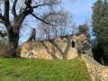
(1) Just after the viaduct, follow theGR® andPR® markings to the left as far as the ruined Saint-Julien Chapel and the Pressignac viaduct.

(2) Pass underneath it, following the yellowPR® markings, then follow the road to the right for a good hundred metres.

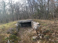
(3) Take a steep, uphill path on the left after a restored house. Follow this uphill path, which turns into a track after you’ve passed under a high-voltage power line. About fifty metres before reaching a wider track coming from Souillac, take a short detour to the left to see the Laval dolmen, which lies hidden at the edge of the woods.

(4) Return to the track and, at the fork, continue to the left, following the yellowPR® markings.

(5) At a place called Lacombe, follow the track to the left, keeping to the yellow markings.

(6) Keep to the right, ignoring the path leading to Lescoux, and carry on straight ahead to the car park (S/E).

Waypoints

  1. S/E : mi 0 - alt. 965 ft - Car park at the edge of the track
  2. 1 : mi 2.29 - alt. 312 ft - Viaduc des Marjaudes
  3. 2 : mi 2.72 - alt. 328 ft - Chapelle Saint-Julien (Présignac)
  4. 3 : mi 2.9 - alt. 367 ft - Pressignac – Start of the trail
  5. 4 : mi 3.7 - alt. 774 ft - Dolmen de Laval (Souillac)
  6. 5 : mi 5.32 - alt. 1,007 ft - Lacombe – Track junction
  7. 6 : mi 5.8 - alt. 1,010 ft - Junction
  8. S/E : mi 6.62 - alt. 958 ft - Car park at the edge of the track

Always be cautious and plan ahead when you're outdoors. Visorando and the author of this route cannot be held responsible for any accidents occurring on this route.

The GR® and PR® markings are the intellectual property of the Fédération Française de Randonnée Pédestre.

Reviews and comments

4.4 / 5
Based on 3 reviews

Reliability of the description
4.7 / 5
Ease of following the route
4.3 / 5
Route interest
4.3 / 5
Tortuejolie
Tortuejolie

Overall rating : 4.7 / 5

Date of your route : Feb 23, 2025
Reliability of the description : ★★★★★ Very good
Ease of following the route : ★★★★☆ Good
Route interest : ★★★★★ Very good
Very busy route : No

We’d recorded the GPS track, which helped us get round the lack of signposting (particularly on the GR de pays) on the way back; otherwise, the description is spot on and it’s a lovely walk that seems to cover a distance of
12 km

Machine-translated

Clarisse 27
Clarisse 27

Overall rating : 4.7 / 5

Date of your route : Aug 05, 2024
Reliability of the description : ★★★★★ Very good
Ease of following the route : ★★★★★ Very good
Route interest : ★★★★☆ Good
Very busy route : No

A well-signposted walk.
Be aware, however, of the elevation gain; the steep climb in direct sunlight can be challenging if you’re not used to it.

Machine-translated

Celineetfrederic
Celineetfrederic

Overall rating : 4 / 5

Date of your route : Apr 28, 2024
Reliability of the description : ★★★★☆ Good
Ease of following the route : ★★★★☆ Good
Route interest : ★★★★☆ Good
Very busy route : No

A pleasant walk, with no difficulties apart from the steep climb from the chapel to the plateau.
Thank you for sharing this.

Machine-translated

Other walks in the area

For more walks, use our search engine .

The GPS track and description are the property of this route's author. Please do not copy them without permission.