Le Mas del Pech from Baladou

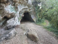
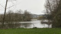
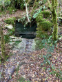
A lovely walk through the countryside with an unexpected spot to rest.

Details

30473142
Creation:
Last update:
Last review:
  • Walking
    Activity: Walking
  • ↔
    Distance: 4.22 mi
  • ◔
    Average duration: 2h 05 
  • ▲
    Difficulty: Easy

  • ⚐
    Back to start: Yes
  • ↗
    Ascent: + 154 ft
  • ↘
    Descent: - 151 ft

  • ▲
    Highest point: 922 ft
  • ▼
    Lowest point: 735 ft
  • ⚐ Country: France
  • ⚐ City: Baladou (46600)
  • ⚑
    Start/End: N 44.922315° / E 1.555555°
  • ❏
    IGN map(s): Ref. 2136ET
  • Hour-by-hour weather

Description of the walk

If arriving via the D803, park in the car park near the town hall, on the left before the church.

(S/E) Head due north, towards the cemetery and the church, along Rue du Bourg. Pass Impasse des Canabals on your left and, immediately afterwards, you’ll reach a junction.

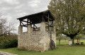
(1) Turn right onto Route de Cuzance. Walk past the school and continue until you reach the chimney of a derelict house.

(2) Turn right onto Chemin du Presbytère. At the junction with Impasse de La Croix du Roc, turn left, heading north-east, and join a road.

(3) At the yellow sign, turn left towards Mas Del Pech. At the fork in the road, turn right and continue to another fork.

(4) At the sign for Mas del Pech Somival, turn left onto the track and follow it for approximately 1.7 km until you reach the D33.

(5) Cross the D33 and continue straight ahead until you reach the edge of the woodland at a crossroads.

(6) Turn left, following the edge of the meadow, then join a road. Follow it to the left for about 700 m.

(7) Turn right onto a grassy path before the houses, and follow the blue and yellow markings until you return.
To do this, cross a road, continue to a junction, turn left and return to the original road junction.

(1) Then turn right and head back to the car park (S/E).

Waypoints

  1. S/E : mi 0 - alt. 768 ft - Car park. Town hall
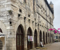
  2. 1 : mi 0.13 - alt. 787 ft - Crossroads at the end of the circular loop - Église Notre-Dame-de-l'Assomption (Baladou)
  3. 2 : mi 0.3 - alt. 817 ft - Rectory Path
  4. 3 : mi 0.97 - alt. 899 ft - Route
  5. 4 : mi 1.43 - alt. 919 ft - Sign for Mas del Pech Somival
  6. 5 : mi 2.44 - alt. 807 ft - D33
  7. 6 : mi 2.81 - alt. 758 ft - Crossroads. Meadow on the left
  8. 7 : mi 3.28 - alt. 771 ft - Grassy path, on the right
  9. S/E : mi 4.22 - alt. 771 ft - Car park. Town hall

Notes

Worth a visit

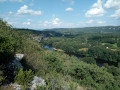
Along the route, you can stop at Roger’s Tree to sit down and admire the view as the sun sets.

Reviews and comments

4.4 / 5
Based on 3 reviews

Reliability of the description
4.7 / 5
Ease of following the route
5 / 5
Route interest
3.7 / 5
User 2739281

Overall rating : 4.7 / 5

Date of your route : Aug 10, 2026
Reliability of the description : ★★★★★ Very good
Ease of following the route : ★★★★★ Very good
Route interest : ★★★★☆ Good
Very busy route : No

A lovely walk, mostly flat, with a mix of shade and sunshine
No particular viewpoint, but a good way to warm up
We did it in an hour and a half, taking our time

Machine-translated

Celineetfrederic
Celineetfrederic

Overall rating : 4.3 / 5

Date of your route : May 08, 2024
Reliability of the description : ★★★★☆ Good
Ease of following the route : ★★★★★ Very good
Route interest : ★★★★☆ Good
Very busy route : No

A very lovely and pleasant walk, almost entirely along footpaths

Machine-translated

MilouCot
MilouCot

Overall rating : 4.3 / 5

Date of your route : Jan 12, 2024
Reliability of the description : ★★★★★ Very good
Ease of following the route : ★★★★★ Very good
Route interest : ★★★☆☆ Average
Very busy route : No

An easy and pleasant route with a mix of shade and sunshine, plenty of woodland, but no views

Machine-translated

Other walks in the area

For more walks, use our search engine .

The GPS track and description are the property of this route's author. Please do not copy them without permission.