Pech de Pinsac

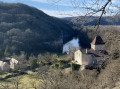
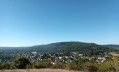
A walk via the Pech de Pinsac, with magnificent views over the Dordogne gorge.

Details

34524272
Creation:
Last update:
Last review:
  • Walking
    Activity: Walking
  • ↔
    Distance: 2.76 mi
  • ◔
    Average duration: 1h 40 
  • ▲
    Difficulty: Easy

  • ⚐
    Back to start: Yes
  • ↗
    Ascent: + 436 ft
  • ↘
    Descent: - 436 ft

  • ▲
    Highest point: 860 ft
  • ▼
    Lowest point: 420 ft
  • ⚐ Country: France
  • ⚐ City: Pinsac (46200)
  • ⚑
    Start/End: N 44.854967° / E 1.512549°
  • ❏
    IGN map(s): Ref. 2036ET
  • Hour-by-hour weather

Description of the walk

The walk starts from the car park at Pinsac Town Hall.

(S/E) From the town hall, turn right onto the road towards Lacave, then take the first street on the left, Rue des Forgerons, then the first right and then left until you reach the church (alternative car park).
Turn right, walking past the church and then the school, then turn left onto Rue du Docteur Marty and continue to a junction.
Head down to the right. The road turns into a track. Carry on straight ahead through the woods, take the very stony climb and you’ll reach a junction.

(1) Take the clearly marked path leading uphill to the right. (You can also continue straight on and then turn right (less clearly marked path) to reduce the gradient but increase the distance).

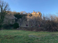
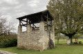
(2) Pass the truffle hut and arrive at the Pech de Pinsac viewpoint. Continue along the cliff and climb up to the next pech for another viewpoint.

(3) Here, with your back to the Dordogne, you’ll find three paths; the one on the left is the one you came up on. Take the middle one. Enter the woodland and carry on. Walk alongside a truffle field and arrive at a field.

(4) 30 metres further on, follow a small path to the left, heading down to a rubbish tip enclosed by a wire fence. You’ll come out onto the tarmac and into the Rougié Haut housing estate. Take the first street on the right to reach the road, which you should follow to the left for 20 metres.

(5) Take a path that descends to the right to join a road; follow this to the left for 10 m before taking the path to the right. At the crossroads, follow the road straight ahead, which leads back to the town hall (S/E).

Waypoints

  1. S/E : mi 0 - alt. 423 ft - Car park at Pinsac Town Hall
  2. 1 : mi 0.57 - alt. 541 ft - Pech de Pinsac
  3. 2 : mi 0.79 - alt. 669 ft - The Truffière hut overlooking the - Dordogne (fleuve)
  4. 3 : mi 1.19 - alt. 797 ft - Unnamed Pech
  5. 4 : mi 1.7 - alt. 850 ft - Field
  6. 5 : mi 2.35 - alt. 584 ft - Road/path junction
  7. S/E : mi 2.76 - alt. 423 ft - Car park at Pinsac Town Hall

Notes

Caution: The path is very stony on the climb up to Pech de Pinsac and then to the second pech.
Hiking boots are essential.
Caution: On the ‘pechs’, you are at the top of cliffs. Take great care if you are with children.
There are no water sources along the walk

Worth a visit

Make the most of this walk to explore Pinsac and its superb houses.
Food and refreshments are available at the entrance to the village.

Reviews and comments

5 / 5
Based on 2 reviews

Reliability of the description
5 / 5
Ease of following the route
5 / 5
Route interest
5 / 5
User 30690077

Overall rating : 5 / 5

Date of your route : Aug 18, 2026
Reliability of the description : ★★★★★ Very good
Ease of following the route : ★★★★★ Very good
Route interest : ★★★★★ Very good
Very busy route : No

A nice way to start things off after a climb up to the first hill, with a magnificent view of the Dordogne – you’ll work up a bit of a sweat by the time you get there. The rest of the walk is a gentle, shaded stroll. Took 1 hour 45 minutes with a 7-year-old child.

Machine-translated

corinnne
corinnne

Overall rating : 5 / 5

Date of your route : May 27, 2024
Reliability of the description : ★★★★★ Very good
Ease of following the route : ★★★★★ Very good
Route interest : ★★★★★ Very good
Very busy route : No

A lovely walk

Machine-translated

Other walks in the area

For more walks, use our search engine .

The GPS track and description are the property of this route's author. Please do not copy them without permission.