Circular route from the Parroy Pond to Mouacourt

An easy walk around the Étang de Parroy and the surrounding villages.

Details

21224706
Creation:
Last update:
Last review:
  • Walking
    Activity: Walking
  • ↔
    Distance: 7.81 mi
  • ◔
    Average duration: 3h 40 
  • ▲
    Difficulty: Moderate

  • ⚐
    Back to start: Yes
  • ↗
    Ascent: + 108 ft
  • ↘
    Descent: - 112 ft

  • ▲
    Highest point: 869 ft
  • ▼
    Lowest point: 732 ft

Photos

Description of the walk

Park in the car park on Route de Bures (D21) near the Étang de Parroy.

(S/E) From the car park, take the path opposite along the pond and continue straight on along the dam (Green Ring signposting)

(1) Turn right, follow these markings and cross the departmental road towards the Parroy campsite (both sets of markings are visible all the way to the campsite).

Red Ring signposting

(2) Cross the bridge and take the path opposite towards the Bois des Sablons.

(3) Turn left, follow the path along the edge of the forest and continue along a road until you reach a crossroad.

(4) Turn right onto this road, then turn left onto a path that crosses a stream and then turns right.

(5) Turn left at the fork, pass under a power line and join a road at the entrance to Mouacourt.

(6) Turn left.

(7) Cross the Sânon and continue to lock No. 15.

(8) Take the cycle path on the left along the Marne–Rhine Canal.

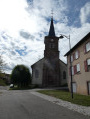
(9) Cross the bridge and enter the village of Parroy via the main street, continuing to the church.

No signposting

(10) After the church, turn left then right at the back of the village, join the D23e and follow it for a few dozen metres.

Red Ring signposting

(11) Turn left and follow the path which bends left and descends to the pond.

::11: Walk along the pond to the embankment.

(1) Head back along the path along the embankment in the opposite direction and return to the starting car park via the footpath (S/E).


Waypoints

  1. S/E : mi 0 - alt. 761 ft - Car park on Route de Bures
  2. 1 : mi 0.59 - alt. 761 ft - Crossroads at the end of the circular loop
  3. 2 : mi 0.88 - alt. 761 ft - Bridge - Canal de la Marne au Rhin
  4. 3 : mi 1.38 - alt. 755 ft - Path on the edge of the forest
  5. 4 : mi 2.13 - alt. 738 ft - Cross-country route
  6. 5 : mi 2.75 - alt. 774 ft - Junction
  7. 6 : mi 3.37 - alt. 748 ft - Road at the entrance to Mouacourt
  8. 7 : mi 3.79 - alt. 738 ft - Crossing the - Sânon (rivière)
  9. 8 : mi 3.95 - alt. 748 ft - Canal bank
  10. 9 : mi 4.94 - alt. 751 ft - Bridge
  11. 10 : mi 5.36 - alt. 817 ft - Church
  12. 11 : mi 5.81 - alt. 860 ft - Fork in the path
  13. 12 : mi 6.74 - alt. 774 ft - Étang de Parroy
  14. S/E : mi 7.81 - alt. 758 ft - Car park on Route de Bures

Notes

A table at the entrance to the village of Parroy.
Several benches along the route.
You can shorten the route at (4) by turning left to head straight to the village of Parroy at (9).

Worth a visit

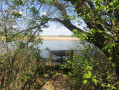
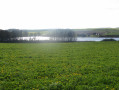
Views of the pond.
Nearby: after the walk, you can head to the water sports centre.
Visit the villages of Mouacourt and Parroy.
Marne–Rhine Canal.
Information boards at various points: flora and fauna, and the history of the vanished village of Villacourt in the centre of Parroy.
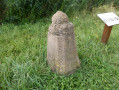
A curious set of scales (?) near the church in Parroy.

Reviews and comments

4.4 / 5
Based on 3 reviews

Reliability of the description
5 / 5
Ease of following the route
4.7 / 5
Route interest
3.7 / 5
User 10771396

Overall rating : 4 / 5

Date of your route : May 08, 2026
Reliability of the description : ★★★★★ Very good
Ease of following the route : ★★★★☆ Good
Route interest : ★★★☆☆ Average
Very busy route : No

Hello,
A pleasant walk. The start of the path is tricky as the grass has grown quite high and it’s a bit of a struggle to get through, especially with the stinging nettles. The section by the pond is really lovely, as is the one near the forest. After that, the rest of the walk is pleasant but nothing special. The scenery isn’t particularly interesting: it’s mostly just countryside. The walk is easy and presents no difficulties. Best done when it’s not too hot, as the route is often in full sun.

Machine-translated

User 20874979

Overall rating : 4.7 / 5

Date of your route : Dec 27, 2025
Reliability of the description : ★★★★★ Very good
Ease of following the route : ★★★★★ Very good
Route interest : ★★★★☆ Good
Very busy route : No

A family walk accessible to all, in the countryside and on the edge of the forest (with a glimpse of three magnificent deer) and a lovely view of Parroy Pond at the end of the route.

Machine-translated

baladin54
baladin54

Overall rating : 4.7 / 5

Date of your route : Nov 08, 2025
Reliability of the description : ★★★★★ Very good
Ease of following the route : ★★★★★ Very good
Route interest : ★★★★☆ Good
Very busy route : No

We did this very easy hike in the fog. Avoid it during hot weather as much of it is exposed. Very pleasant to do on a beautiful sunny day in spring or autumn...

Machine-translated

Other walks in the area

For more walks, use our search engine .

The GPS track and description are the property of this route's author. Please do not copy them without permission.