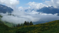
Circular Novallay route via Beauvillard and Villarly

An easy walk, featuring waterfalls and small bridges. Can be done in winter with a little snow.

Details

n°45883690
Creation:
Last update:
Last review:
  • Walking
    Activity: Walking
  • ↔
    Distance: 4.07 mi
  • ◔
    Average duration: 2h 35 
  • ▲
    Difficulty: Easy

  • ⚐
    Back to start: Yes
  • ↗
    Ascent: + 837 ft
  • ↘
    Descent: - 823 ft

  • ▲
    Highest point: 4,403 ft
  • ▼
    Lowest point: 3,619 ft

Description of the walk

Park in the bend just before you reach the village: three to four spaces available.

(S/E) Set off along the quiet approach road.

(1) At the first junction, turn left towards Le Villaret; 20 metres further on, turn right without heading for the hamlet and follow the signs for Beauvillard. Once in the hamlet, negotiate the hairpin bend to the right and continue to the end of the road.

(2) Take the path on the left towards Villary and head into the village until you come out onto Route de la Scierie.

(3) Turn right, walk past the church and then turn right twice. Pass the first hairpin bend and continue to the second.

(4) At the pylon, leave the road and take the path on the left towards Novallay. Cross the Ruisseau du Gollet and reach a junction.

(5) Turn right, cross the stream again and head for the car park (S/E).

Waypoints

  1. S/E : mi 0 - alt. 4,390 ft - Le Novallay
  2. 1 : mi 0.58 - alt. 4,167 ft - Junction
  3. 2 : mi 1.38 - alt. 4,091 ft - Beauvillard
  4. 3 : mi 2.63 - alt. 3,619 ft - Villary
  5. 4 : mi 3.03 - alt. 3,796 ft - Start of the path
  6. 5 : mi 3.52 - alt. 4,075 ft - Junction
  7. S/E : mi 4.07 - alt. 4,390 ft - Le Novallay

Reviews and comments

3.7 / 5
Based on 2 reviews

Reliability of the description
3.5 / 5
Ease of following the route
4 / 5
Route interest
3.5 / 5
User 28907384

Hello
Do you think this route is suitable for mountain biking?
Thank you in advance for your reply.
LGS

Machine-translated

Gafaz
Gafaz

Hello,
Looking back, there was a bit of tarmac in the summer… But it was a quiet road… Didn’t you enjoy the little village, the stream and the little bridge? As for me, I did it in winter… The snow was part of the scenery!

Machine-translated

User 26828564

Overall rating : 2.7 / 5

Date of your route : Jul 28, 2025
Reliability of the description : ★★★☆☆ Average
Ease of following the route : ★★★☆☆ Average
Route interest : ★★☆☆☆ Disappointing
Very busy route : No

The hike isn't very interesting, with lots of paved roads (even if there aren't many cars) and high-voltage power lines. The climb is long and difficult, with few views along the way.

There are much better places to visit in the area.

Best regards, Christophe

Machine-translated

Nordeau
Nordeau

Overall rating : 4.7 / 5

Date of your route : Aug 10, 2024
Reliability of the description : ★★★★☆ Good
Ease of following the route : ★★★★★ Very good
Route interest : ★★★★★ Very good
Very busy route : No

A brilliant hike!
I would, however, advise beginners to follow the route in the opposite direction: there’s a 300m climb over the last 2 km!

The start of the walk is in full sun for about 2 km! The rest is well shaded by the trees in the forest! When we were there on 10/08/24, it wasn’t possible to return via the last bridge (under renovation)

Please note: it’s not possible to swim in the little stream (it’s too small )

Thanks for the route!

Machine-translated

Other walks in the area

For more walks, use our search engine .

The GPS track and description are the property of this route's author. Please do not copy them without permission.