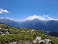
Circular route via the Col du Mont and the Archeboc refuge

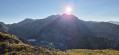
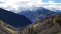
This route in the Haute Tarentaise, away from the major ski resorts, climbs up to the Col du Mont on the border with Italy.
It can be combined with an overnight stay at the Refuge de l’Archeboc, allowing for a leisurely return via Lac Noir and the hamlet of La Sassière the following day.

Details

652243
Creation:
Last update:
Last review:
  • Walking
    Activity: Walking
  • ↔
    Distance: 11.12 mi
  • ◔
    Average duration: 9h 15 
  • ▲
    Difficulty: Difficult

  • ⚐
    Back to start: Yes
  • ↗
    Ascent: + 4,783 ft
  • ↘
    Descent: - 4,764 ft

  • ▲
    Highest point: 8,652 ft
  • ▼
    Lowest point: 5,741 ft

Description of the walk

Park in the Pierre Giret car park: this is the designated parking area for vehicles not authorised to proceed any further.

(S/E) Walk up the road, then continue to the left, skirting the buildings.

(1) Leave the return path on your left just after the bridge over the stream and continue along the road. Pass the houses in the hamlet of Savonne.

(2) Quickly take the path on the right. Continue the long climb along this path, which often runs through woodland, until you reach a sheep track.

(3) Follow it uphill and carry on straight ahead until you reach the hamlet of La Motte, where the Archeboc refuge is located.

(4) Walk past the refuge and continue uphill, this time along a path heading south-east. Navigate a few winding and steep sections before reaching the Col du Mont, which marks the border with Italy.

(5) Head back down to the refuge (where you may spend the night).

(4) From the refuge, turn right towards the north into the Ruisseau des Trousses valley. After crossing the stream, gradually climb the slope to reach a junction.

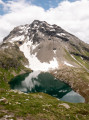
(6) Ignore the path branching off to the left which descends into the Mercuel valley. Continue climbing to reach the shores of Lac Noir.

(7) Continue climbing north-west. Shortly after the Col de Montséti, begin a long descent that follows the Aïvettaz stream before crossing it and reaching the hamlet of La Sassière.

(8) Pass through the hamlet, cross the Sassière torrent and continue left along the track. Pass close to the Ruitor refuge, then the Saint-Pierre Chapel a little further on.

(9) As the track overlooks a torrent to your right and at the junction with the track leading to the buildings at La Vacherie d’en Bas, leave the track and take a path branching off to the right. Continue downwards alongside the torrent until you rejoin the road.

(1) Turn right to quickly return to the car park below (S/E).

Waypoints

  1. S/E : mi 0 - alt. 5,745 ft - Pierre Giret car park
  2. 1 : mi 0.2 - alt. 5,810 ft - Crossroads at the end of the circular loop
  3. 2 : mi 0.35 - alt. 5,883 ft - Path on the right
  4. 3 : mi 1.97 - alt. 6,211 ft - Sheep track
  5. 4 : mi 3.2 - alt. 6,654 ft - Refuge de l'Archeboc
  6. 5 : mi 4.79 - alt. 8,652 ft - Col du Mont
  7. 6 : mi 7.41 - alt. 7,690 ft - Junction
  8. 7 : mi 7.87 - alt. 8,163 ft - Lac Noir (Tarentaise)
  9. 8 : mi 9.29 - alt. 6,667 ft - La Sassière
  10. 9 : mi 10.44 - alt. 6,316 ft - Path on the right
  11. S/E : mi 11.12 - alt. 5,741 ft - Car park

Notes

(9) If you do not take the footpath, the track leads back to the road above the hamlet of Savonne.

Reviews and comments

5 / 5
Based on 2 reviews

Reliability of the description
5 / 5
Ease of following the route
5 / 5
Route interest
5 / 5
GuilletJC
GuilletJC

Overall rating : 5 / 5

Date of your route : Sep 10, 2019
Reliability of the description : ★★★★★ Very good
Ease of following the route : ★★★★★ Very good
Route interest : ★★★★★ Very good

A lovely walk; the warden at the mountain hut was very friendly.

Machine-translated

ygerard1999@gmail.com

Overall rating : 5 / 5

Date of your route : Aug 17, 2019
Reliability of the description : ★★★★★ Very good
Ease of following the route : ★★★★★ Very good
Route interest : ★★★★★ Very good

A lovely walk. We started it at Ruitor. The descent to Lac Noir was absolutely stunning.
The return journey from Archeboc to the P Giret car park is a bit long (and not quite as interesting).

Machine-translated

Other walks in the area

For more walks, use our search engine .

The GPS track and description are the property of this route's author. Please do not copy them without permission.