Country:

 City:
City:


To get to Sainte-Foy-Tarentaise, take the D84 to the hamlet of Le Miroir and head up towards the area known as La Savonne. Park in the car park known as Pierre Giret, situated along the road just before you reach La Savonne, which will be our starting and finishing point.
Note: extreme caution is advised on the narrow, winding stretch of road between Sainte-Foy-Tarentaise and the Pierre Giret car park, both on the way there and on the way back.
(S/E) Head north along the road and, as you pass , admire the hamlet of Pierre Giret, notably a house that appears to be set into the rock.
(1) Leave the road and take the path on the left towards the Refuge du Ruitor.
(2) Take the well-marked track heading due east, then north-east, still heading towards the Refuge du Ruitor. As you walk, you’ll pass the Vacherie d’en bas, the Vacherie d’en haut and the little Saint-Pierre Chapel, before entering the magnificent little Ruitor valley. Walk past the Refuge du Ruitor, cross the footbridge and reach the hamlet of La Sassière, where some of the houses are currently being renovated.
(3) Continue along the left bank of the Ruisseau du Petit, crossing a series of rocky outcrops, some of which allow you to wade across the stream. The signposting becomes less reliable here, so you’ll need to look out for either yellow markers or structures resembling carriage gates painted yellow with the number 2 inside. Note here: in the final narrow passage before Lac du Petit, cables are installed on the left-hand side above the right bank to allow you to cross high above the stream, but I would advise instead following the right bank, which is easily passable. For all these sections, trust your own judgement to follow the path that suits you best from among all those visible along the route. Reach Lac du Petit.
(4) Walk along its left-hand side and cross a rocky scree slope to reach the bottom of the valley.
(5) Turn left towards the north-west and the path straightens out again distinctly, with a succession of ledges – some of which are rocky but present no particular difficulty – leading you to the Col du Tachuy. Please note: there may be snowfields depending on the time of year you undertake the hike. Reach the Col du Tachuy.
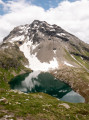
(6) Then walk on for about a hundred metres on the Italian side of the Col du Tachuy to get a clear view of the lakes below.
(7) Return via the same route, paying close attention to the markings described above amongst the rocky outcrops to make the descent easier; this is always more challenging than the ascent, with fatigue adding to the difficulty.
(2) Here you have two options:
- take the path on the right that you followed on the way up,
- continue along the more passable track, which will only cost you 5 minutes but will allow you to conserve a bit of energy and find a fountain on leaving the hamlet of La Savonne, in case, like me, you’ve used up your water supply a little further up.
(1) Follow the same route as on the way up, but in the opposite direction, to return to the Pierre Giret car park (S/E).

 Visorando Member
 Association / Club / Walk leader
 Very difficult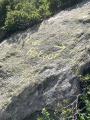
 Moderate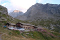
 Tourist office