Country:
 City:
City:



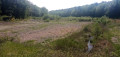

Start from the Chêne Creux car park in La Grange-aux-Bois, near the cemetery (hiking sign). From the D3 in La Grange-aux-Bois, follow the signs for the fitness trail.
Throughout the walk, follow the PR®9 “Route du Fau du Valmy”.
Markings: Yellow + Red and White
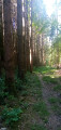
(S/E) Head east, follow a path through the woodland and ignore all turnings on the right.
(1) After about 400 m, turn left and walk past a handball stadium on your left. Continue along a track.
(2) Carefully cross the D3 diagonally to the right and take a stony path running parallel to the road.
(3) At the edge of the forest, turn left onto a grassy path. Enter the forest, ignore a path coming from the left and head gently downhill.
(4) At a fork in the road, keep to the right and descend more steeply along a sunken track. Cross a stream. Shortly afterwards, at a fork in the road, veer left (ignore a diversion on the right labelled ‘temporary’ but with no date). Cross a stream via a footbridge and immediately arrive at a three-way junction.
(5) Turn right here. At the next junction, turn right again. Head up a small valley along a track that still bears traces of forestry machinery (as of May 2025). Further on, a parallel path on the right-hand side offers an easier route. Shortly after passing a hut, you’ll reach a crossroads.
(6) Turn left towards Le Fau de Valmy, and take a path running alongside a wide grassy avenue (La Grande Tranchée).
(7) As you approach a track on the left-hand side, first turn right then left to join a path that winds through the undergrowth whilst remaining broadly parallel to the track.
(8) Cross a track (on the right, there’s the option of a round trip to the Fau de Valmy site). Continue along a winding path.
Yellow markings
(9) At a three-way junction, turn left. You’ll soon come out onto the track you saw earlier; follow it to the right. Pass a small hunting lodge, stay on the track and ignore all side paths.
(10) At the start of a gentle left-hand bend (plot no. 12), turn right onto a path that leads into the forest. At the first Fork in the road (not shown on the IGN map), keep left. The path gives way to a grassy track, then a trail through the grass.
Yellow + Blue and Yellow markings
(11) As you approach a fence, turn left, between plots no. 12 and no. 11, and head downhill. Further on, the path gives way to a track through a fir forest. A little further still, you’ll come to a path through deciduous woodland with a stream below on the right. As you approach the stream, head uphill and then back down again. Cross the stream and you’ll immediately reach a T-junction.
(12) Turn left here. Walk through the forest to the next T-junction.
Yellow markings
(13) Here, there are two options:
- For a shorter route of around 3 km, turn left towards La Grange-aux-Bois and rejoin the main route at (18).
- Otherwise, as shown on the map, turn right towards Étang de Florent. Walk westwards along a path, ignoring any offshoots to the right.
(14) Continue along the signposted path (the purple border intended to mark it on the IGN map has not been updated here). Further on, pass through a forest gate and continue along a track.
(15) You’ll come out onto a road; follow it carefully to the left. Cross a stream and take note of the shrubbery that has grown up since the pond was drained about ten years ago (according to information from a walker we met there).
(16) When the road bends to the right, turn left onto a shaded path. Cross a stream. At a Fork in the road, take the left-hand path. Walk alongside a cleared area on your left.
(17) You’ll come out onto a track; follow it to the left. Turn right with the track.
(18) Ignore a path coming from the left and continue along the track, which climbs slightly.
(19) At the Fork in the road shortly afterwards (sign and map), veer to the right. Pass through a metal gate and continue on level ground along a compacted track. Note a few private ponds below on the right.
(20) At the bottom of a short descent, turn right onto a grassy path. Cross a stream.
(21) At the fork in the road shortly afterwards, turn right and descend gently through the woodland. Ignore a footbridge on the right and head slightly uphill. Follow the marked path as it winds along, ignoring faint tracks on either side, and cross a stream. This brings you back to the three-way junction you passed at the start of the walk.
Markings: Yellow + Red and White
(5) Turn right and cross the stream one last time. Cross a small stream and head uphill through the woodland.
(4) Continue straight on and climb at a gentler gradient. At the top, turn left and emerge from the forest.
(3) Then take the path on the right that runs parallel to the D3.
(2) Cross the road carefully and continue along the track. Walk past the handball stadium on your right.
(1) Turn right and carry on straight ahead until you reach the Chêne Creux car park (S/E).


 Visorando Member

 Easy
Easy  Local authority