Circular walk around the castles and rocks in Wintzenheim, starting from the Chalet Adeif

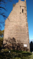
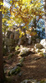
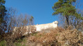
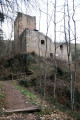
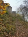
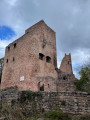
This walk offers a chance to take a break and soak up some history and culture. Set in a region renowned for its castles – particularly the Three Castles of Éguisheim – this area is well worth exploring. The entire walk takes place through a beautiful forest. In total, you’ll pass no fewer than six castles along the route. In addition to these, there are rock formations and a fountain. Those who enjoy rock formations will also be in for a treat with the Rocher Turenne, the Roche du Corbeau and the Rocher d’Ehrbergkopf.
The GPX track may prove very useful.

Details

49176214
Creation:
Last update:
Last review:
  • Walking
    Activity: Walking
  • ↔
    Distance: 11.03 mi
  • ◔
    Average duration: 7h 20 
  • ▲
    Difficulty: Moderate

  • ⚐
    Back to start: Yes
  • ↗
    Ascent: + 2,608 ft
  • ↘
    Descent: - 2,589 ft

  • ▲
    Highest point: 2,080 ft
  • ▼
    Lowest point: 906 ft
  • ⚐ Country: France
  • ⚐
  • ⚐ City: Wintzenheim (68920)
  • ⚑
    Start/End: N 48.063255° / E 7.28456°
  • Accessible from the train station Gare de St-Gilles-L (Haut-Rhin).
  • ❏
    IGN map(s): Ref. 3718OT, 3718OTR, 3719OT, 3719OTR
  • Hour-by-hour weather

Photos

Description of the walk

The route starts at the Chalet Adeif/Chapelle des Bois car park in Wintzenheim. Enjoy the stunning view over the Colmar region.

(S/E) Then take the only path that leads into the forest. At the junction, carry straight on to reach a track. Follow it to the left until you reach the junction with the next track.

(1) Follow it uphill. After a hairpin bend, leave a track on your left and follow the Red Cross signposting to the right until you reach the Hohlandsbourg car park. Take the second road on the right, which leads to the castle. Here, enjoy the view over the Alsace plain.

(2) Head down the winding path to the left of the viewpoint. When you reach the road, follow it straight ahead until the second bend. Here, you’ll find a very inconspicuous hunters’ track.

(3) Follow it to the left. To the right is the Roche du Corbeau, which you can climb. Keep an eye on the inconspicuous track and pass between the Roche du Corbeau on the right and another rocky peak on the left. You’ll reach a plateau. Then head left until you reach the path marked with a Yellow Rectangle crossed out in white. Continue to the right, cross the road and leave the Yellow Triangle path behind. At the next junction, continue to the right towards the Rocher de Ehrbergkopf.

(4) Continue along the path and keep to the right. Keep descending until you reach the hairpin bend in the road. Take the path leading down opposite, then turn left towards the Route des Cinq Châteaux.

(5) Head uphill, then take the first path on the right. Do the same when you reach the track. At the junction, continue uphill until you reach the Yellow Rectangle path.

(6) Follow it to the left, then cut across the track again to reach the pass near Pflixbourg Castle.

(7) Turn right to visit the castle.

(8) Return to the pass via the same route.

(7) Continue straight ahead. When you reach the road, follow it uphill to the hairpin bend. Leave the road and follow the track. Stay on this track until you reach the Fontaine de la Dame.

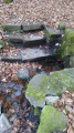
(9) The fountain is on the right, a little way down. From the entrance to the fountain, follow the steps to the left and ignore a junction to rejoin the Route des Cinq Châteaux. Keep to the right on the path and cut across a track. Rejoin the road further on and, here too, keep to the right. At the next junction, continue to the right and then right again to visit the Rocher Turenne. Take a moment to admire this distinctive geological formation.

(10) Return to the previous junction and head straight on to the right. Keep to the left all the way to the road: first turn left then right to join a track leading downhill. Further on, keep to the right and you’ll reach a clearing offering views of the Three Castles of Éguisheim.There is a bench here.

(11) Stay on the track. At the next bend, continue downhill straight ahead, then, staying at the same level, take the path on the right to the car park. Cross the car park and take the wide path leading to the castles on the left. At the junction, follow the narrowest path to reach the entrance to the castles.

(12) Then continue downhill and keep left at the crossroads. Reach the next one and turn left to cut across a track and arrive at the next one.

(13) Cut across the next track. At the junction with a stream, continue along the path opposite towards Hagueneck. Follow the path to where it ends at the track. Then turn right and then left onto the Red Diamond trail towards Hagueneck Castle. You’ll reach the castle after a short detour to the left. Don’t hesitate to climb up to the keep for a view of the region.

(14) Continue along the path and, at the track, turn right, then rejoin the path on the left. Cross another track and arrive at a road. Follow it straight on to the houses at Sainte-Gertrude.

(15) Follow the path that runs behind them. Take two hairpin bends, then at the third, turn right towards the Chapelle des Bois. When you reach the junction from the outward journey, turn right to return to the starting point:;S/E::.

Waypoints

  1. S/E : mi 0 - alt. 1,227 ft - Chalet Adeif
  2. 1 : mi 0.65 - alt. 1,601 ft - Crossroads of trails
  3. 2 : mi 1.34 - alt. 2,047 ft - Château de Hohlandsbourg
  4. 3 : mi 1.78 - alt. 1,749 ft - Hunters’ trail
  5. 4 : mi 2.42 - alt. 1,657 ft - Ehrbergkopf
  6. 5 : mi 3.31 - alt. 906 ft - Route des Cinq Châteaux
  7. 6 : mi 4.09 - alt. 1,178 ft - Yellow Rectangle Trail
  8. 7 : mi 4.34 - alt. 1,371 ft - Castle Pass
  9. 8 : mi 4.45 - alt. 1,470 ft - Château de Pflixbourg
  10. 9 : mi 5.77 - alt. 1,831 ft - Fontaine de la Dame
  11. 10 : mi 6.28 - alt. 2,080 ft - Turenne Rock
  12. 11 : mi 6.81 - alt. 1,857 ft - Path through the Three Castles of Éguisheim
  13. 12 : mi 7.77 - alt. 1,877 ft - Les trois châteaux
  14. 13 : mi 8.55 - alt. 1,411 ft - Trail
  15. 14 : mi 9.61 - alt. 1,398 ft - Château du Hagueneck
  16. 15 : mi 10.35 - alt. 1,168 ft - Ste-Gertrude
  17. S/E : mi 11.03 - alt. 1,227 ft - Chalet Adeif

Notes

Please note: there is a very faint path at (3) which looks more like hunters’ tracks. For those wishing to take an official route, follow the Yellow Rectangle on IGN maps.

YouTube video

Worth a visit

-(2) Hohlandsbourg
-(3) Roche du Corbeau
-(4) Rocher de Ehrbergkopf
-(8) Pflixbourg
-(9) Fontaine de la Dame
-(10) Rocher Turenne
-(11) Viewpoint over the Three Castles of Éguisheim
-(12) The Three Castles of Éguisheim
-(14) Hagueneck

Reviews and comments

4.1 / 5
Based on 4 reviews

Reliability of the description
4.3 / 5
Ease of following the route
3.3 / 5
Route interest
4.8 / 5
WILY68
WILY68

Overall rating : 5 / 5

Date of your route : Mar 09, 2026
Reliability of the description : ★★★★★ Very good
Ease of following the route : ★★★★★ Very good
Route interest : ★★★★★ Very good
Very busy route : No

A very beautiful route for discovering or rediscovering the area. However, the number of kilometres and elevation gain is greater than stated. Nevertheless, it is a beautiful and pleasant hike, mostly through forest.

Machine-translated

gilberlou
gilberlou

Overall rating : 4.3 / 5

Date of your route : Dec 12, 2025
Reliability of the description : ★★★★☆ Good
Ease of following the route : ★★★★☆ Good
Route interest : ★★★★★ Very good
Very busy route : No

A beautiful hike with castles as the highlight, which makes the outing even more enjoyable. There was some hunting going on that day, so caution is advised. The only downside is that I don't understand why the distance displayed is much shorter than the actual distance, and the elevation gain is also lower. This is annoying, especially when the days are short.

Machine-translated

PHKE
PHKE

Overall rating : 3 / 5

Date of your route : Dec 17, 2024
Reliability of the description : ★★★★☆ Good
Ease of following the route : ★☆☆☆☆ Very disappointing
Route interest : ★★★★☆ Good
Very busy route : Yes

Paths that aren’t shown on the map, so you have to cut through the woods.
I find that the app isn’t accurate enough and isn’t very reliable.

Machine-translated

virgule
virgule

Hello,

However, the increasing number of footpaths along the route means you need to pay particular attention so as not to lose your way.

I completely agree with you. There was talk of removing the signposts from certain paths to let nature take its course, but that’s not on the cards in this area.

Machine-translated

Nature57
Nature57
• Edited:

Overall rating : 4 / 5

Date of your route : Jun 29, 2024
Reliability of the description : ★★★★☆ Good
Ease of following the route : ★★★☆☆ Average
Route interest : ★★★★★ Very good
Very busy route : No

A lovely, long walk through a vast forest (particularly pleasant in hot weather), offering the chance to explore the ruins of several castles in this part of Alsace. The geological features along the way are also interesting. The views over the Alsace plain and the town of Colmar are magnificent. However, the multitude of footpaths along the route means you need to pay close attention to ensure you stay on the right track. A GPS app is a significant advantage, if not essential.

Machine-translated

virgule
virgule

Hello,

the region is indeed famous for its castles, and it’s ideal for walking. I’d recommend doing this route whilst the ‘Route des Cinq Châteaux’ is closed (from 15 November to 15 March), as during the tourist season, the three castles in Eguisheim are so crowded you’d think you were at Disneyland.

Machine-translated

Other walks in the area

For more walks, use our search engine .

The GPS track and description are the property of this route's author. Please do not copy them without permission.