Tuckheim – Ribeauvillé

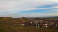
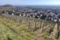
Viticulture is an integral part of the Alsatian landscape. There is even a route named after it. This route is the third stage of the vineyard trail and links Turckheim to Ribeauvillé. There are numerous vantage points, indeed they are almost everywhere outside the villages. The villages themselves are very traditional, with pretty half-timbered houses, and possess an undeniable charm. The region’s heritage is equally well represented.

This walk is part of a multi-day hike: La traversée des vignes d'Alsace

Details

n°64885715
Creation:
Last update:
Last review:
  • Walking
    Activity: Walking
  • ↔
    Distance: 13.70 mi
  • ◔
    Average duration: 7h 45 
  • ▲
    Difficulty: Difficult

  • ⚐
    Back to start: No
  • ↗
    Ascent: + 1,703 ft
  • ↘
    Descent: - 1,716 ft

  • ▲
    Highest point: 1,247 ft
  • ▼
    Lowest point: 764 ft
  • ⚐ Country: France
  • ⚐
  • ⚐ City: Turckheim (68230)
  • ⚑
    Start: N 48.085824° / E 7.279764°
  • ⚑
    End: N 48.191822° / E 7.325779°
  • Accessible from the train station Gare de Ribeauville-Gare-Routiè.
  • ❏
    IGN map(s): Ref. 3617ET, 3617ETR, 3718OT, 3718OTR
  • Hour-by-hour weather

Description of the walk

The route starts at the Turckheim railway station.

Signposted with the Green Saltire

(S) With your back to the station, turn right towards Route de Wintzenheim and cross the Fecht before heading left along Place de la République. Continue to the street on the other side of the square.

(1) Turn right and pass under a tower to reach the junction by the tourist office. Head straight on towards the town hall. Carry on to the end of Rue du Conseil, where you’ll find a care home.

(2) Turn right and walk alongside it until you reach the Porte de Brand. Go under it, then keep left until you reach the bend.

(3) Take the path on the right. A few signs explain the history of winegrowing in Turckheim. At the end of the path, continue left onto a road, then head uphill to the right through the vineyards. Carry on straight ahead until you reach the pass.

Yellow Triangle markings

(4) Keep going straight ahead, then turn right. Continue in this direction until you reach Niedermorschwihr and the D10.7.

(5) Turn left towards the church. Go round it on the left to take a path leading to the main road. Follow it to the right until you reach the third street on the left.

(6) Take this, cross the Weidbach and then keep to the right. At the Fork in the road, head uphill and continue to the next hairpin bend.

(7) Keep straight ahead. As you enter the woods, turn right and head downhill to Rue des Trois Épis in Katzenthal.

(8) Turn right.

No signposting

First turn left then right to rejoin the Grande Rue.

Château signposting

Head down to the church.

(9) Take the street between the town hall and the church. Then turn right, followed by a left-hand turn leading to the Chemin du Riesling.

(10) Stay on the track to the right. When you reach the road again, carry on straight ahead. Go past the junction with a statue and follow the path to the tarmac road on the left.

(11) Go uphill and then keep to the right. Continue straight ahead until you can go no further.

(12) First turn right then left, and enter Ammerschwihr. Carry straight on twice.

No signposts

Then, at the third set of straight-ahead junctions, keep right onto a path until it ends at Rue de la Cinquième Division Blindée.

(13) Turn left. Pass the square in front of the town hall (on the left) and continue to the next junction. Go up the street to the second junction. Keep right until you reach the church.

(14) Return to the previous junction and turn right, then left along the Walbach until you reach Rue du Sandbach (at the end).

Blue Disc signposting

(15) Follow the path leading uphill to the right. Continue straight on, uphill, until you reach the entrance to the forest.

(16) Keep to the right at all times to reach the D415.

Blue Cross signposting

Cross the road with care. Turn left, then right to reach the cemetery.

No signposting

(17) Walk up the street between the cemetery and the Weiss. Continue to a footbridge on the right, then carry on to the second bridge. Head towards the second bridge, then turn immediately left until you reach the next bridge.

(18) Cross to the other side of the river and walk down the street to the town hall.

(19) Turn left twice.

Red Ring signposting

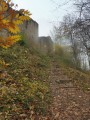
Turn left towards the castle and climb to the top of the tower to admire the 360° panoramic view.

No signposting

(20) With your back to the castle, take the dirt track that starts on the right. You’ll come to a crossroads.

Green Saltire signposting

Carry on straight ahead until you can go no further.

(21) Keep climbing to the left. Take a bend and leave the track on the left to continue on level ground. At the junction, head downhill and join the road.

(22) Head uphill. At the next Fork in the road, take the path on the left, then keep to the right and rejoin the road, heading uphill to the pass.

(23) Take the track on the left. Keep going straight on until you reach Ricquewihr. When you reach the first houses, keep to the right until you reach Rue de la Tuilerie.

Unmarked

(24) Head straight ahead onto a track, then keep left. Further on, head down to the right until you reach the town entrance (town hall on the left).

(25) Go underneath it and head back up to the belfry, on the other side of the village.

Green Saltire signposting

(26) Turn right, climb one final hill and continue to a junction.

No signposting

(27) Keep to the right, following the vineyards. Carry on until you start the descent. You’ll reach the second path on the left.

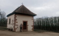
(28) Take this path and cut across a track. Then carry on straight ahead all the way to Hunawihr. On arriving in the village, visit the fortified church on the right.

(29) Return to the previous junction and head straight on. At the fountain, turn right, then take the first street on the left. Keep right at the Fork in the road, then you’ll reach a junction with Rue du Rosacker.

(30) Carry on to the left to leave Hunawihr. Pass a junction and you’ll reach a track.

(31) Turn right onto it. At the road, first turn right then left to head straight on to the next junction.

(32) Carry on to the right, then left and right again onto a tarmac road. Follow it down to the departmental road.

(33) First turn left then right to reach Ribeauvillé coach station (E).

Waypoints

  1. S : mi 0 - alt. 778 ft - Gare de Turckheim
  2. 1 : mi 0.1 - alt. 781 ft - Place de la République - Source de la Fecht
  3. 2 : mi 0.3 - alt. 784 ft - Care home
  4. 3 : mi 0.44 - alt. 804 ft - Virage
  5. 4 : mi 0.93 - alt. 1,076 ft - Col
  6. 5 : mi 1.25 - alt. 1,007 ft - D10.7
  7. 6 : mi 1.49 - alt. 981 ft - Turn left onto the street
  8. 7 : mi 1.99 - alt. 1,056 ft - Lacet
  9. 8 : mi 2.63 - alt. 938 ft - Rue des Trois-Épis
  10. 9 : mi 2.88 - alt. 876 ft - Church
  11. 10 : mi 3 - alt. 879 ft - Riesling Trail
  12. 11 : mi 3.67 - alt. 804 ft - Path on the left
  13. 12 : mi 4.14 - alt. 791 ft - Junction
  14. 13 : mi 4.46 - alt. 771 ft - Rue de la 5e Division Blindée
  15. 14 : mi 4.74 - alt. 784 ft - Church
  16. 15 : mi 4.99 - alt. 810 ft - End of the street
  17. 16 : mi 5.46 - alt. 968 ft - Entrance to the forest
  18. 17 : mi 6.1 - alt. 804 ft - Cemetery - Weiss (rivière)
  19. 18 : mi 6.52 - alt. 820 ft - Bridge over the - Weiss (rivière)
  20. 19 : mi 6.75 - alt. 810 ft - Town Hall Square
  21. 20 : mi 6.96 - alt. 971 ft - Château de Kaysersberg
  22. 21 : mi 7.59 - alt. 919 ft - End of the trail
  23. 22 : mi 8.53 - alt. 889 ft - Route de Kientzheim
  24. 23 : mi 9.03 - alt. 1,086 ft - Col
  25. 24 : mi 10.06 - alt. 1,037 ft - Riquewihr, Rue de la Tuilerie
  26. 25 : mi 10.47 - alt. 945 ft - Entrance to Riquewihr, town hall
  27. 26 : mi 10.73 - alt. 1,033 ft - Belfry
  28. 27 : mi 10.98 - alt. 1,161 ft - Junction
  29. 28 : mi 11.54 - alt. 1,125 ft - Path on the left
  30. 29 : mi 12.18 - alt. 928 ft - Église Saint-Jacques le Majeur (Hunawihr)
  31. 30 : mi 12.44 - alt. 869 ft - Rue du Rosacker
  32. 31 : mi 12.61 - alt. 909 ft - Trail
  33. 32 : mi 13.1 - alt. 971 ft - Junction
  34. 33 : mi 13.58 - alt. 807 ft - Departmental road
  35. E : mi 13.7 - alt. 784 ft - Ribeauvillé coach station

Notes

Many winegrowers are present along the route. Make sure you have some extra change if you wish to buy wine. Here are the wine merchants and estates you’ll encounter in order along the walk:

-Niedermorschwir: Justin Boxler, Laurent JM et Fils, Domaine La Rogerie, Mullenbach, Domaine de l’Oriel, J-B Weinzorn.

-Katzenthal: Jean Paul Ecklé, Domaine Meyer-Fonné, Bernhard J Marc, Vincent Spannagel, Domaine Henri Klée, Domaine Michel and Jean-Luc Stoecklé, Paul Spannagel.

-Ammerschwihr: Kaefferkopf Albert Bohn, Habold Lucien and Sons, Kuehn, Jean Marc Simonis, Marcel Lichtle and Sons, Schiele Paul and Denis, Domaine du Sonnenberg.

-Kaysersberg: Caveau du Viticulteur.

-Riquewihr: Mittnacht Klack, Charles Sparr, Anne-Catherine and Jean-Luc Bucher, Grands Vignerons Dopff and Rion, Domaine Jung Gustave and Sons, Bernard Schwach, Hugel, Maison Zimmen, SJ Fritsch and Sons.

-Hunawihr: Caves Mallo, Laurent Bucher.

-Ribeauvillé: L’Or du Terroir, Cave de Ribeauvillé (E).

Toilets are available in Kaysersberg and Riquewihr.

Worth a visit

-Visit Turckheim (between (S) and (3)), Niedermorschwihr (between (5) and (6)), Ammerschwihr (between (12) and (15)), Kaysersberg (between (17) and (20)).
-Castles, towers, gates and fortifications: Turckheim (3), Kaysersberg (20), Ammerschihr, Riquewihr (25) and (26), the fortified church at Hunawihr (29).
-Churches: Turckheim, Niedermorscwihr, Ammerschihr (14), Kaysersberg, Hunawihr (29).
-Museum on the Colmar Pocket in Turckheim.
-Enjoy the many panoramic views.

Reviews and comments

5 / 5
Based on 1 review

Reliability of the description
5 / 5
Ease of following the route
5 / 5
Route interest
5 / 5
strecker JY
strecker JY

Overall rating : 5 / 5

Date of your route : Oct 20, 2025
Reliability of the description : ★★★★★ Very good
Ease of following the route : ★★★★★ Very good
Route interest : ★★★★★ Very good
Very busy route : No

I did this hike from south to north, Turkheim to Ribeauvillé, unfortunately with a cool north wind. It would have been better if I had checked the weather forecast and done it in the opposite direction. It's very convenient to take the train or bus at each end, which is what I did: the Strasbourg-Turckheim train on the way there and the bus to Sélestat on the way back, then the Sélestat-Strasbourg train. A good route.

Machine-translated

Other walks in the area

For more walks, use our search engine .

The GPS track and description are the property of this route's author. Please do not copy them without permission.