Country:

 City:
City:


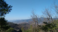
Start in Turckheim, at the station quay. Coming from Colmar, turn left immediately after the railway line and before the bridge over the River Fecht, heading towards Camping Le Médiéval; park alongside the stadium after the tennis courts.
(You can also start from the agricultural college car park if you wish to avoid Turckheim and the roadside area).
(S/E) Continue along the road beside the Fecht, then turn left at the next junction. Walk past the ‘Espace rive droite’ hall until you reach the wayside cross.
(1) Take the path running between the gardens, marked with a Yellow Rectangle (GR®® 532), towards Saint Gilles.
Cross the railway line, turn right, then carry on straight ahead, still following the Yellow Rectangle markings. When you reach the RD417 departmental road, turn left then immediately right, passing through the agricultural college car park, following the Yellow Rectangle markings towards Pflixbourg. As you leave the car park, continue right onto the road and head for the junction with the Route des Cinq Châteaux.
(2) Turn left onto this road to reach a house near Saint-Gilles.
(3) Turn left uphill to enter the forest, following the Red Diamond markings towards Ehrbergkopf. You’ll rejoin the Route des Cinq Châteaux at a sharp bend.
(4) Immediately turn right up the path marked with a Yellow Triangle, heading towards Ehrbergkopf and Hohlandsbourg.
N.B.: The IGN ‘paper’ map shows yellow-white-yellow Yellow Rectangles, which have been changed on the ground to Yellow Triangles; in some places, the old markings can still be seen.
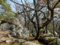
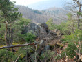
The path winds its way up, then follows the ridge, passing by the Ehrbergkopf Rocks.
(5) On the descent, at a junction, turn left, still following the Yellow Triangle markings, towards Hohlandsbourg and the Meyer Monument. Cross a forest track, veer slightly to the left, then take the path on the right, marked with a Blue Cross. After a few metres, ignore the markings and continue along the path on the right, running below the road. You’ll reach the Route des Cinq Châteaux (car park) at the foot of Hohlandsbourg.
(6) Follow the path opposite which climbs up to the castle, marked with a Yellow Rectangle. Take the path marked with a Yellow Circle on the right, a circular walk around Hohlandsbourg Castle, to the large square in front of the entrance, offering a lovely view of Colmar and the plain.
(7) Return to the Yellow Rectangle markings and take the road downhill (you can make a round trip to a viewpoint, a 10-minute walk away).
(8) At the hairpin bend, leave the road and follow the Sentier de l’Écureuil to the right. Further on, ignore the Yellow Rectangle signpost on the left and continue to the right towards the Fontaine de la Dame.
(9) When you reach a forest track, turn right and take a short round trip to the fountain (picnic spot). Then continue down the forest track, following the Red Triangle signposting, towards Pflixbourg. Further on, leave the track to follow the Yellow Rectangle signposting (GR®®532) towards Pflixbourg, until you reach the junction with the path leading to the castle.
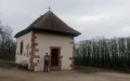
(10) Turn left to reach and visit Pflixbourg Castle.
(11) Return to the previous junction.
(10) Carry on to the left, following the Yellow Rectangle markings towards Gare Saint-Gilles. Further down, follow the Blue Triangle markings towards Saint-Gilles and the Petit Sentier des Roches. After this unspoilt path, rejoin the Yellow Rectangle markings and continue downhill to the Saint-Gilles road.
(12) Continue along this road to the right, passing greenhouses and then the football pitch. You’ll reach the start of the ‘Route forestière des Cinq Châteaux’ and the agricultural college.
(2) Follow the same route as on the way there back to the starting point (S/E).





 Visorando Member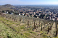

 Difficult
  Easy
Easy