Country:

 City:
City:


On the Prads track, at Heyre, 500 m before Heyre, park in the ‘Les Handicapés’ car park, easily recognisable by the three larch trees on the right and the steep track leading uphill to the left – the only one from the junction with the Tercier track. You can also reach this point on foot or by mountain bike via thePR® ‘Tour du Carton’ trail.
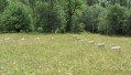
(S/E) Take the track that branches off to the left, heading straight towards the mountain at first, up a short steep section, then turning right to climb more gently. Follow this track to a level stretch (Clot Mégi), the start of the hidden plateau.
(1) Continue along the track, which makes a sharp bend to the left and heads back northwards, climbing a little further before following the contour line. As you pass a murky spring, look out for deer tracks. When red and green markings become visible, there is a beautiful panorama to the left, over Blégiers, Heyre and as far as Mont Ventoux.
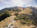
(2) At the bend in the ridge leading to the Crête du Carton (red markings – do not follow these), you’ll emerge onto the stony plateau of La Gourre. Follow the green markers and cairns along a faintly marked path (stony ground) through alpine vegetation.
From this point onwards, this is chamois territory. A few may appear as the path winds round bends, particularly early in the morning and at dusk. During the day, they are higher up, amongst the large scree slopes. The best spot for spotting them is a large rock in a clearing, topped by a cairn.
The path remains level until an exposed hillock comes into view in the middle of the slope, to the left and below. Descend through the scree, taking care to follow the cairns and Green Circles closely. Then leave the scree behind and enter the forest; a well-marked path descends towards the Prads-Heyre track, which you’ll join at the Col de la Ruine.
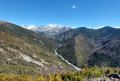
(3) Cross this track and climb to the summit opposite, from where there is a fine view over the upper Bléone Valley and the Estrop.
Follow the ridge downwards, taking care not to enter the forest. Walk along the edge of the forest on the left until you reach a well-marked descending path.
Follow this until you reach thePR® Tour du Carton path, which you should take to the left: there’s a lovely panoramic view of Notre-Dame des Anges, a restored hamlet and a sheepfold. Return to the track and follow it to the right to reach the starting point (S/E).

 .
.
 Visorando Member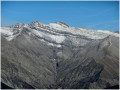
 Difficult
 Moderate
 Very difficult