All in Cardboard

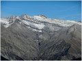
A well-marked route allowing you to explore the magnificent Crête du Carton, ascending via the north-west ridge and descending via the Col de la Baisse and Col de la Colle passes.

Details

n°10764877
Creation:
Last update:
Last review:
  • Walking
    Activity: Walking
  • ↔
    Distance: 8.90 mi
  • ◔
    Average duration: 7h 00 
  • ▲
    Difficulty: Difficult

  • ⚐
    Back to start: Yes
  • ↗
    Ascent: + 3,310 ft
  • ↘
    Descent: - 3,323 ft

  • ▲
    Highest point: 6,962 ft
  • ▼
    Lowest point: 3,970 ft

Photos

Description of the walk

Park in the village of Heyre.

(S/E) From the village, follow the track towards Prads as far as the hamlet known as “Les Handicapés”, easily recognisable by the three larch trees on the left and the steep track leading up to the right – the only one from the village of Heyre. It is also possible to reach this point, on foot or by mountain bike, via thePR® “Tour du Carton” trail.

(1) Take the track branching off to the right, initially heading straight towards the mountain up a short, steep slope, then turning right to climb more gently. Follow this track to a flat area (Clot Mégi), the start of the hidden plateau.
Continue along the track, which takes a sharp bend to the left and heads back northwards, climbing a little further before following the contour line. As you pass a murky spring, look out for deer tracks. When red and green markings become visible, there’s a beautiful panoramic view to the left, over Blégiers, Heyre and as far as Mont Ventoux.

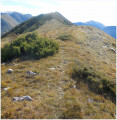
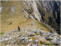
(2) As you round the ridge, follow the red markings on the right as they climb steeply, first to a flat outcrop, then across a scree slope, then through the forest (admire the two laburnums on the left), along the ridge and finally along the edge of a meadow, up to the crest. A steep and at times slightly exposed climb. Where the slopes change, there are frequent opportunities to spot chamois. (Red markings).

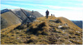
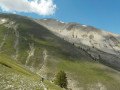
(3) Follow the long ridge to the successive summits (a magnificent and varied panorama, dotted with larch trees, typical of the ‘Roof of the World of Haute Provence’, as Alexandra David-Neel and Pierre Magnan described it), then continue downhill to the Col de la Baisse.
Just before the pass, join a well-marked path below on the right.

(4) Follow thePR® Tour du Carton to the right until you reach the junction with a track (yellow markings).

(5) From here, you can continue along thePR® Tour du Carton, but this adds to the distance and involves a descent followed by an ascent. It is easier to follow the track to the right, which roughly follows the contour lines.

(6) Join thePR® Tour du Carton (yellow markings) again, and cross the Col de la Colle, where there used to be an abandoned village following an avalanche. Shortly afterwards, turn left – don’t forget to stop for a drink at the spring marked on the left – then turn right. The path climbs up past some water channels, then descends back to the starting point (S/E).

Waypoints

  1. S/E : mi 0 - alt. 3,993 ft - The village of Heyre
  2. 1 : mi 0.37 - alt. 4,108 ft - People with disabilities
  3. 2 : mi 1.61 - alt. 4,646 ft - La Gourre
  4. 3 : mi 2.26 - alt. 6,257 ft - The Carton ridge and pasture
  5. 4 : mi 4.59 - alt. 5,725 ft - The Col de la Baisse
  6. 5 : mi 5.81 - alt. 4,619 ft - Track above Chavailles
  7. 6 : mi 6.77 - alt. 4,636 ft - Track above La Combe
  8. S/E : mi 8.9 - alt. 3,993 ft - The village of Heyre

Notes

Make sure you have good walking shoes, plenty of water and something to eat. Apart from in summer, the ridge may be snow-covered. Avoid this route during thunderstorms, as there is a risk of lightning on the ridge.

Worth a visit

A ‘carton’ was traditionally a quarter-log used to support round roof tiles. This is where the mountain gets its name, as the village of Heyre has always been covered with Provençal roofs featuring Romanesque tiles.

It is also possible to walk along the Carton ridge starting from Tercier.
Head to the point (4) via thePR® Tour du Carton and follow the ridge in the opposite direction.
However, the descent from the point (3) to the relay mast, where you join a track leading down to Tercier, is poorly marked and extremely overgrown.

Always be cautious and plan ahead when you're outdoors. Visorando and the author of this route cannot be held responsible for any accidents occurring on this route.

The GR® and PR® markings are the intellectual property of the Fédération Française de Randonnée Pédestre.

Reviews and comments

4.3 / 5
Based on 2 reviews

Reliability of the description
4 / 5
Ease of following the route
4 / 5
Route interest
5 / 5
ag13
ag13

It’s true that the climb is tough and, in places, dizzying. But Visorando rates the difficulty more on the basis of the length of the walk and the elevation gain.

Machine-translated

pferney
pferney
• Edited:

Overall rating : 3.7 / 5

Date of your route : Sep 04, 2022
Reliability of the description : ★★★☆☆ Average
Ease of following the route : ★★★☆☆ Average
Route interest : ★★★★★ Very good
Very busy route : No

In my opinion, the difficulty of the hike is underestimated. It’s at least a black-rated route.

The climb from point 2 to 3 is very challenging and at times very steep (almost like rock climbing). This section is signposted, but it’s quite easy to get lost. As for the section between Tercier and point 3, which we wanted to take to shorten the route, it’s dangerous in places because it’s very poorly marked. At times, you’re walking along a sheer ridge. We had to turn back.

It’s a shame, as the view over the Bléone is magnificent.

Machine-translated

mimibob04
mimibob04

Overall rating : 5 / 5

Date of your route : Oct 09, 2020
Reliability of the description : ★★★★★ Very good
Ease of following the route : ★★★★★ Very good
Route interest : ★★★★★ Very good
Very busy route : No

We went on this lovely walk starting from Prads Haute Bléone. The ridge walk is magnificent and offers views of the surrounding peaks: Montagne de Boule, l’Estrop, le Mourre Frey, le Cheval Blanc, the ridges of La Reynière, le Blayeul, etc. It’s a relatively quiet walk, particularly from Prads (16 km with 1,123 m of elevation gain)
http://www.lescopainsrandonneurs04.fr/14...
Thank you for this lovely route; see you soon on the trails...

Machine-translated

Other walks in the area

For more walks, use our search engine .

The GPS track and description are the property of this route's author. Please do not copy them without permission.