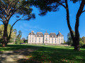
Saint-Cricq-de-Chalosse circular loop

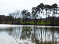
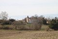
Circular route taking in the village, woods, fields, a pond and castles.

Details

1127757
Creation:
Last update:
Last review:
  • Walking
    Activity: Walking
  • ↔
    Distance: 5.57 mi
  • ◔
    Average duration: 3h 00 
  • ▲
    Difficulty: Easy

  • ⚐
    Back to start: Yes
  • ↗
    Ascent: + 499 ft
  • ↘
    Descent: - 522 ft

  • ▲
    Highest point: 417 ft
  • ▼
    Lowest point: 210 ft

Photos

Description of the walk

Park your car in the square near the sports hall on Allée du Château.

(S/E) Start behind Saint-Cricq Castle.
Go past the back of the bullring and turn right onto Allée Jean Lafitte until you reach the water tower.

(1) Take the Chemin de Pebastat on the right until you reach the hamlet of Bastiaton.

(2) Continue straight ahead along the path, then turn left onto a shaded dirt track. You’ll reach thePR® junction at the edge of the woods.

(3) Take the next dirt track on the left which runs along the edge of the woods and follow it straight on until you reach the junction with the Gaujacq road (D326).

(4) Follow this tarmac road, pass through Bernadon, staying on the road, and reach the crossroads at the hamlet of Sébé.

(5) Turn right onto Chemin de Herrères and follow it straight on until you reach the Pétastet junction.

(6) Turn sharply, then continue straight on to the pond; once there, follow the bank to the left until you reach the end

(7) Leave the pond and take the path leading up to Château de Lataulade.

(8) Take the path on the right to Le Cassou. Continue along the path on the right, passing through Bordes.
Keep heading south to reach the crossroads at the edge of the woods.

(3) Turn left to reach Saint-Cricq via the Chemin de la Ramée and return to the starting car park (S/E).


Waypoints

  1. S/E : mi 0 - alt. 397 ft - Square near the sports hall Allée du Château
  2. 1 : mi 0.24 - alt. 413 ft - Water tower
  3. 2 : mi 0.59 - alt. 404 ft - Bastiaton hamlet
  4. 3 : mi 0.91 - alt. 246 ft - Edge of the woods
  5. 4 : mi 1.6 - alt. 404 ft - Route de Gaujacq (D326)
  6. 5 : mi 2.29 - alt. 364 ft - Chemin de Herrères junction
  7. 6 : mi 3.31 - alt. 289 ft - Sharp right-hand bend
  8. 7 : mi 3.9 - alt. 223 ft - End of the pond
  9. 8 : mi 4.42 - alt. 374 ft - Lataulade Castle
  10. S/E : mi 5.57 - alt. 394 ft - Square near the sports hall Allée du Château

Worth a visit

Always be cautious and plan ahead when you're outdoors. Visorando and the author of this route cannot be held responsible for any accidents occurring on this route.

The GR® and PR® markings are the intellectual property of the Fédération Française de Randonnée Pédestre.

Reviews and comments

4.5 / 5
Based on 4 reviews

Reliability of the description
5 / 5
Ease of following the route
4.3 / 5
Route interest
4.3 / 5
papitof
papitof

Overall rating : 4.3 / 5

Date of your route : Aug 21, 2024
Reliability of the description : ★★★★★ Very good
Ease of following the route : ★★★★☆ Good
Route interest : ★★★★☆ Good
Very busy route : No

The perfect walk for exploring the area

Machine-translated

skargo
skargo

Overall rating : 4.7 / 5

Date of your route : Feb 20, 2024
Reliability of the description : ★★★★★ Very good
Ease of following the route : ★★★★★ Very good
Route interest : ★★★★☆ Good
Very busy route : Yes

A walk in the sunshine, but there’s still water on the path
Skargomically

Machine-translated

chantal64000
chantal64000

Overall rating : 5 / 5

Date of your route : Jul 12, 2020
Reliability of the description : ★★★★★ Very good
Ease of following the route : ★★★★★ Very good
Route interest : ★★★★★ Very good
Very busy route : No

There is already a 5 km route, and the 10 km route was marked out as well

Machine-translated

ylj
ylj

Hello,
Was it at point 79 or 86 (IGN map) that you had the problem?

Machine-translated

MVac44
MVac44

Overall rating : 4 / 5

Date of your route : Aug 27, 2018
Reliability of the description : ★★★★★ Very good
Ease of following the route : ★★★☆☆ Average
Route interest : ★★★★☆ Good

A missed right turn in the Landes de Herrière area. It might be worth adding a marker

Machine-translated

Other walks in the area

For more walks, use our search engine .

The GPS track and description are the property of this route's author. Please do not copy them without permission.