Route de Gachon à Brassempouy

A very short circular route, mainly on country lanes, offering magnificent views and passing through a mosaic of landscapes.

Details

466807
Creation:
Last update:
Last review:
  • Walking
    Activity: Walking
  • ↔
    Distance: 2.20 mi
  • ◔
    Average duration: 1h 10 
  • ▲
    Difficulty: Easy

  • ⚐
    Back to start: Yes
  • ↗
    Ascent: + 213 ft
  • ↘
    Descent: - 213 ft

  • ▲
    Highest point: 410 ft
  • ▼
    Lowest point: 167 ft

Description of the walk

Parking opposite the community centre.

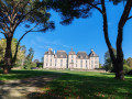
(S/E) Start at the bus stop. Head towards the village centre and admire the beautiful buildings of Brassempouy, as well as its church, which is notable for its stone roof. Look out for a sundial to the left of the church.

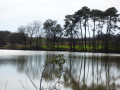
(1) After the church, take a small path on the right that looks like a private road (Chemin de Labache); don’t hesitate. Then turn right opposite the poultry farm and, after about a hundred metres (keep to the left), join a pleasant little wooded path on the right. Pass close to a small lake. Ignore two paths branching off to the right.

(2) Turn right onto the stony path that climbs up the hillside. This path leads to the Gachon farm, where you rejoin a tarmac road.

(3) Join the main road (take care) on the right and follow the main street of Brassempouy to the community centre (S/E).

Waypoints

  1. S/E : mi 0 - alt. 381 ft - Village hall/bus park
  2. 1 : mi 0.14 - alt. 407 ft - Junction, small path looking like a private road
  3. 2 : mi 1.23 - alt. 167 ft - Junction with a stony track
  4. 3 : mi 1.85 - alt. 344 ft - Junction with the A-road
  5. S/E : mi 2.2 - alt. 381 ft - Village hall/bus park

Notes

Blue markings, small markers on plaques.

Reviews and comments

4.1 / 5
Based on 5 reviews

Reliability of the description
4.8 / 5
Ease of following the route
4.4 / 5
Route interest
3.2 / 5
Coutand jo
Coutand jo

Overall rating : 5 / 5

Date of your route : Sep 16, 2024
Reliability of the description : ★★★★★ Very good
Ease of following the route : ★★★★★ Very good
Route interest : ★★★★★ Very good
Very busy route : No

A lovely little walk along a shaded path, with views of the Pyrenees. Good

Machine-translated

Pantxica
Pantxica

Overall rating : 3.7 / 5

Date of your route : Mar 25, 2024
Reliability of the description : ★★★★★ Very good
Ease of following the route : ★★★★☆ Good
Route interest : ★★☆☆☆ Disappointing
Very busy route : No

A very easy route, apart from a muddy path, but otherwise uninteresting, except for the village and its few pretty houses

Machine-translated

DDucasse
DDucasse

Overall rating : 3.3 / 5

Date of your route : May 15, 2023
Reliability of the description : ★★★★☆ Good
Ease of following the route : ★★★☆☆ Average
Route interest : ★★★☆☆ Average
Very busy route : No

A short walk with points of interest at the start, particularly the village. There are blue signposts (C D) which may conflict with the directions on Visorando. Beautiful views

Machine-translated

mimine40
mimine40

Overall rating : 4 / 5

Date of your route : Sep 12, 2021
Reliability of the description : ★★★★★ Very good
Ease of following the route : ★★★★★ Very good
Route interest : ★★☆☆☆ Disappointing
Very busy route : Yes

Hello,

I chose this route for its length (a gentle stroll after a good meal), the commentary and its gentle gradient.
However, we were disappointed because, whilst the very first part is pleasant, with its little shaded sunken path, most of the route is on a path in full sun, with little to offer, and the climb leads onto a tarmac road to return to the village.
So, I’m rather mixed in my feelings and a bit disappointed. Fortunately, the village is pretty and the houses are interesting.

Kind regards,
Nadine Castillon

Machine-translated

pimca
pimca

Overall rating : 4.7 / 5

Date of your route : Mar 19, 2018
Reliability of the description : ★★★★★ Very good
Ease of following the route : ★★★★★ Very good
Route interest : ★★★★☆ Good

A short, easy but pleasant walk

Machine-translated

Other walks in the area

For more walks, use our search engine .

The GPS track and description are the property of this route's author. Please do not copy them without permission.