Route of the Ruisseau des Landes from Andriaou to Amadou

A pleasant route, alternating between secondary roads and farm tracks, offering a lovely exploration of the Luy de Béarn agricultural plain.

Details

466795
Creation:
Last update:
Last review:
  • Walking
    Activity: Walking
  • ↔
    Distance: 4.23 mi
  • ◔
    Average duration: 2h 00 
  • ▲
    Difficulty: Easy

  • ⚐
    Back to start: Yes
  • ↗
    Ascent: + 98 ft
  • ↘
    Descent: - 98 ft

  • ▲
    Highest point: 246 ft
  • ▼
    Lowest point: 138 ft
  • ⚐ Country: France
  • ⚐ City: Amou (40330)
  • ⚑
    Start/End: N 43.592377° / W 0.747783°
  • Hour-by-hour weather

Description of the walk

Blue ‘balisette’ markings on signs.
Parking is available in the Place de Técouère car park, near the fronton. The route starts at the corner of the square, near the information point.

(S/E) From Place Técouère, take Rue Técouère towards the sports hall to reach the stadium.

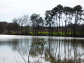
(1) Before reaching the stadium, turn right onto the fitness trail, which leads to a footbridge crossing the Luy de Béarn. Take in the lush woodland forming a canopy of trees above the river.

(2) The route branches off to the left near the fruit cooperative and follows the Luy for two kilometres, through farmland. The open-field landscape is set against a backdrop of distant hillsides.

(3) Cross the D15 with care and continue along the path opposite. At the first junction, turn right towards the Piraout neighbourhood (watch out for the dog).

(4) At the fork in the road, continue straight ahead. The route alternates between cultivated fields and copses.

(5) After the Landes d’Andriou stream, at a place called Treytin, turn right to rejoin the tarmac road on your right, which leads back to the village of Amou.

(6) At the large roundabout, carry on straight ahead to cross the Luy. Crossing the Luy de Béarn near the bullring offers a lovely view of the river and its well-tended banks. Reach the opposite bank and the starting point (S/E).

Waypoints

  1. S/E : mi 0 - alt. 148 ft - Information Point, Place Técouère
  2. 1 : mi 0.32 - alt. 144 ft - On the right, before the stadium, head towards the footbridge over the - Luy de Béarn (rivière)
  3. 2 : mi 0.54 - alt. 144 ft - Fruit cooperative
  4. 3 : mi 1.89 - alt. 171 ft - Crossing the D15 at Biernabe
  5. 4 : mi 2.24 - alt. 184 ft - Opposite, at La Fouche
  6. 5 : mi 3.18 - alt. 236 ft - Turn right at Treytin
  7. 6 : mi 4.05 - alt. 144 ft - Opposite, at the roundabout
  8. S/E : mi 4.23 - alt. 148 ft - Information Point, Place Técouère

Reviews and comments

4.3 / 5
Based on 3 reviews

Reliability of the description
4.7 / 5
Ease of following the route
4.7 / 5
Route interest
3.7 / 5
bernardoreyen
bernardoreyen

Overall rating : 5 / 5

Date of your route : Jun 15, 2026
Reliability of the description : ★★★★★ Very good
Ease of following the route : ★★★★★ Very good
Route interest : ★★★★★ Very good
Very busy route : No

A lovely, well-marked walk that’s a real pleasure, combining fields and woodland with a touch of the River Luy.
Great for a family outing

Machine-translated

Noulet
Noulet

Overall rating : 3.3 / 5

Date of your route : Aug 12, 2021
Reliability of the description : ★★★★☆ Good
Ease of following the route : ★★★★☆ Good
Route interest : ★★☆☆☆ Disappointing
Very busy route : No

Hello,
The only attraction of this route is the start and finish in Amou, thanks to the walk along the River Luy and through the village of Amou.
Walking through fields of maize and sunflowers in the blazing sun was rather uninteresting. Only the pretty houses helped us to keep going.
But we probably didn’t choose the right time of year to come hiking in the area. However, the dog mentioned in the description was nowhere to be seen.
We set off from Amou at 10.45 am and returned to the starting point at around 12.10 pm.
But we intend to plan our other walks using Visorando.
Thank you.

Machine-translated

Paori
Paori

Overall rating : 4.7 / 5

Date of your route : Aug 21, 2017
Reliability of the description : ★★★★★ Very good
Ease of following the route : ★★★★★ Very good
Route interest : ★★★★☆ Good

A really lovely walk and easy to follow thanks to the clear signposting (I didn’t need to get the map out once).
I’d just advise dog owners to be careful – the route takes you past several fields with horses (just round a bend, so you don’t have time to react) and you may need to keep your dog on a lead.

Machine-translated

Other walks in the area

For more walks, use our search engine .

The GPS track and description are the property of this route's author. Please do not copy them without permission.